Yenimahalle, Ankara
| Yenimahalle - Ankara | |
|---|---|
| District | |
|
Yenimahalle from AŞTİ | |
 Location of Ankara within Turkey. | |
 Yenimahalle - Ankara Location of Ankara within Turkey. | |
| Coordinates: 39°58′N 32°49′E / 39.967°N 32.817°E | |
| Country |
|
| Region | Central Anatolia |
| Province | Ankara |
| Government | |
| • Governor | Meftun Dallı |
| • Mayor | Fethi Yaşar (CHP) |
| Area[1] | |
| • District | 274.16 km2 (105.85 sq mi) |
| Elevation | 830 m (2,720 ft) |
| Population (2012)[2] | |
| • District | 687,042 |
| • District density | 2,500/km2 (6,500/sq mi) |
| Time zone | EET (UTC+2) |
| • Summer (DST) | EEST (UTC+3) |
| Postal code | 06xxx |
| Area code(s) | 0312 |
| Licence plate | 06 |
| Website | www.yenimahalle.gov.tr |

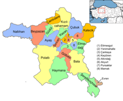
Yenimahalle is a metropolitan district of Ankara Province in the Central Anatolia region of Turkey, a fast-growing urban residential district of the city of Ankara, Turkey's capital. According to 2010 census, population of the urban center (with no rural population) is 648,160[3] The district covers an area of 274 km2 (106 sq mi),[4] and the average elevation is 830 m (2,723 ft).

The name Yenimahalle means the new quarter and in the late 1940s the area of open land to the west of the city was allocated for civil servants and workers housing. This grew with the construction of the E5 highway through the area and even more when the metro was built. Today the district mainly consists of large estates of apartment buildings and although the area is being filled up with concrete buildings there is still green space, tennis courts and other sports areas. There is some illegal building at the edge of the district but Yenimahalle is mainly planned development. This is the home for both of Ankara's teams: Gençlerbirliği and Ankaragücü, although their shared stadium is in Altındağ.
82% of the working population are civil servants or workers in the city of Ankara. There is also a large retired community, and a small but growing number of traders and shopkeepers. Ankara's largest industrial area, OSTIM Industrial Zone, is on the edge of the district too. The rural areas are used mainly for growing grains and pulses.
The headquarters of the national intelligence service Millî İstihbarat Teşkilâtı is in Yenimahalle.
Prominent neighbourhoods
- Çayyolu - One of the wealthiest neighbourhoods in Ankara. Quiet, attractive area, with many modern housing complexes and smart shopping centres, outside the city centre but the metro system now reaches the district which is also near to many university buildings. Location of note include the exotically named Bangabandhu Şeyh Mucibur Rahman Boulevard, Tea Way Barbershop and the well-known Ömürlü köfte restaurant. Includes the posh Ümitköy villas and many luxury apartments.
- Batıkent - Large area of duplex and triplex buildings, complexes and shopping centres for Ankara's citizens. Once quiet and distant from the city, it is becoming more animate with the reach of subway. Much of the area has been filled in with estates of tower blocks.
- Yenimahalle - the original centre of the district, now swamped by all the housing estates surrounding it.
- Demetevler, Şentepe and Karşıyaka - worker's housing
- Beşevler - home to Gençlerbirliği, Gazi University and parts of Atatürk's Forest Farm industries, as well as the Turkish State Cemetery.
Tandoğan - home to Ankaragücü, Ankara University, and MKE
Places of interest
- Akköprü, a bridge over the Ankara River, built by the Seljuk Turks in 1222, on the old trade route to Baghdad.
- Atatürk Forest Farm and Zoo, park and farm, financed by Mustafa Kemal Atatürk (1881-1938) personally to provide a place of recreation and agriculture in the city. It contains the Ankara Zoo and a full-size replica of the house in Salonica (today in Greece), where Atatürk was born.
- Ankara 75th Anniversary Race Course, horse racetrack
Notes
- ↑ "Area of regions (including lakes), km²". Regional Statistics Database. Turkish Statistical Institute. 2002. Retrieved 2013-03-05.
- ↑ "Population of province/district centers and towns/villages by districts - 2012". Address Based Population Registration System (ABPRS) Database. Turkish Statistical Institute. Retrieved 2013-02-27.
- ↑ Statistical Institute
- ↑ Statoids. "Statistical information on districts of Turkey". Archived from the original on 2010-05-26. Retrieved 2008-05-04.
References
- Falling Rain Genomics, Inc. "Geographical information on Yenimahalle, Turkey". Retrieved 2008-04-01.
- Governorship of Ankara, Turkey. "General information on Yenimahalle, Ankara" (in Turkish). Retrieved 2008-04-01.
External links
- District governor's official website (Turkish)
- District municipality's official website (Turkish)
Coordinates: 39°58′19″N 32°48′43″E / 39.97194°N 32.81194°E