Éghezée
| Éghezée | |
|---|---|
| Municipality | |
|
Éghezée Town Hall | |
 Éghezée Location in Belgium | |
|
Location of Éghezée in the province of Namur 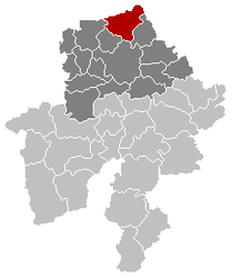 | |
| Coordinates: 50°35′N 04°55′E / 50.583°N 4.917°ECoordinates: 50°35′N 04°55′E / 50.583°N 4.917°E | |
| Country | Belgium |
| Community | French Community |
| Region | Wallonia |
| Province | Namur |
| Arrondissement | Namur |
| Government | |
| • Mayor | Dominique van Roy (EPV) |
| • Governing party/ies | EPV, IC |
| Area | |
| • Total | 102.81 km2 (39.70 sq mi) |
| Population (1 January 2016)[1] | |
| • Total | 15,951 |
| • Density | 160/km2 (400/sq mi) |
| Postal codes | 5310 |
| Area codes | 081 |
| Website | www.eghezee.be |
.jpg)
Éghezée (French: [e.ɡə.ze]) is a Walloon municipality located in the Belgian province of Namur. On 1 January 2010 the municipality had 15,169 inhabitants. The total area is 102.81 km², giving a population density of 146.93 inhabitants per km².
The municipality consists of the following sub-municipalities: Éghezée proper, Aische-en-Refail, Bolinne, Boneffe, Branchon, Dhuy, Hanret, Leuze, Liernu, Longchamps, Mehaigne, Noville-sur-Mehaigne, Saint-Germain, Taviers, Upigny, and Waret-la-Chaussée.
A protected site in the region is the Château de Bolinne-Harlue, located in the Bolinne-Harlue municipality.
See also
References
- ↑ Population per municipality as of 1 January 2016 (XLS; 397 KB)
External links
-
 Media related to Éghezée at Wikimedia Commons
 - Official website (in French)
 |
Perwez (WBR) | Ramillies (WBR) | Orp-Jauche (WBR) | |
| Gembloux | |
Wasseiges (WLG) Fernelmont | ||
| ||||
| | ||||
| La Bruyère | Namur |
Municipalities in the Province of Namur | ||
|---|---|---|
| Dinant |  | |
| Namur | ||
| Philippeville | ||
This article is issued from Wikipedia - version of the 11/30/2016. The text is available under the Creative Commons Attribution/Share Alike but additional terms may apply for the media files.