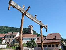
Allarmont
| Allarmont | ||
|---|---|---|
 | ||
| ||
 Allarmont | ||
|
Location within Grand Est region  Allarmont | ||
| Coordinates: 48°28′59″N 7°00′51″E / 48.4831°N 7.0142°ECoordinates: 48°28′59″N 7°00′51″E / 48.4831°N 7.0142°E | ||
| Country | France | |
| Region | Grand Est | |
| Department | Vosges | |
| Arrondissement | Saint-Dié-des-Vosges | |
| Canton | Raon-l'Étape | |
| Intercommunality | Vallée de la Plaine | |
| Government | ||
| • Mayor (2008–2014) | Dominique Aubert | |
| Area1 | 13.21 km2 (5.10 sq mi) | |
| Population (2006)2 | 261 | |
| • Density | 20/km2 (51/sq mi) | |
| Time zone | CET (UTC+1) | |
| • Summer (DST) | CEST (UTC+2) | |
| INSEE/Postal code | 88005 / 88110 | |
| Elevation |
332–813 m (1,089–2,667 ft) (avg. 350 m or 1,150 ft) | |
|
1 French Land Register data, which excludes lakes, ponds, glaciers > 1 km² (0.386 sq mi or 247 acres) and river estuaries. 2 Population without double counting: residents of multiple communes (e.g., students and military personnel) only counted once. | ||

Allarmont (German: Allhartsberg) is a commune in the Vosges department in Grand Est in northeastern France.
See also
References
External links
| Wikimedia Commons has media related to Allarmont. |
This article is issued from Wikipedia - version of the 11/7/2016. The text is available under the Creative Commons Attribution/Share Alike but additional terms may apply for the media files.