Ortoncourt
| Ortoncourt | |
|---|---|
 | |
 Ortoncourt | |
|
Location within Grand Est region  Ortoncourt | |
| Coordinates: 48°22′02″N 6°30′46″E / 48.3672°N 6.5128°ECoordinates: 48°22′02″N 6°30′46″E / 48.3672°N 6.5128°E | |
| Country | France |
| Region | Grand Est |
| Department | Vosges |
| Arrondissement | Épinal |
| Canton | Rambervillers |
| Government | |
| • Mayor (2008–2014) | Philippe Jeanroy |
| Area1 | 4.39 km2 (1.69 sq mi) |
| Population (2006)2 | 82 |
| • Density | 19/km2 (48/sq mi) |
| Time zone | CET (UTC+1) |
| • Summer (DST) | CEST (UTC+2) |
| INSEE/Postal code | 88338 / 88700 |
| Elevation |
297–391 m (974–1,283 ft) (avg. 320 m or 1,050 ft) |
|
1 French Land Register data, which excludes lakes, ponds, glaciers > 1 km² (0.386 sq mi or 247 acres) and river estuaries. 2 Population without double counting: residents of multiple communes (e.g., students and military personnel) only counted once. | |
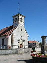
Ortoncourt is a commune in the Vosges department in Grand Est in northeastern France.
History
There is a record of a latinate version of the name, Ortonis curte, recorded in the eleventh century when the village was part of the bailiwick of Châtel-sur-Moselle. In terms of ecclesiastical administration its church, dedicated to Saint Urban, came under the parish of Moyemont.
Under the secular arrangements established in the wake of the French revolution, Ortoncourt in 1790 became part of the canton of Fauconcourt in the district of Rambervillers until 1800 when the modern administrative structure was introduced.
See also
References
| Wikimedia Commons has media related to Ortoncourt. |
This article is issued from Wikipedia - version of the 11/6/2016. The text is available under the Creative Commons Attribution/Share Alike but additional terms may apply for the media files.