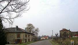
Les Ableuvenettes
| Les Ableuvenettes | |
|---|---|
 | |
 Les Ableuvenettes | |
|
Location within Grand Est region  Les Ableuvenettes | |
| Coordinates: 48°11′28″N 6°11′10″E / 48.191°N 6.186°ECoordinates: 48°11′28″N 6°11′10″E / 48.191°N 6.186°E | |
| Country | France |
| Region | Grand Est |
| Department | Vosges |
| Arrondissement | Épinal |
| Canton | Dompaire |
| Intercommunality | Pays d'entre Madon et Moselle |
| Government | |
| • Mayor (2008–2014) | Louis Mulot |
| Area1 | 4.49 km2 (1.73 sq mi) |
| Population (2006)2 | 65 |
| • Density | 14/km2 (37/sq mi) |
| Time zone | CET (UTC+1) |
| • Summer (DST) | CEST (UTC+2) |
| INSEE/Postal code | 88001 / 88270 |
| Elevation |
293–387 m (961–1,270 ft) (avg. 318 m or 1,043 ft) |
|
1 French Land Register data, which excludes lakes, ponds, glaciers > 1 km² (0.386 sq mi or 247 acres) and river estuaries. 2 Population without double counting: residents of multiple communes (e.g., students and military personnel) only counted once. | |
Les Ableuvenettes is a commune in the Vosges department in Grand Est in northeastern France. The discovery of coins certifies that Romans once occupied the area.
The first mention of Les Ableuvenettes dates from 1148, in the form of Albuvisnei.
See also
References
| Wikimedia Commons has media related to Les Ableuvenettes. |
This article is issued from Wikipedia - version of the 11/6/2016. The text is available under the Creative Commons Attribution/Share Alike but additional terms may apply for the media files.