Bertrimoutier
| Bertrimoutier | |
|---|---|
|
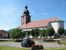
Saint-Jacques-le-Majeur | |
 Bertrimoutier | |
|
Location within Grand Est region  Bertrimoutier | |
| Coordinates: 48°16′21″N 7°03′18″E / 48.2725°N 7.055°ECoordinates: 48°16′21″N 7°03′18″E / 48.2725°N 7.055°E | |
| Country | France |
| Region | Grand Est |
| Department | Vosges |
| Arrondissement | Saint-Dié-des-Vosges |
| Canton | Saint-Dié-des-Vosges-Est |
| Intercommunality | Val de Galilée |
| Government | |
| • Mayor (2008–2014) | Guy Hurstel |
| Area1 | 3.72 km2 (1.44 sq mi) |
| Population (2006)2 | 377 |
| • Density | 100/km2 (260/sq mi) |
| Time zone | CET (UTC+1) |
| • Summer (DST) | CEST (UTC+2) |
| INSEE/Postal code | 88054 / 88520 |
| Elevation |
373–596 m (1,224–1,955 ft) (avg. 444 m or 1,457 ft) |
|
1 French Land Register data, which excludes lakes, ponds, glaciers > 1 km² (0.386 sq mi or 247 acres) and river estuaries. 2 Population without double counting: residents of multiple communes (e.g., students and military personnel) only counted once. | |
Bertrimoutier is a commune in the Vosges department in Grand Est in northeastern France.[1]
See also
References
External links
| Wikimedia Commons has media related to Bertrimoutier. |
This article is issued from Wikipedia - version of the 11/6/2016. The text is available under the Creative Commons Attribution/Share Alike but additional terms may apply for the media files.