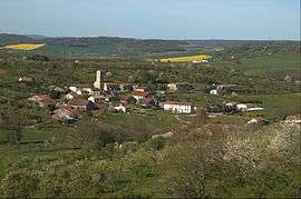
Gugney-aux-Aulx
| Gugney-aux-Aulx | |
|---|---|
 | |
 Gugney-aux-Aulx | |
|
Location within Grand Est region  Gugney-aux-Aulx | |
| Coordinates: 48°18′13″N 6°16′15″E / 48.3036°N 6.2708°ECoordinates: 48°18′13″N 6°16′15″E / 48.3036°N 6.2708°E | |
| Country | France |
| Region | Grand Est |
| Department | Vosges |
| Arrondissement | Épinal |
| Canton | Dompaire |
| Intercommunality | Pays d'Entre Madon et Moselle |
| Government | |
| • Mayor (2008–2014) | Jack Brie |
| Area1 | 8.67 km2 (3.35 sq mi) |
| Population (2011)2 | 156 |
| • Density | 18/km2 (47/sq mi) |
| Time zone | CET (UTC+1) |
| • Summer (DST) | CEST (UTC+2) |
| INSEE/Postal code | 88223 / 88450 |
| Elevation | 295–421 m (968–1,381 ft) |
|
1 French Land Register data, which excludes lakes, ponds, glaciers > 1 km² (0.386 sq mi or 247 acres) and river estuaries. 2 Population without double counting: residents of multiple communes (e.g., students and military personnel) only counted once. | |
Gugney-aux-Aulx is a commune in the Vosges department in Grand Est in northeastern France. As of 2011, the commune has a population of 156.[1]
See also
References
External links
| Wikimedia Commons has media related to Gugney-aux-Aulx. |
This article is issued from Wikipedia - version of the 11/6/2016. The text is available under the Creative Commons Attribution/Share Alike but additional terms may apply for the media files.