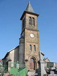
Saint-Benoît-la-Chipotte
| Saint-Benoît-la-Chipotte | |
|---|---|
 | |
 Saint-Benoît-la-Chipotte | |
|
Location within Grand Est region  Saint-Benoît-la-Chipotte | |
| Coordinates: 48°21′30″N 6°44′08″E / 48.3583°N 6.7356°ECoordinates: 48°21′30″N 6°44′08″E / 48.3583°N 6.7356°E | |
| Country | France |
| Region | Grand Est |
| Department | Vosges |
| Arrondissement | Épinal |
| Canton | Rambervillers |
| Intercommunality | Région de Rambervillers |
| Government | |
| • Mayor (2008–2014) | Philippe Lecomte |
| Area1 | 20.77 km2 (8.02 sq mi) |
| Population (2006)2 | 423 |
| • Density | 20/km2 (53/sq mi) |
| Time zone | CET (UTC+1) |
| • Summer (DST) | CEST (UTC+2) |
| INSEE/Postal code | 88412 / 88700 |
| Elevation |
324–524 m (1,063–1,719 ft) (avg. 340 m or 1,120 ft) |
|
1 French Land Register data, which excludes lakes, ponds, glaciers > 1 km² (0.386 sq mi or 247 acres) and river estuaries. 2 Population without double counting: residents of multiple communes (e.g., students and military personnel) only counted once. | |
Saint-Benoît-la-Chipotte is a commune in the Vosges department in Grand Est in northeastern France.
See also
References
| Wikimedia Commons has media related to Saint-Benoît-la-Chipotte. |
This article is issued from Wikipedia - version of the 11/6/2016. The text is available under the Creative Commons Attribution/Share Alike but additional terms may apply for the media files.