Sanchey
| Sanchey | |
|---|---|
|
Sanchey Fort | |
 Sanchey | |
|
Location within Grand Est region  Sanchey | |
| Coordinates: 48°10′24″N 6°21′50″E / 48.1733°N 6.3639°ECoordinates: 48°10′24″N 6°21′50″E / 48.1733°N 6.3639°E | |
| Country | France |
| Region | Grand Est |
| Department | Vosges |
| Arrondissement | Épinal |
| Canton | Épinal-Ouest |
| Intercommunality | Pays d'Olima et du Val d'Avière |
| Government | |
| • Mayor (2008–2014) | Gilles Dubois |
| Area1 | 5.51 km2 (2.13 sq mi) |
| Population (2006)2 | 801 |
| • Density | 150/km2 (380/sq mi) |
| Time zone | CET (UTC+1) |
| • Summer (DST) | CEST (UTC+2) |
| INSEE/Postal code | 88439 / 88390 |
| Elevation |
341–456 m (1,119–1,496 ft) (avg. 360 m or 1,180 ft) |
|
1 French Land Register data, which excludes lakes, ponds, glaciers > 1 km² (0.386 sq mi or 247 acres) and river estuaries. 2 Population without double counting: residents of multiple communes (e.g., students and military personnel) only counted once. | |

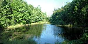
The Comtesse pond in the forest near Sanchey
Sanchey is a commune in the Vosges department in Grand Est in northeastern France.
See also
References
| Wikimedia Commons has media related to Sanchey. |
This article is issued from Wikipedia - version of the 11/6/2016. The text is available under the Creative Commons Attribution/Share Alike but additional terms may apply for the media files.