Argusville, North Dakota
| Argusville, North Dakota | |
|---|---|
| City | |
|
Argusville High School in Argusville | |
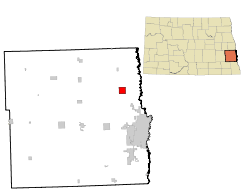 Location of Argusville, North Dakota | |
| Coordinates: 47°3′6″N 96°56′8″W / 47.05167°N 96.93556°WCoordinates: 47°3′6″N 96°56′8″W / 47.05167°N 96.93556°W | |
| Country | United States |
| State | North Dakota |
| County | Cass |
| Area[1] | |
| • Total | 4.01 sq mi (10.39 km2) |
| • Land | 4.01 sq mi (10.39 km2) |
| • Water | 0 sq mi (0 km2) |
| Elevation | 886 ft (270 m) |
| Population (2010)[2] | |
| • Total | 475 |
| • Estimate (2015)[3] | 475 |
| • Density | 118.5/sq mi (45.8/km2) |
| Time zone | Central (CST) (UTC-6) |
| • Summer (DST) | CDT (UTC-5) |
| ZIP code | 58005 |
| Area code(s) | 701 |
| FIPS code | 38-03020 |
| GNIS feature ID | 1027730[4] |
| Website | cityofargusville.com |

Argusville is a city in Cass County, North Dakota, United States. The population was 475 at the 2010 census,[5] increasing from 147 a decade earlier due to a huge housing boom from 2004 to 2008. Argusville was founded in 1881.
History
Argusville was platted in 1881, when the railroad was extended to that point.[6] The city most likely derived its name from a local newspaper, the Daily Argus.[7] A post office was established at Argusville in 1881, and remained in operation until 1982.[8]
Geography
Argusville is located at 47°3′6″N 96°56′8″W / 47.05167°N 96.93556°W (47.051565, -96.935662).[9]
According to the United States Census Bureau, the city has a total area of 4.01 square miles (10.39 km2), all of it land.[1]
Demographics
| Historical population | |||
|---|---|---|---|
| Census | Pop. | %± | |
| 1930 | 115 | — | |
| 1940 | 145 | 26.1% | |
| 1950 | 126 | −13.1% | |
| 1960 | 118 | −6.3% | |
| 1970 | 118 | 0.0% | |
| 1980 | 147 | 24.6% | |
| 1990 | 161 | 9.5% | |
| 2000 | 147 | −8.7% | |
| 2010 | 475 | 223.1% | |
| Est. 2015 | 475 | [10] | 0.0% |
| U.S. Decennial Census[11] 2015 Estimate[3] | |||
2010 census
As of the census[2] of 2010, there were 475 people, 151 households, and 128 families residing in the city. The population density was 118.5 inhabitants per square mile (45.8/km2). There were 152 housing units at an average density of 37.9 per square mile (14.6/km2). The racial makeup of the city was 97.9% White, 0.2% African American, 1.5% Native American, and 0.4% from two or more races.
There were 151 households of which 58.9% had children under the age of 18 living with them, 76.8% were married couples living together, 4.0% had a female householder with no husband present, 4.0% had a male householder with no wife present, and 15.2% were non-families. 11.3% of all households were made up of individuals and 3.3% had someone living alone who was 65 years of age or older. The average household size was 3.15 and the average family size was 3.42.
The median age in the city was 31.7 years. 38.7% of residents were under the age of 18; 3.7% were between the ages of 18 and 24; 38.1% were from 25 to 44; 15.1% were from 45 to 64; and 4.4% were 65 years of age or older. The gender makeup of the city was 53.3% male and 46.7% female.
2000 census
As of the census of 2000, there were 147 people, 62 households, and 45 families residing in the city, though the town had a housing boom from 2004 to 2009. The population density was 36.8 people per square mile (14.2/km²). There were 65 housing units at an average density of 16.3 per square mile (6.3/km²). The racial makeup of the city was 100.00% White. Hispanic or Latino of any race were 0.68% of the population.
There were 62 households out of which 32.3% had children under the age of 18 living with them, 71.0% were married couples living together, 1.6% had a female householder with no husband present, and 27.4% were non-families. 21.0% of all households were made up of individuals and 1.6% had someone living alone who was 65 years of age or older. The average household size was 2.37 and the average family size was 2.76.
In the city the population was spread out with 21.1% under the age of 18, 5.4% from 18 to 24, 32.0% from 25 to 44, 32.0% from 45 to 64, and 9.5% who were 65 years of age or older. The median age was 40 years. For every 100 females there were 107.0 males. For every 100 females age 18 and over, there were 114.8 males.
The median income for a household in the city was $44,750, and the median income for a family was $53,750. Males had a median income of $31,786 versus $26,071 for females. The per capita income for the city was $19,984. None of the population and none of the families were below the poverty line.
References
- 1 2 "US Gazetteer files 2010". United States Census Bureau. Archived from the original on 2012-01-24. Retrieved 2012-06-14.
- 1 2 "American FactFinder". United States Census Bureau. Retrieved 2012-06-14.
- 1 2 "Population Estimates". United States Census Bureau. Retrieved June 29, 2016.
- ↑ "US Board on Geographic Names". United States Geological Survey. 2007-10-25. Retrieved 2008-01-31.
- ↑ "2010 Census Redistricting Data (Public Law 94-171) Summary File". American FactFinder. United States Census Bureau. Archived from the original on 26 July 2011. Retrieved 2 May 2011.
- ↑ Hoheisel, Tim; Nielsen, Andrew R. (2007). Cass County. Arcadia Publishing. p. 47. ISBN 978-0-7385-4145-7.
- ↑ Federal Writers' Project (1938). North Dakota, a Guide to the Northern Prairie State. WPA. p. 194. ISBN 978-1-62376-033-5.
- ↑ "Cass County". Jim Forte Postal History. Retrieved 24 October 2015.
- ↑ "US Gazetteer files: 2010, 2000, and 1990". United States Census Bureau. 2011-02-12. Retrieved 2011-04-23.
- ↑ "Annual Estimates of the Resident Population for Incorporated Places: April 1, 2010 to July 1, 2015". Retrieved July 2, 2016.
- ↑ United States Census Bureau. "Census of Population and Housing". Archived from the original on May 11, 2015. Retrieved July 21, 2013.
Municipalities and communities of Cass County, North Dakota, United States | ||
|---|---|---|
| Cities | 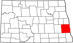 | |
| Townships |
| |
| CDPs | ||
| Unincorporated communities | ||
| Footnotes | ‡This populated place also has portions in an adjacent county or counties | |
| Counties | ||
|---|---|---|
| Main cities | ||
| Surrounding areas |
| |
‡ - county seat | ||