Austevoll
| Austevoll kommune | |||
|---|---|---|---|
| Municipality | |||
|
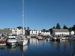
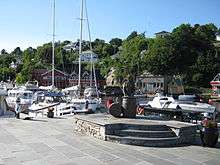
Bekkjarvik harbour | |||
| |||
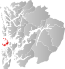 Austevoll within Hordaland | |||
| Coordinates: 60°02′16″N 05°16′06″E / 60.03778°N 5.26833°ECoordinates: 60°02′16″N 05°16′06″E / 60.03778°N 5.26833°E | |||
| Country | Norway | ||
| County | Hordaland | ||
| District | Midhordland | ||
| Administrative centre | Storebø | ||
| Government | |||
| • Mayor (2013) | Renate Møgster Klepsvik (Frp) | ||
| Area | |||
| • Total | 117.18 km2 (45.24 sq mi) | ||
| • Land | 114.23 km2 (44.10 sq mi) | ||
| • Water | 2.95 km2 (1.14 sq mi) | ||
| Area rank | 373 in Norway | ||
| Population (2013) | |||
| • Total | 4,924 | ||
| • Rank | 206 in Norway | ||
| • Density | 43.1/km2 (112/sq mi) | ||
| • Change (10 years) | 9.7 % | ||
| Demonym(s) | Austevolling[1] | ||
| Time zone | CET (UTC+1) | ||
| • Summer (DST) | CEST (UTC+2) | ||
| ISO 3166 code | NO-1244 | ||
| Official language form | Nynorsk | ||
| Website |
www | ||
|
| |||

Austevoll is a municipality and an archipelago in Hordaland county, Norway. It is located in the traditional district of Midthordland in Western Norway. The administrative centre is the village of Storebø on the island of Huftarøy. Other villages include Årland, Austevollshella, Bakkasund, Bekkjarvik, Birkeland, Haukanes, Husavik, Kolbeinsvik, Otterå, Våge, and Vinnes.
The municipality consists of several islands located southwest of the city of Bergen. The municipality is considered to be among the ports in the world with the largest ocean-going fishing trawler fleet. Since the 1980s, the offshore oil industry and fish farming industry have both grown to be important industries in Austevoll.
General information


The municipality of Austevoll was established on 1 January 1886 when it was separated from the municipality of Sund. The initial population for the new municipality of Austevoll was 2,396. On 1 January 1964, the southern part of the islands of Selbjørn and Huftarøy (population: 696) was transferred from the municipality of Fitjar to Austevoll. This put the whole Austevoll archipelago in the municipality of Austevoll.[2]
Name
The municipality is named after the old Austevoll farm (Old Norse: Austrvǫllr), since this was the old site of the Austevoll Church. The farm is now part of the village of Austevollshella. The first element is austr which means "east" and the last element is vǫllr which means "meadow". The municipality has changed the spelling of its name three times. Before 1889 the name was written "Østevold" or "Østervold". From 1889-1917, it was spelled "Austevold", and since 1918 it has been spelled "Austevoll".[3]
Coat-of-arms
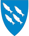
The coat-of-arms were granted on 30 November 1984. The arms are blue with four silver-colored fish swimming up to the left. The shoal of herring was chosen for the arms since herring fishing is a very important part of the local economy.[4]
Churches
The Church of Norway has one parish (sokn) within the municipality of Austevoll. It is part of the Fana deanery in the Diocese of Bjørgvin.
| Parish (Sokn) | Church Name | Location of the Church | Year Built |
|---|---|---|---|
| Austevoll | Austevoll Church | Storebø | 1890 |
| Bekkjarvik Church | Bekkjarvik | 1895 | |
| Hundvåkøy Church | Austevollshella | 1990 | |
| Møkster Church | Stolmen | 1892 | |
| Store-Kalsøy Chapel | Bakkasund | 1975 |
Geography
Austevoll consists of 667 islands off the west coast of Western Norway. The municipality has a total land area of 114.23 square kilometres (44.10 sq mi) and a costal line of 337 kilometres (209 mi). It lies south of the Korsfjorden, west of the Bjørnafjorden, and north of the Selbjørnsfjorden.[5] The highest point in Austevoll is the mountain Loddo, reaching 244 metres (801 ft) above sea level. The Marstein Lighthouse lies in the northwestern part of the municipality.
Largest islands
Neighbours
The island municipality shares water borders with the municipality of Sund to the north, Bergen and Os municipalities to the northeast, Tysnes municipality to the east, and Fitjar and Bømlo municipalities to the south. The North Sea lies to the west of Austevoll.
Demographics
| Historical population | ||
|---|---|---|
| Year | Pop. | ±% |
| 1855 | 2,057 | — |
| 1865 | 2,260 | +9.9% |
| 1875 | 2,396 | +6.0% |
| 1890 | 2,332 | −2.7% |
| 1900 | 2,434 | +4.4% |
| 1910 | 2,459 | +1.0% |
| 1920 | 2,760 | +12.2% |
| 1930 | 2,928 | +6.1% |
| 1946 | 3,272 | +11.7% |
| 1951 | 3,231 | −1.3% |
| 1961 | 3,366 | +4.2% |
| 1971 | 3,854 | +14.5% |
| 1981 | 3,912 | +1.5% |
| 1991 | 4,148 | +6.0% |
| 2001 | 4,446 | +7.2% |
| 2011 | 4,680 | +5.3% |
| 2014 | 4,924 | +5.2% |
| Source: Statistics Norway.[6][7] | ||
Of the 667 islands, only eight are populated year-round. About 29% of the inhabitants live in densely populated areas. About 28% of the inhabitants are under the age of 17, which is 4.4% over the national average. About 4.7% of the inhabitants are 80 years or older.[5]
Villages
| Rank | Village | Village Population (2005)[8] | District Population (2001)[9] |
|---|---|---|---|
| 1 | Storebø | 1,032 | 1,341 |
| 2 | Bekkjarvik | 355 | 489 |
| 3 | Kolbeinsvik | 481 | |
| 4 | Vinnes | 378 | |
| 5 | Haukanes | 235 |
Inhabited islands
| Rank | Island | Area (km²) | Population [9] | Density (/km²) | Largest settlement | Highest point | Elevation (m) |
|---|---|---|---|---|---|---|---|
| 1 | Huftarøy | 50.4 | 2,435 | 48.3 | Storebø | Loddo | 244 |
| 2 | Selbjørn | 25 | 956 | 38.24 | Bekkjarvik | Kongsafjellet | 185 |
| 3 | Hundvåkøy | 10.7 | 554 | 51.7 | Austevollshella | 61 | |
| 4 | Stolmen | 7.9 | 206 | 26.0 | Våge | Såta | 60 |
| 5 | Storekalsøy | 6 | 167 | 27.0 | Bakkasund | Mjuken | 57 |
| 6 | Møkster | 65 | |||||
| 7 | Litlekalsøy | 26 |
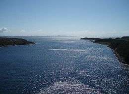
Gallery


Industry
Fishing is the most important industry in Austevoll, as it has been for centuries. Traditionally, fishing has taken place in coastal areas, not far off shore. After decades of overfishing, the herring disappeared in the 1950s. This forced a restructuring of the fishing fleet. Since the 1960s, the shipping companies built bigger ships, and went further out into the seas, and they began fishing for other fish species, not just herring. The overfishing of herring also forced better research on fishing, resulting in the Norwegian Institute of Marine Research. Austevoll is the home of the Austevoll Aquaculture Research Station.
Since the early 1980s, the offshore supply industry has emerged in the wake of the offshore Norwegian oil industry. The offshore shipping company DOF, which is listed on the Oslo Stock Exchange, has its headquarters at Storebø.
Education
There are five primary schools and one middle school in Austevoll, all run by the municipality. There is also one secondary school, teaching mainly fishing and nautical subjects. This is operated by the Hordaland County Municipality.
Transportation
Austevoll has car ferry connections from Hufthammar on the north tip of Huftarøy to Krokeide in Bergen, and from Husavik on the south tip of Huftarøy to Sandvikvåg in Fitjar. The municipality is also connected by express boats to Bergen in the north, and Stord, Haugesund, and Stavanger in the south. All express boat routes are operated by Norled, and ferry routes are operated by Fosen Namsos.
The islands of Huftarøy and Selbjørn, Selbjørn and Stolmen, and Hundvåkøy and Storekalsøy are connected with bridges. A fourth bridge, connecting Huftarøy and Hundvåkøy, was opened on 17 November 2007. This bridge, which in fact consists of two bridges and two stone fillings, bears the name "Austevollsbrua".
Government
All municipalities in Norway, including Austevoll, are responsible for primary education (through 10th grade), outpatient health services, senior citizen services, unemployment and other social services, zoning, economic development, and municipal roads. The municipality is governed by a municipal council of elected representatives, which in turn elect a mayor.
Municipal council
The municipal council (Kommunestyre) of Austevoll is made up of 21 representatives that are elected to every four years. Since the 2011 election a coalition of the Progress Party and Center Party has held power in the council, the latter two terms the coalition also consisted of the Christian Democratic Party who broke out after the 2011 local election. In 2011 the coalition won 12 of the 21 seats in the municipal council and has an electoral and political cooperation. The Conservative Party, Labour Party and Christian Democratic Party make up the opposition. For 2011–2015, the party breakdown is as follows:[10]
| Party Name | Name in Norwegian | Number of representatives | |
|---|---|---|---|
| Labour Party | Arbeiderpartiet | 2 | |
| Progress Party | Framstegspartiet | 10 | |
| Conservative Party | Høgre | 6 | |
| Christian Democratic Party | Kristelig Folkeparti | 1 | |
| Centre Party | Senterpartiet | 2 | |
| Total number of members: | 21 | ||
In the 2003-2007 election period The Liberal Party was represented in the municipal council and held one seat. In the 1999-2003 election period an all-party female electoral list held one seat in the council. From 1995 to 1999 the Socialist Left Party held one seat.
Executive committee of local council
The executive committee of local council has 9 seats, divided between all parties in the municipal council. Divided like this:
- The Progress Party (4 seats)
- The Conservative Party (2 seats)
- Labour Party (1 seat)
- Center Party (1 seat)
- Christian Democratic Party (1 seat)
Mayor
The following is a list of mayors of Austevoll:[11][12]
| # | Name | Office | Political Party | Occupation |
|---|---|---|---|---|
| Ole Olsen Strømme | 1886–1901 | Church bell ringer | ||
| Peder Olai Kleppe | 1902–1919 | Fisherman | ||
| Olai Naustheller | 1920–1925 | Farmer | ||
| Mikkel Nilsen Birkeland | 1926–1935 | Farmer | ||
| Magnus Larssen | 1935–1937 | School teacher | ||
| Salomon O. Fagerbakke | 1938–1945 | Fisherman | ||
| Salomon V. Kalvenes | 1946–1959 | Fisherman | ||
| Rikard S. Storebø | 1960–1969 | Liberal Party | Social security manager | |
| Peder Kalve | 1970–1975 | Conservative Party | Maritime pilot | |
| Magnus Stangeland | 1976–1981 | Centre Party | School principal | |
| Knut K. Kalvenes | 1982–1985 | Conservative Party[13] | Retailer | |
| Hallvard Møgster | 1986–1989 | Christian Democratic Party | Captain | |
| Inge Bjarne Storebø | 1990–2001 | Conservative Party | Bank manager | |
| Olav P. Årland | 2001–2003 | Christian Democratic Party | Shipmaster | |
| Helge André Njåstad | 2003–2011 | Progress Party | Student | |
| Renate Møgster Klepsvik | 2011–present | Progress Party |
Notable residents
- Halvor Olai Birkeland, gold medalist in 1920 Summer Olympics
- Rasmus Ingvald Birkeland, gold medalist in 1920 Summer Olympics
- Knut Fagerbakke, Deputy Mayor of Trondheim
- Claus Lundekvam, professional footballer
- Abelone Møgster, merchant and resistance fighter during World War II
- Halvor O. Larsen Møgster, gold medalist in 1920 Summer Olympics
- Magnus Stangeland, member of parliament, mayor and entrepreneur
- Henrik Olsen Østervold, gold medalist in 1920 Summer Olympics
- Jan Bertin Østervold, known as Jan Thomas, stylist and actor
- Jan Olsen Østervold, gold medalist in 1920 Summer Olympics
- Kristian Olsen Østervold, gold medalist in 1920 Summer Olympics
- Ole Olsen Østervold, gold medalist in 1920 Summer Olympics
References
- ↑ "Navn på steder og personer: Innbyggjarnamn" (in Norwegian). Språkrådet. Retrieved 2015-12-01.
- ↑ Jukvam, Dag (1999). "Historisk oversikt over endringer i kommune- og fylkesinndelingen" (PDF) (in Norwegian). Statistisk sentralbyrå.
- ↑ Rygh, Oluf (1910). Norske gaardnavne: Søndre Bergenhus amt (in Norwegian) (11 ed.). Kristiania, Norge: W. C. Fabritius & sønners bogtrikkeri. pp. 251–252.
- ↑ "Civic heraldry of Norway - Norske Kommunevåpen". Heraldry of the World. Retrieved 2015-01-14.
- 1 2 Statistics Norway (2006). "Tall om Austevoll kommune" (in Norwegian). Archived from the original on 9 September 2006.
- ↑ Projected population - Statistics Norway
- ↑ Per 1 January 1964, a part of 1222 Fitjar (696 persons) and 1244 Austevoll were merged to one municipality, 1244 Austvoll.
- ↑ Statistics Norway (1 January 2006). "Urban settlements. Population and area, by municipality". Archived from the original on 21 August 2006.
- 1 2 Statistics Norway. "Folke- og bustadteljing 2001" (PDF) (in Norwegian).
- ↑ "Members of the local councils, by party/electoral lists and municipality" (in Norwegian). Statistics Norway. 2011.
- ↑ "Former mayors of Austevoll municipality" (in Norwegian).
- ↑ "Fattigstyret i Møkster sokn" (in Norwegian). Archived from the original on 3 October 2011.
- ↑ "Knut Kalvenes" (in Norwegian). Høyre. 2003. Retrieved 19 December 2007.
External links
| Wikimedia Commons has media related to Austevoll. |
 The dictionary definition of Austevoll at Wiktionary
 Hordaland travel guide from Wikivoyage
- Austevoll travel guide from Wikivoyage
- The gavl-boat "Notmann" sailing under the Selbjørn bridge
- 3-mountain hike in Austevoll in 10 minutes
- Kayaking in Austevoll
- Diving in Austevoll