Britton, South Dakota
| Britton, South Dakota | |
|---|---|
| City | |
| Motto: "The View Is Great From Here" | |
 Location in Marshall County and the state of South Dakota | |
| Coordinates: 45°47′34″N 97°45′10″W / 45.79278°N 97.75278°WCoordinates: 45°47′34″N 97°45′10″W / 45.79278°N 97.75278°W | |
| Country | United States |
| State | South Dakota |
| County | Marshall |
| Incorporated | 1883[1] |
| Area[2] | |
| • Total | 0.73 sq mi (1.89 km2) |
| • Land | 0.73 sq mi (1.89 km2) |
| • Water | 0 sq mi (0 km2) |
| Elevation | 1,358 ft (414 m) |
| Population (2010)[3] | |
| • Total | 1,241 |
| • Estimate (2015)[4] | 1,242 |
| • Density | 1,700.0/sq mi (656.4/km2) |
| Time zone | Central (CST) (UTC-6) |
| • Summer (DST) | CDT (UTC-5) |
| ZIP code | 57430 |
| Area code(s) | 605 |
| FIPS code | 46-07380[5] |
| GNIS feature ID | 1254066[6] |
| Website | http://www.brittonsouthdakota.com/ |
Britton is a city in and the county seat of Marshall County, South Dakota, United States.[7] The population was 1,241 at the 2010 census.
A weekly newspaper, the Britton Journal, is published in Britton.
History
Britton was founded in 1884 as a stop on the Chicago, Milwaukee, St. Paul and Pacific Railroad. In 1885, the town was designated county seat of the newly formed Marshall County. It received its city rights in 1906.[8] The city is named after Isaac Britton, a railroad official.[9]
Geography
Britton is located at 45°47′34″N 97°45′10″W / 45.79278°N 97.75278°W (45.792817, -97.752912).[10]
According to the United States Census Bureau, the city has a total area of 0.73 square miles (1.89 km2), all of it land.[2]
Britton has been assigned the ZIP code 57430 and the FIPS place code 07380.
Demographics
| Historical population | |||
|---|---|---|---|
| Census | Pop. | %± | |
| 1890 | 514 | — | |
| 1900 | 519 | 1.0% | |
| 1910 | 901 | 73.6% | |
| 1920 | 1,105 | 22.6% | |
| 1930 | 1,312 | 18.7% | |
| 1940 | 1,500 | 14.3% | |
| 1950 | 1,430 | −4.7% | |
| 1960 | 1,442 | 0.8% | |
| 1970 | 1,495 | 3.7% | |
| 1980 | 1,590 | 6.4% | |
| 1990 | 1,394 | −12.3% | |
| 2000 | 1,328 | −4.7% | |
| 2010 | 1,241 | −6.6% | |
| Est. 2015 | 1,242 | [11] | 0.1% |
| U.S. Decennial Census[12] 2015 Estimate[4] | |||
2010 census
As of the census[3] of 2010, there were 1,241 people, 574 households, and 313 families residing in the city. The population density was 1,700.0 inhabitants per square mile (656.4/km2). There were 658 housing units at an average density of 901.4 per square mile (348.0/km2). The racial makeup of the city was 97.8% White, 0.5% African American, 0.7% Native American, 0.1% Asian, and 0.9% from two or more races. Hispanic or Latino of any race were 1.1% of the population.
There were 574 households of which 23.0% had children under the age of 18 living with them, 44.6% were married couples living together, 6.1% had a female householder with no husband present, 3.8% had a male householder with no wife present, and 45.5% were non-families. 41.3% of all households were made up of individuals and 21.7% had someone living alone who was 65 years of age or older. The average household size was 2.06 and the average family size was 2.79.
The median age in the city was 48.6 years. 20.1% of residents were under the age of 18; 6% were between the ages of 18 and 24; 18.7% were from 25 to 44; 27.7% were from 45 to 64; and 27.5% were 65 years of age or older. The gender makeup of the city was 48.7% male and 51.3% female.
2000 census
As of the census[5] of 2000, there were 1,328 people, 580 households, and 346 families residing in the city. The population density was 1,893.5 people per square mile (732.5/km²). There were 667 housing units at an average density of 951.0 per square mile (367.9/km²). The racial makeup of the city was 97.82% White, 1.13% Native American, 0.15% Asian, 0.08% from other races, and 0.83% from two or more races. Hispanic or Latino of any race were 0.98% of the population.
There were 580 households out of which 27.4% had children under the age of 18 living with them, 49.5% were married couples living together, 6.9% had a female householder with no husband present, and 40.2% were non-families. 37.4% of all households were made up of individuals and 22.9% had someone living alone who was 65 years of age or older. The average household size was 2.18 and the average family size was 2.88.
In the city the population was spread out with 22.9% under the age of 18, 5.0% from 18 to 24, 23.2% from 25 to 44, 22.2% from 45 to 64, and 26.7% who were 65 years of age or older. The median age was 44 years. For every 100 females there were 87.8 males. For every 100 females age 18 and over, there were 82.9 males.
As of 2000 the median income for a household in the city was $31,148, and the median income for a family was $37,639. Males had a median income of $29,931 versus $18,500 for females. The per capita income for the city was $18,327. About 5.7% of families and 8.7% of the population were below the poverty line, including 4.7% of those under age 18 and 16.2% of those age 65 or over.
Economy
Britton is home to a thriving economy. Several industries reside in the town including a roof and floor truss plant, a prefabricated wall plant, a fan clutch manufacturing facility, and a machine shop manufacturing company.
Britton is home to three gas stations, two restaurants/steak houses, three motels, a water park, softball fields, a bowling alley, a movie theatre, a recently built library, and many other conveniences.
The Dakota, Missouri Valley and Western Railroad provides rail service to Britton.
Education
The Britton-Hecla school district covers Britton. There is one elementary school and one high school on the same premises.
Notable people
- Frank Farrar, twenty-fourth Governor of South Dakota.
Footnotes
- ↑ "SD Towns" (PDF). South Dakota State Historical Society. Archived from the original (PDF) on 2010-02-10. Retrieved 2010-02-11.
- 1 2 "US Gazetteer files 2010". United States Census Bureau. Archived from the original on 2012-01-24. Retrieved 2012-06-21.
- 1 2 "American FactFinder". United States Census Bureau. Retrieved 2012-06-21.
- 1 2 "Population Estimates". United States Census Bureau. Retrieved June 7, 2016.
- 1 2 "American FactFinder". United States Census Bureau. Archived from the original on 2013-09-11. Retrieved 2008-01-31.
- ↑ "US Board on Geographic Names". United States Geological Survey. 2007-10-25. Retrieved 2008-01-31.
- ↑ "Find a County". National Association of Counties. Archived from the original on 2011-05-31. Retrieved 2011-06-07.
- ↑ Hellmann, Paul T. (May 13, 2013). Historical Gazetteer of the United States. Routledge. p. 984. Retrieved 30 November 2013.
- ↑ Federal Writers' Project (1940). South Dakota place-names, v.1-3. University of South Dakota. p. 28.
- ↑ "US Gazetteer files: 2010, 2000, and 1990". United States Census Bureau. 2011-02-12. Retrieved 2011-04-23.
- ↑ "Annual Estimates of the Resident Population for Incorporated Places: April 1, 2010 to July 1, 2015". Retrieved July 2, 2016.
- ↑ United States Census Bureau. "Census of Population and Housing". Archived from the original on May 11, 2015. Retrieved June 7, 2016.
External links
- Marshall County Journal
- Ivan Besse, Britton, South Dakota, 1938-39. —Silent amateur film of daily life in Britton, SD in 1938.
Municipalities and communities of Marshall County, South Dakota, United States | ||
|---|---|---|
| Cities | 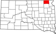 | |
| Towns | ||
| CDP | ||
| Unincorporated communities | ||
| Indian reservation | ||
| Footnotes | ‡This populated place also has portions in an adjacent county or counties | |