Butte County, South Dakota
| Butte County, South Dakota | |
|---|---|
 Butte County Courthouse | |
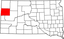 Location in the U.S. state of South Dakota | |
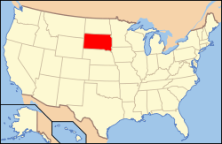 South Dakota's location in the U.S. | |
| Founded | May 6, 1883 |
| Seat | Belle Fourche |
| Largest city | Belle Fourche |
| Area | |
| • Total | 2,266 sq mi (5,869 km2) |
| • Land | 2,250 sq mi (5,827 km2) |
| • Water | 16 sq mi (41 km2), 0.7% |
| Population (est.) | |
| • (2015) | 10,283 |
| • Density | 4.5/sq mi (2/km²) |
| Congressional district | At-large |
| Time zone | Mountain: UTC-7/-6 |
| Website |
butte |
Butte County is a county located in the U.S. state of South Dakota. As of the 2010 census, the population was 10,110.[1] Its county seat is Belle Fourche.[2] The county was established in the Dakota Territory on March 2, 1883, and given the descriptive name based on the French word for a hill.[3]
History
Prehistory
In 1975, Plesiosaurus fossils dating back to the Cretaceous Period were discovered in Butte County. These fossils were approximately 110 million years old. In the 1980s, a 90-million-year-old fossil of a clawless lobster was discovered. A tyrannosaurus rex skeleton was found in 1981.[4]
The early human history of the Belle Fourche River Valley, and by extension, Butte County, has been traced back to about 3000 BC. The first people of the area were Native Americans who resided on the northwestern plains of North America. The earliest known evidence of human activity in the area dates back to the Middle Plains Archaic Period of the Plains Indians, which lasted from about 3000 to 1500 BC. Traces of tipi rings dating from this time period have been found. In 1979 and 1980, archeologists excavated a fortified and previously inhabited site located west of Belle Fourche that dated back to AD 1000. This site was called the Smiley-Evans Site and had been recorded in 1959. Until 1984, only 47 archaeological sites had been recorded, but after the excavation of the Smiley-Evans Site, several investigations were undertaken. As of 1989, 199 archaeological sites have been discovered in the county.[4]
Geography
According to the U.S. Census Bureau, the county has a total area of 2,266 square miles (5,870 km2), of which 2,250 square miles (5,800 km2) is land and 16 square miles (41 km2) (0.7%) is water.[5]
Major highways
 U.S. Highway 85
 U.S. Highway 212
 South Dakota Highway 34
 South Dakota Highway 79
 South Dakota Highway 168
Adjacent counties
- Harding County - north
- Perkins County - northeast
- Meade County - southeast
- Lawrence County - southwest
- Crook County, Wyoming - west
- Carter County, Montana - northwest
Demographics
| Historical population | |||
|---|---|---|---|
| Census | Pop. | %± | |
| 1890 | 1,037 | — | |
| 1900 | 2,907 | 180.3% | |
| 1910 | 4,993 | 71.8% | |
| 1920 | 6,819 | 36.6% | |
| 1930 | 8,589 | 26.0% | |
| 1940 | 8,004 | −6.8% | |
| 1950 | 8,161 | 2.0% | |
| 1960 | 8,592 | 5.3% | |
| 1970 | 7,825 | −8.9% | |
| 1980 | 8,372 | 7.0% | |
| 1990 | 7,914 | −5.5% | |
| 2000 | 9,094 | 14.9% | |
| 2010 | 10,110 | 11.2% | |
| Est. 2015 | 10,283 | [6] | 1.7% |
| U.S. Decennial Census[7] 1790-1960[8] 1900-1990[9] 1990-2000[10] 2010-2015[1] | |||
2000 census
As of the census[11] of 2000, there were 9,094 people, 3,516 households, and 2,468 families residing in the county. The population density was 4 people per square mile (2/km²). There were 4,059 housing units at an average density of 2 per square mile (1/km²). The racial makeup of the county was 95.52% White, 0.10% Black or African American, 1.65% Native American, 0.24% Asian, 1.09% from other races, and 1.40% from two or more races. 2.93% of the population were Hispanic or Latino of any race. 37.3% were of German, 10.0% Norwegian, 8.2% United States or American, 7.8% Irish and 7.7% English ancestry.
There were 3,516 households out of which 35.00% had children under the age of 18 living with them, 57.40% were married couples living together, 9.00% had a female householder with no husband present, and 29.80% were non-families. 25.60% of all households were made up of individuals and 11.90% had someone living alone who was 65 years of age or older. The average household size was 2.55 and the average family size was 3.07.
In the county, the population was spread out with 28.30% under the age of 18, 7.20% from 18 to 24, 26.00% from 25 to 44, 23.40% from 45 to 64, and 15.20% who were 65 years of age or older. The median age was 38 years. For every 100 females there were 96.90 males. For every 100 females age 18 and over, there were 93.20 males.
The median income for a household in the county was $29,040, and the median income for a family was $34,173. Males had a median income of $26,769 versus $15,758 for females. The per capita income for the county was $13,997. About 9.40% of families and 12.80% of the population were below the poverty line, including 17.40% of those under age 18 and 11.80% of those age 65 or over.
2010 census
As of the 2010 United States Census, there were 10,110 people, 4,160 households, and 2,786 families residing in the county.[12] The population density was 4.5 inhabitants per square mile (1.7/km2). There were 4,621 housing units at an average density of 2.1 per square mile (0.81/km2).[13] The racial makeup of the county was 94.2% white, 1.9% American Indian, 0.2% black or African American, 0.2% Asian, 0.1% Pacific islander, 0.8% from other races, and 2.6% from two or more races. Those of Hispanic or Latino origin made up 3.0% of the population.[12] In terms of ancestry, 40.9% were German, 16.6% were Irish, 15.7% were Norwegian, 10.4% were English, and 5.2% were American.[14]
Of the 4,160 households, 30.5% had children under the age of 18 living with them, 52.3% were married couples living together, 9.8% had a female householder with no husband present, 33.0% were non-families, and 28.5% of all households were made up of individuals. The average household size was 2.40 and the average family size was 2.92. The median age was 41.1 years.[12]
The median income for a household in the county was $39,041 and the median income for a family was $52,829. Males had a median income of $37,429 versus $25,273 for females. The per capita income for the county was $20,418. About 11.5% of families and 15.6% of the population were below the poverty line, including 25.0% of those under age 18 and 8.9% of those age 65 or over.[15]
Communities
Cities
- Belle Fourche (county seat)
- Newell
Towns
Census-designated place
Unincorporated communities
Townships
The county is divided into two townships: Union and Vale; and two areas of unorganized territory: East Butte and West Butte.
See also
| Wikimedia Commons has media related to Butte County, South Dakota. |
References
- 1 2 "State & County QuickFacts". United States Census Bureau. Retrieved November 26, 2013.
- ↑ "Find a County". National Association of Counties. Archived from the original on 2011-05-31. Retrieved 2011-06-07.
- ↑ Joseph Nathan Kane, The American Counties (4th Ed.), (The Scarecrow Press, 1983), pp68, 479
- 1 2 Engebretson, Pat; Heck, Kay; Herrett, Helen (1989). A History of Butte County, South Dakota. Dallas, TX: Curtis Media. ISBN 0-88107-139-0.
- ↑ "2010 Census Gazetteer Files". United States Census Bureau. August 22, 2012. Retrieved March 22, 2015.
- ↑ "County Totals Dataset: Population, Population Change and Estimated Components of Population Change: April 1, 2010 to July 1, 2015". Retrieved July 2, 2016.
- ↑ "U.S. Decennial Census". United States Census Bureau. Archived from the original on May 11, 2015. Retrieved March 22, 2015.
- ↑ "Historical Census Browser". University of Virginia Library. Retrieved March 22, 2015.
- ↑ Forstall, Richard L., ed. (March 27, 1995). "Population of Counties by Decennial Census: 1900 to 1990". United States Census Bureau. Retrieved March 22, 2015.
- ↑ "Census 2000 PHC-T-4. Ranking Tables for Counties: 1990 and 2000" (PDF). United States Census Bureau. April 2, 2001. Retrieved March 22, 2015.
- ↑ "American FactFinder". United States Census Bureau. Archived from the original on 2013-09-11. Retrieved 2011-05-14.
- 1 2 3 "DP-1 Profile of General Population and Housing Characteristics: 2010 Demographic Profile Data". United States Census Bureau. Retrieved 2016-03-11.
- ↑ "Population, Housing Units, Area, and Density: 2010 - County". United States Census Bureau. Retrieved 2016-03-11.
- ↑ "DP02 SELECTED SOCIAL CHARACTERISTICS IN THE UNITED STATES – 2006-2010 American Community Survey 5-Year Estimates". United States Census Bureau. Retrieved 2016-03-11.
- ↑ "DP03 SELECTED ECONOMIC CHARACTERISTICS – 2006-2010 American Community Survey 5-Year Estimates". United States Census Bureau. Retrieved 2016-03-11.
 |
Carter County, Montana | Harding County | Perkins County | |
| Crook County, Wyoming | |
|||
| ||||
| | ||||
| Lawrence County | Meade County |
Municipalities and communities of Butte County, South Dakota, United States | ||
|---|---|---|
| Cities | | |
| Towns | ||
| Townships | ||
| Unorganized territories |
| |
| CDP | ||
| Other unincorporated communities | ||
| Ghost town | ||
Coordinates: 44°55′N 103°29′W / 44.91°N 103.49°W