Caçapava
| Caçapava | |||
|---|---|---|---|
| |||
|
Motto: Mea autem Brasiliae magnitudo My greatness is also Brazil's | |||
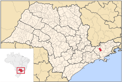 Location in the state of São Paulo and Brazil | |||
 Caçapava Location in the state of São Paulo and Brazil | |||
| Coordinates: 23°06′03″S 45°42′25″W / 23.10083°S 45.70694°WCoordinates: 23°06′03″S 45°42′25″W / 23.10083°S 45.70694°W | |||
| Country | Brazil | ||
| Region | Southeast | ||
| State | São Paulo | ||
| Metropolitan Region | Vale do Paraíba e Litoral Norte | ||
| Government | |||
| • Mayor | Henrique Rinco (PSDB) | ||
| Area | |||
| • Total | 368.99 km2 (142.47 sq mi) | ||
| Population (2015)[1] | |||
| • Total | 91,162 | ||
| • Density | 250/km2 (640/sq mi) | ||
| Time zone | BRT (UTC-3) | ||
| • Summer (DST) | BRST (UTC-2) | ||
| Area code(s) | +55 12 | ||


Caçapava (pronounced as /ka-sah-pah-vah/) is a municipality in the state of São Paulo in Brazil. It is part of the Metropolitan Region of Vale do Paraíba e Litoral Norte.[2] The population is 91,162 (2015 est.) in an area of 368.99 km².[1] The elevation is 570 m. The city lies between Taubaté (20 km) and São José dos Campos (21 km) as well as between the city of São Paulo (109 km) and the city of Rio de Janeiro (325 km). The average yearly temperature is 21.5°C, with a minimum average of 10.6°C on July and a maximum average of 30.1°C on February.[3]
Caçapava has a military unit known as 12ª Brigada de Infantaria Leve, which is part of the national army force and is constantly ready to take part in national and international missions. The city has also a reasonable industrial activity with important industries, like Nestlé and Pilkington, among others:
- ADEZAN Ind Com Embalagens e Serviços Ltda
- ALAMBIQUE do Antenor
- BLUETECH
- BRASQUÍMICA Produtos Asfalticos Ltda
- CABLETECH Ind. Com. de Condutores Elétricos
- CEA – Centro Empresarial Aeroespacial
- CEBRACE Cristal Plano Ltda
- Cerâmica BRUMATTI Ltda
- CORTESIA Serviços de Concretagem Ltda
- CPW Brasil Ltda
- DVR Power Centers
- FERNANDO D. Perez Belart
- FLC Ind e Com Plásticos Ltda
- Graúna Usinagem
- Grupo Antolim (Intertrim, Iramec, Trimtec)
- HUBNER Sanfonas Industriais Ltda
- INTRIERI Ind Com Ltda
- IPA (TI Automotives)
- ITALSPEED Automotive
- LEAR do Brasil Ind e Com de Interiores Automotivos
- Mecânica Caçapava Ltda
- Metal G Industrial
- MWL Brasil Rodas & Eixos Ltda
- N. PADOVANI Gomes & Cia Ltda
- OLGBER Especialidades Ltda
- PENIDO Construtora
- PREMOVALE
- REPROCESSA Resíduos Industriais Ltda
- ROSENBERGER Domex
- SIMOLDES Plásticos Ind Ltda
- SOTEF Soc. Técnica de Engenharia e Fundações Ltda
- STAR RACER Brasil Ltda
- TREVES DO BRASIL
- TW Espumas Ltda
- VALEPOSTE Ind Com Artefatos Cimento Ltda
- VIAPOL Ltda
- VORANA Usinagem e Com Ltda
- WOW Ind Com Ltda
- YUSHIRO do Brasil Ind Química Ltda [4]
It's expected an ascension of the industrial activity in the city as an executive airport is under construction (Aerovale).