Ferraz de Vasconcelos
| Ferraz de Vasconcelos | ||
|---|---|---|
| ||
| Nickname(s): Terra da Uva (Land Grape) | ||
| Motto: Labor Omnia Vincit | ||
 Location of Ferraz de Vasconcelos | ||
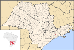
 Ferraz de Vasconcelos Location in Brazil | ||
| Coordinates: 23°32′28″S 46°22′08″W / 23.54111°S 46.36889°W | ||
| Country |
| |
| Region | Southeast | |
| State | São Paulo | |
| Government | ||
| • Mayor | Acir Filló (PSDB) | |
| Area | ||
| • Total | 29.56 km2 (11.41 sq mi) | |
| Elevation | 759 m (2,490 ft) | |
| Population (2015)[1] | ||
| • Total | 184,700 | |
| • Density | 6,200/km2 (16,000/sq mi) | |
| Time zone | UTC-3 (UTC-3) | |
| • Summer (DST) | UTC-2 (UTC-2) | |
| HDI (2000) | 0,772 – medium | |
| Website | Ferraz de Vasconcelos | |

Ferraz de Vasconcelos is a municipality in the state of São Paulo in Brazil. It is part of the Metropolitan Region of São Paulo.[2] The population is 184,700 (2015 est.) in an area of 29.56 km².[1]
History and the City
Ferraz de Vasconcelos is one of the cities of São Paulo founded by immigrants.
Ferraz de Vasconcelos was founded by two Italian immigrants, Helmuth Hans Hermann and Henry Louis Baxmann Kaesemodel.
Polo Italy Grape production in Brazil, the city is a pioneer in the cultivation of fruit. The first seedlings reach the hands of Italian immigrants who fixate on site. With the coming of Japanese agriculture becomes the main economic source. Today, the town hall and public buildings of the city are baptized Palace of Grape Italy.
Location
Ferraz de Vasconcelos is situated in the eastern region of Greater São Paulo. Altitude: 759 meters above sea level. Limits are Poa and Suzano east, São Paulo west, Maua southwest Ribeirão Pires and south Itaquaquecetuba north .
Tourism
Ferraz does not have great tourism potential, but has large events that attract many tourists to the City:
- The Championship skateboard: Every year takes place at the Convention Center Ferraz a competition of Skate contest where amateur practitioners of the region;
- The Little Castle: Built in 1948 by German Arthur Zenker, is undergoing restoration. The Museum will be installed in the municipality and a library;
- Grape Festival: Occurs between the first and second quarter of the year, the current goal of the festival is to promote Presentations Artists and famous Amusement Park;
- Church of Our Lady Peace: Traditional Church of Ferraz de Vasconcelos, most baptized in the municipality are held in place;
- Vine Ferraz: It is the largest vine Brazil, has 40 meters and 105 grafts of various varieties of Italy Grape;
- Municipal Stadium Clemente Belarmino: Every year we celebrate the birthday of the city departing from established players in the entire country;
- Parade of October 14: Anniversary of the municipality.
Notable People
External links
- Official Page of Ferraz de Vasconcelos
- EncontraFerrazdeVasconcelos - Find everything about Ferraz de Vasconcelos city
 |
São Paulo | | ||
| São Paulo | |
Poá and Suzano | ||
| ||||
| | ||||
| Ribeirão Pires and Mauá |
Coordinates: 23°32′28″S 46°22′08″W / 23.54111°S 46.36889°W