Cahone, Colorado
| Cahone, Colorado | |
|---|---|
| Unincorporated community | |
 Cahone  Cahone Location within the state of Colorado | |
| Coordinates: 37°39′39″N 108°48′01″W / 37.66083°N 108.80028°WCoordinates: 37°39′39″N 108°48′01″W / 37.66083°N 108.80028°W | |
| Country |
|
| State |
|
| County | Dolores County |
| Established | About 1912[1] |
| Elevation[2] | 6,680 ft (2,036 m) |
| Time zone | MST (UTC-7) |
| • Summer (DST) | MDT (UTC-6) |
| ZIP Code | 81320[3] |
Cahone is an unincorporated community and U.S. Post Office in Dolores County, Colorado, United States. The ZIP Code of the Cahone Post Office is 81320.[3]
History
The town of Cahone was established about 1912.[1] The Cahone Post Office opened on May 21, 1916.[4] The town was named by Bert Ballenger, the town's first postmaster, for a nearby canyon named El Cajon in Spanish, meaning little box.[1]
Ansel Hall Ruin, also known as Cahone Ruin, was a prehistoric North San Juan pueblo from the AD 1000-1499 period and has been listed on the National Register of Historic Places since 1997.[5]
See also
- Outline of Colorado
- State of Colorado
- Old Spanish National Historic Trail
- Prehistoric sites of Colorado
References
- 1 2 3 Eichler, Geo. R. (1977). Colorado Place Names. 77-089726: Johnson Publishing Company.
- ↑ "US Board on Geographic Names". United States Geological Survey. 2007-10-25. Retrieved 2008-01-31.
- 1 2 "United States Zip Code" (JavaScript/HTML). United States Postal Service. Retrieved November 12, 2016.
- ↑ Bauer, William H.; James L. Ozment; John H. Willard (1990). Colorado Post Offices 1859-1989. 90-34759: The Colorado Railroad Museum. ISBN 0-918654-42-4.
- ↑ National Register of Historic Places in Dolores County, Colorado American Dreams, Inc. Retrieved 2011-10-7.
External links
| Wikimedia Commons has media related to Cahone, Colorado. |
Municipalities and communities of Dolores County, Colorado, United States | ||
|---|---|---|
| Towns | 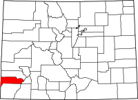 | |
| Unincorporated communities | ||

This article is issued from Wikipedia - version of the 11/12/2016. The text is available under the Creative Commons Attribution/Share Alike but additional terms may apply for the media files.