Conejos County, Colorado
| Conejos County, Colorado | |
|---|---|
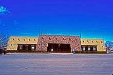 Conejos County Courthouse | |
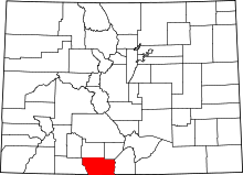 Location in the U.S. state of Colorado | |
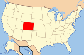 Colorado's location in the U.S. | |
| Founded | November 1, 1861 |
| Named for | Conejos River |
| Seat | Conejos |
| Largest town | Manassa |
| Area | |
| • Total | 1,291 sq mi (3,344 km2) |
| • Land | 1,287 sq mi (3,333 km2) |
| • Water | 3.6 sq mi (9 km2), 0.3% |
| Population (est.) | |
| • (2015) | 8,130 |
| • Density | 6.4/sq mi (2/km²) |
| Congressional district | 3rd |
| Time zone | Mountain: UTC-7/-6 |
| Website |
www |
Conejos County is one of the 64 counties of the U.S. state of Colorado. As of the 2010 census, the population was 8,256.[1] The county seat is the unincorporated community of Conejos.[2]
History
The first European known to visit this area was Don Diego de Vargas in 1694, but he left behind no colonists. In 1708, Juan de Uribarri passed through searching for run-away Indian slaves.[3]
Conejos County was one of the original 17 counties created by the General Assembly of the Territory of Colorado on 1861-11-01, although it was originally named Guadalupe County and renamed Conejos County a week later, on November 7. Its name coming from the Spanish word "conejo", meaning rabbit, for the large abundance of rabbits in the area. Also early in its existence, the county seat was moved from the town of Guadalupe to Conejos. The original boundaries of the county included a large portion of southwestern Colorado.
In 1874, most of the western and northern portions of the county were broken away to form parts of Hinsdale, La Plata and Rio Grande counties, and Conejos County achieved its modern borders in 1885 when its western half was taken to create Archuleta County.
Religious history
The community of Conejos is the location of the oldest church in Colorado, called Our Lady of Guadalupe Parish. This church was constructed in 1856. The first settlers into the area were from New Mexico, primarily from Abiquiu, San Juan de los Caballeros and Santa Cruz. As more people arrived, mission churches were set up and all had the records housed with Our Lady of Guadalupe Parish.
When the neighboring town of Antonito was built, the Theatines, priests from Spain, came into the area and built St. Augustine church in 1880 within Antonito. The church records from Our Lady of Guadalupe Parish are now housed at the church offices of Saint Augustine. Conejos is approximately a mile northwest of Antonito.
Presbyterians came into Conejos County in 1880 establishing churches in Antonito, Alamosa, Cenicero, Del Norte, Mogote, San Rafael, and Monte Vista. They also established schools in the area and had a large number of Hispanic converts. A jacal went up in 1854 in Guadalupe, now known as Conejos, which was the beginning of Our Lady of Guadalupe Parish.
There is also a large Mormon population within Conejos County. Settlers belonging to The Church of Jesus Christ of Latter-day Saints (LDS Church) began settling in the towns of La Jara, Manassa and Sanford; each town currently has an LDS meetinghouse. Fox Creek, a village approximately 11 miles west of Antonito, is the newest community to have an LDS meetinghouse erected, although there had previously been meetinghouse there. Fox Creek, however, is not a predominantly Mormon population.
Genealogy
Records available for this area are marriage records, which are held by the county clerk. Divorce records are maintained by the clerk of the district court. Agencies that hold records for marriages and divorces from 1900 to 1939 are the Colorado State Archives and Denver Public Library Genealogy Department. Other records available are marriage records from 1871 and death records from 1877-1907. This also include land records from 1871, probate records from 1875, and court records from 1877. However, some records were lost due to a fire, but birth records for 1877-1907 are still preserved.[4] Websites that will be of use when doing genealogical research are The Colorado Genealogical Society and Conejos County WW II Enlistments.
Amendment 64
When Colorado Amendment 64 was being voted into effect by Coloradans, Conejos County residents voted against approving the measure to legalize and regulate recreational Marijuana consumption and possession for those 21 or older; Conejos residents simultaneously voted for a Democratic president in the 2008 and 2012 presidential elections, making Conejos county the only Colorado county with the distinction of leaning liberal with recent presidential picks and leaning conservative with regard to marijuana policy.
Geography
According to the U.S. Census Bureau, the county has a total area of 1,291 square miles (3,340 km2), of which 1,287 square miles (3,330 km2) is land and 3.6 square miles (9.3 km2) (0.3%) is water.[5]
Conejos County is in a broad high mountain valley in South Central Colorado. It has an area of approximately 825,446 acres (3,340 km2) in 1,290 square miles (3,340 km2). Roughly half the area is on the nearly level floor of the valley, where the average elevation is about 7,700 feet (2,350 m). The western half of the county ranges from gently rolling to steep foothills with mountains that rise in elevation to about 13,000 feet (4,000 m).
Conejos County is situated with the National Forest to the west and the Rio Grande to the east, along Colorado's southern border with the state of New Mexico. Only about 34 percent of Conejos County is privately owned with the other 66 percent being National Forest, Bureau of Land Management (BLM) or State owned lands.
Climate
In winter, the average temperature is 21.6 degrees Fahrenheit, and the average daily minimum temperature is 4 degrees. In summer, the average temperature is 61.4 degrees, and the average maximum temperature is 79.6 degrees.
Seventy-one percent of the annual precipitation falls in the months of April through September. Average seasonal snowfall is 28 inches. The average relative humidity in mid-afternoon in spring is less than 35 percent; during the rest of the year, it is about 45 percent. The percentage of possible sunshine is 77 in the summer and 73 in the winter.
Adjacent counties
- Rio Grande County - north
- Alamosa County - northeast
- Costilla County - east
- Taos County, New Mexico - southeast
- Rio Arriba County, New Mexico - south
- Archuleta County- west
National protected areas
Historic trails and sites
Scenic trails and byways
Demographics
| Historical population | |||
|---|---|---|---|
| Census | Pop. | %± | |
| 1870 | 2,504 | — | |
| 1880 | 5,605 | 123.8% | |
| 1890 | 7,193 | 28.3% | |
| 1900 | 8,794 | 22.3% | |
| 1910 | 11,285 | 28.3% | |
| 1920 | 8,416 | −25.4% | |
| 1930 | 9,803 | 16.5% | |
| 1940 | 11,648 | 18.8% | |
| 1950 | 10,171 | −12.7% | |
| 1960 | 8,428 | −17.1% | |
| 1970 | 7,846 | −6.9% | |
| 1980 | 7,794 | −0.7% | |
| 1990 | 7,453 | −4.4% | |
| 2000 | 8,400 | 12.7% | |
| 2010 | 8,256 | −1.7% | |
| Est. 2015 | 8,130 | [6] | −1.5% |
| U.S. Decennial Census[7] 1790-1960[8] 1900-1990[9] 1990-2000[10] 2010-2015[1] | |||
As of the census[11] of 2000, there were 8,400 people, 2,980 households, and 2,211 families residing in the county. The population density was 6 people per square mile (3/km²). There were 3,886 housing units at an average density of 3 per square mile (1/km²). The racial makeup of the county was 72.76% White, 0.21% Black or African American, 1.69% Native American, 0.15% Asian, 0.07% Pacific Islander, 21.50% from other races, and 3.61% from two or more races. 58.92% of the population were Hispanic or Latino of any race.
There were 2,980 households out of which 38.50% had children under the age of 18 living with them, 56.30% were married couples living together, 12.70% had a female householder with no husband present, and 25.80% were non-families. 23.70% of all households were made up of individuals and 11.50% had someone living alone who was 65 years of age or older. The average household size was 2.80 and the average family size was 3.33.
In the county the population was spread out with 32.10% under the age of 18, 8.50% from 18 to 24, 23.60% from 25 to 44, 20.80% from 45 to 64, and 15.00% who were 65 years of age or older. The median age was 34 years. For every 100 females there were 98.50 males. For every 100 females age 18 and over, there were 98.10 males.
The median income for a household in the county was $24,744, and the median income for a family was $29,066. Males had a median income of $26,351 versus $20,200 for females. The per capita income for the county was $12,050. About 18.60% of families and 23.00% of the population were below the poverty line, including 28.20% of those under age 18 and 17.30% of those age 65 or over.
Communities
Towns
Census-designated places
Other communities
- Bear Creek
- Bountiful
- Cañon
- Carmel
- Elk Creek
- Fox Creek
- Guadalupe
- Horca
- La Florida
- Lasauces
- Las Mesitas
- Lobatos
- Mogote
- Ortiz
- Osier
- Platoro
- Richfield
- Rincones
- San Antonio
- Sheep Creek
Notable people
Fred Haberlein - Muralist
See also
- Outline of Colorado
- Index of Colorado-related articles
- Guadalupe County, Colorado Territory
- National Register of Historic Places listings in Conejos County, Colorado
References
- 1 2 "State & County QuickFacts". United States Census Bureau. Retrieved January 25, 2014.
- ↑ "Find a County". National Association of Counties. Archived from the original on 2011-05-31. Retrieved 2011-06-07.
- ↑ Mead, Frances Harvey, Conejos County:The Canyons...The River...The Villages and the People, copyright, Frances Harvey Mead, 1894, p.1,2
- ↑ Alice Eichholz, Red Book American State, County and Town Sources; Ancestry.com, Colorado.
- ↑ "US Gazetteer files: 2010, 2000, and 1990". United States Census Bureau. 2011-02-12. Retrieved 2011-04-23.
- ↑ "County Totals Dataset: Population, Population Change and Estimated Components of Population Change: April 1, 2010 to July 1, 2015". Retrieved July 2, 2016.
- ↑ "U.S. Decennial Census". United States Census Bureau. Archived from the original on May 11, 2015. Retrieved June 7, 2014.
- ↑ "Historical Census Browser". University of Virginia Library. Retrieved June 7, 2014.
- ↑ "Population of Counties by Decennial Census: 1900 to 1990". United States Census Bureau. Retrieved June 7, 2014.
- ↑ "Census 2000 PHC-T-4. Ranking Tables for Counties: 1990 and 2000" (PDF). United States Census Bureau. Retrieved June 7, 2014.
- ↑ "American FactFinder". United States Census Bureau. Archived from the original on 2013-09-11. Retrieved 2011-05-14.
External links
- Conejos County Official Website
- Conejos County Government
- Colorado County Evolution by Don Stanwyck
- Colorado Historical Society
- Cumbres & Toltec Scenic Railroad
- San Luis Valley Dweller
- Valley Courier Newspaper
- Conejos County Citizen
- Antonito Police Department
- Conejos County Crime Statistics
 |
Rio Grande County | Alamosa County | | |
| Archuleta County | |
Costilla County | ||
| ||||
| | ||||
| Rio Arriba County, New Mexico | Taos County, New Mexico |
Municipalities and communities of Conejos County, Colorado, United States | ||
|---|---|---|
| Towns | | |
| CDPs | ||
| Unincorporated communities | ||

Coordinates: 37°13′N 106°11′W / 37.21°N 106.19°W