Platteville, Colorado
| Platteville, Colorado | |
|---|---|
| Town | |
|
Platteville Town Hall | |
| Motto: "Small Town Atmosphere, Big Town Vision"[1] | |
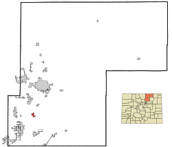 Location in Weld County and the state of Colorado | |
| Coordinates: 40°12′52″N 104°49′27″W / 40.21444°N 104.82417°WCoordinates: 40°12′52″N 104°49′27″W / 40.21444°N 104.82417°W | |
| Country |
|
| State |
|
| County[2] | Weld |
| Founded | 1871 |
| Incorporated (town) | January 1, 1887[3] |
| Government | |
| • Type | Statutory Town[2] |
| • Mayor | Steve Nelson |
| • Town Manager | Troy Renken |
| Area | |
| • Total | 2.527 sq mi (6.545 km2) |
| • Land | 2.527 sq mi (6.545 km2) |
| • Water | 0 sq mi (0 km2) |
| Elevation[4] | 4,813 ft (1,467 m) |
| Population (2010) | |
| • Total | 2,485 |
| • Density | 1,580/sq mi (623.7/km2) |
| Time zone | Mountain (MST) (UTC-7) |
| • Summer (DST) | MDT (UTC-6) |
| ZIP code[5] | 80651 |
| Area code(s) | 970 |
| FIPS code | 08-60160 |
| GNIS feature ID | 0180790 |
| Website | plattevillegov.org |

Platteville is a Statutory Town in Weld County, Colorado, United States. The population was 2,485 at the 2010 census. It is adjacent to Fort Vasquez on U.S. Highway 85.
History
Platteville was founded on May 27, 1871, and was incorporated on January 1, 1887.[6] The town was named for its location on the Platte River.[7]
Geography
Platteville is located at 40°12′52″N 104°49′27″W / 40.21444°N 104.82417°W (40.214468, -104.824070).[8]
The town is situated along the east bank of the South Platte River at the intersection of U.S. Highway 85 and State Highway 66.
The Fort St. Vrain Generating Station, originally a nuclear power plant and now operating as a natural gas powered electricity generating facility operated by Xcel Energy, is approximately one-quarter-mile northwest of Platteville.
According to the United States Census Bureau, Platteville has a total area of 2.527 square miles (6.54 km2), all of it land.
Demographics
| Historical population | |||
|---|---|---|---|
| Census | Pop. | %± | |
| 1890 | 213 | — | |
| 1900 | 263 | 23.5% | |
| 1910 | 430 | 63.5% | |
| 1920 | 479 | 11.4% | |
| 1930 | 533 | 11.3% | |
| 1940 | 561 | 5.3% | |
| 1950 | 570 | 1.6% | |
| 1960 | 582 | 2.1% | |
| 1970 | 683 | 17.4% | |
| 1980 | 1,662 | 143.3% | |
| 1990 | 1,515 | −8.8% | |
| 2000 | 2,370 | 56.4% | |
| 2010 | 2,485 | 4.9% | |
| Est. 2015 | 2,619 | [9] | 5.4% |
As of the census[11] of 2010, there were 2,485 people, 951 households, and 935 families residing in Platteville. The population density was 1,606.5 people per square mile (618.3/km²). There were 819 housing units at an average density of 555.1 per square mile (213.7/km²). The racial makeup of Platteville was 73.84% White, 0.55% Native American, 0.30% Asian, 0.17% Pacific Islander, 22.24% from other races, and 2.91% from two or more races. Hispanic or Latino of any race were 35.19% of the population.
There were 786 households out of which 45.4% had children under the age of 18 living with them, 61.6% were married couples living together, 10.1% had a female householder with no husband present, and 24.4% were non-families. 18.1% of all households were made up of individuals and 5.3% had someone living alone who was 65 years of age or older. The average household size was 3.02 and the average family size was 3.50.
The Platteville population was spread out with 32.8% under the age of 18, 9.7% from 18 to 24, 32.3% from 25 to 44, 18.7% from 45 to 64, and 6.5% who were 65 years of age or older. The median age was 30 years. For every 100 females there were 103.6 males. For every 100 females age 18 and over, there were 99.5 males.
The median income for a household in Platteville was $43,472, and the median income for a family was $47,574. Males had a median income of $34,048 versus $25,430 for females. The per capita income for Platteville was $15,802. About 6.9% of families and 8.7% of the population were below the poverty line, including 9.6% of those under age 18 and 5.5% of those age 65 or over.
Arts and culture
Annual cultural events
Platteville celebrates the harvest season every August since 1910. The name of the harvest festival has changed many times over the years, and is currently called, simply, Harvest Daze.
See also
References
- ↑ "Town of Platteville Colorado". Town f Platteville Colorado. Retrieved September 22, 2012.
- 1 2 "Active Colorado Municipalities". State of Colorado, Department of Local Affairs. Retrieved 2007-09-01.
- ↑ "Colorado Municipal Incorporations". State of Colorado, Department of Personnel & Administration, Colorado State Archives. December 1, 2004. Retrieved 2007-09-02.
- ↑ "US Board on Geographic Names". United States Geological Survey. 2007-10-25. Retrieved 2008-01-31.
- ↑ "ZIP Code Lookup" (JavaScript/HTML). United States Postal Service. Retrieved 2007-12-15.
- ↑ "Platteville, Colorado". City-Data.com. Retrieved September 19, 2012.
- ↑ Dawson, John Frank. Place names in Colorado: why 700 communities were so named, 150 of Spanish or Indian origin. Denver, CO: The J. Frank Dawson Publishing Co. p. 41.
- ↑ "US Gazetteer files: 2010, 2000, and 1990". United States Census Bureau. 2011-02-12. Retrieved 2011-04-23.
- ↑ "Annual Estimates of the Resident Population for Incorporated Places: April 1, 2010 to July 1, 2015". Retrieved July 2, 2016.
- ↑ "Census of Population and Housing". Census.gov. Retrieved June 4, 2015.
- ↑ "American FactFinder". United States Census Bureau. Retrieved 2008-01-31.
External links
- Platteville Website Portal style website, Government, Business, Library, Recreation and more
- City-Data.com Comprehensive Statistical Data and more about Tipton
- CDOT map of the Town of Platteville
Municipalities and communities of Weld County, Colorado, United States | ||
|---|---|---|
| Cities | 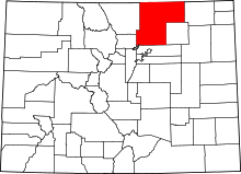 | |
| Towns | ||
| CDP | ||
| Unincorporated communities | ||
| Ghost towns | ||
| Footnotes | ‡This populated place also has portions in an adjacent county or counties | |
