Chippewa National Forest
| Chippewa National Forest | |
|---|---|
|
IUCN category VI (protected area with sustainable use of natural resources) | |
|
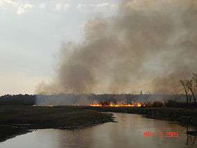
Fire in Chippewa National Forest | |
 | |
| Location | Itasca / Cass / Beltrami counties, Minnesota, USA |
| Nearest city | Cass Lake, MN |
| Coordinates | 47°20′26″N 94°12′24″W / 47.34056°N 94.20667°WCoordinates: 47°20′26″N 94°12′24″W / 47.34056°N 94.20667°W |
| Area | 666,623 acres (2,697.73 km2)[1] |
| Established | 1908 |
| Governing body | U.S. Forest Service |
| Website | Chippewa National Forest |
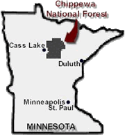
Chippewa National Forest is a National Forest located in northcentral Minnesota, United States, in the counties of Itasca, Cass, and Beltrami. Forest headquarters are located in Cass Lake, Minnesota. There are local ranger district offices in Blackduck, Deer River, and Walker.
History and geography
The forest covers 666,623 acres (2,697.73 km2). Water is abundant, with over 1,300 lakes (including Leech Lake), 923 miles (1,485 km) of rivers and streams, and 400,000 acres (1,600 km2) of wetlands.[2] Inside the forest the Cut Foot Sioux Trail runs along the Laurentian Divide.
The forest was established as the Minnesota Forest Reserve on June 27, 1902, with passage of the Morris Act.[3] While this act mainly addressed the disposition of unallotted lands on Ojibwe Indian reservations in Minnesota, 200,000 acres (810 km2) of the Chippewas of the Mississippi, Cass Lake, Leech Lake, and Winnibigoshish Indian reservations were designated as a Forest Reserve.
The Reserve was re-established as the Minnesota National Forest on May 23, 1908.[4] In 1928 the forest was renamed in honor of the Chippewa Indians from whose land the forest was created. Subsequent boundary expansions and land purchases increased the area of the forest to its present size. Today, approximately 75 percent of the forest's land is within the Leech Lake Indian Reservation.
Fauna and flora
Aspen, birch, pine, balsam fir and maple blanket the forest. Old growth forest such as the Lost Forty section of the CNF is valuable for wildlife, including bald eagle, several species of hawk and woodpecker, red squirrel, weasel and numerous other species. In the 1960s the bald eagle population in the forest was only 12 nesting pairs.[5] Since then the population has rebounded and the bald eagle population of the Chippewa National Forest is one of the highest density in the lower forty eight states at 150 nesting pairs.[6]
The Lost Forty
The forest contains an area known as the Lost Forty. This area, which has a total of 144 acres (0.58 km2), was accidentally mapped as part of Coddington Lake when the original maps of the region were laid out in 1882.[7] As a result of the mapping error, the Lost Forty was never logged.
It contains some of the oldest forest in the state, with some trees more than 350 years old. Less than two percent of Minnesota's total forested land today is such old growth forest. These unique qualities offer an abundance of outdoor recreational opportunities throughout the year.
See also
References
- ↑ "Land Areas of the National Forest System" (PDF). U.S. Forest Service. January 2012. Retrieved 20 June 2012.
- ↑ http://www.fs.fed.us/r9/forests/chippewa/about/forest_facts/index.php Accessed 18 July 2006
- ↑ 32 Stat., 400
- ↑ 35 Stat., 268
- ↑ http://www.fs.fed.us/r9/forests/chippewa/recreation/wildlife_viewing/ Accessed 18 July 2006
- ↑ http://www.conservationfund.org/?article=2775&back=true Accessed 18 July 2006
- ↑ http://www.fs.usda.gov/Internet/FSE_DOCUMENTS/fsm9_016469.pdf "Lost forty history"], Forest Service, Retrieved 02 September 2015
External links
- History of the Forest "The Real Story of Chippewa National Forest" by Tim Brady in November-December 2004 issue of Minnesota Conservation Volunteer
- The Chippewa National Forest Website
- Online Map of the forest
- Print maps of the forest