Apache-Sitgreaves National Forest
| Apache-Sitgreaves National Forest | |
|---|---|
|
IUCN category VI (protected area with sustainable use of natural resources) | |
 | |
 | |
| Location | Arizona and New Mexico, United States |
| Nearest city | Springerville |
| Coordinates | 33°38′14″N 109°17′17″W / 33.63722°N 109.28806°WCoordinates: 33°38′14″N 109°17′17″W / 33.63722°N 109.28806°W |
| Area | 2,761,386 acres (11,175 km2)[1] |
| Governing body | U.S. Forest Service |
| Website | Apache-Sitgreaves National Forest |
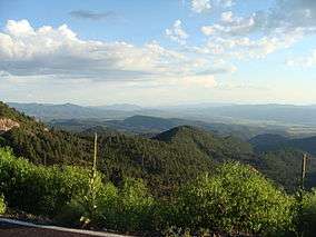
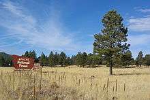
The Apache-Sitgreaves National Forest is a 2.76-million-acre (11,169 km2)[1] United States National Forest which runs along the Mogollon Rim and the White Mountains in east-central Arizona and extending into the U.S. state of New Mexico. Both forests are managed as one unit by USDA Forest Service from the forests Supervisors Office in Springerville, Arizona. Apache-Sitgreaves has over 400 species of wildlife. With its high elevation and cool summer breezes it is a popular weekend destination from the hot desert for Phoenix, Arizona residents. The forest is divided into 5 Ranger Districts (Clifton, Alpine, Springerville, Lakeside, and Black Mesa) that span almost 300 miles (480 km) from Clifton, Arizona in the east-central portion of Arizona to the eastern boundary of the Coconino National Forest in north-central Arizona. The Apache-Sitgreaves National Forest borders the western and northern borders of the Fort Apache Indian Reservation. It is located in parts of Greenlee, Apache, Navajo, and Coconino counties in eastern and east-central Arizona, and Catron County in western New Mexico. The more northwesterly Sitgreaves National Forest portion lies adjacent to the north side of the Fort Apache Indian Reservation and is located entirely in Arizona, within Navajo, Apache, and Coconino counties. It has a total area of 818,651 acres (3,313 km2). The more southeasterly and much larger Apache National Forest portion lies adjacent to the east side of the Fort Apache and the San Carlos Indian Reservations. It lies on both sides of the border with New Mexico, in Greenlee, Catron, and Apache counties. It has a total area of 1,813,601 acres (7,339 km2).[2]
Lakes, rivers and streams
Apache-Sitgreaves National Forests has 8 notable cold water lakes and boasts numerous lakes and reservoirs and over 680 miles (1094 km) of rivers and streams. The headwaters for the Black, Little Colorado and San Francisco rivers are in the White Mountains.
- Aker Lake
- Big Lake
- Woods Canyon Lake
- Willow Springs Lake
- Black Canyon Lake
- Chevelon Canyon Lake
- Luna Lake
- Bear Canyon Lake
- Crescent Lake
- Blue River
Wilderness areas
There are four wilderness areas within Apache-Sitgreaves National Forest. All lie within the former Apache National Forest section. Three have been officially designated by Congress as part of the National Wilderness Preservation System.[3]
- Bear Wallow Wilderness
- Escudilla Wilderness
- Mount Baldy Wilderness
The fourth, the Blue Range Primitive Area, was designated as a Primitive Area by the Secretary of Agriculture in 1933. The area has been managed under the highest level of forest service protection to maintain its wilderness qualities. It was recommended the this area be included in the Blue Range Wilderness in 1971, but in 1980 Congress only acted upon an adjacent New Mexico portion within Gila National Forest.[4][5]
See also
References
- 1 2 "Land Areas of the National Forest System As of September 30, 2011" (PDF). U.S. Forest Service. Retrieved 2012-03-19.
- ↑ Table 6 – NFS Acreage by State, Congressional District and County – United States Forest Service – September 30, 2007
- ↑ Wilderness.net website – 23 June 2012
- ↑ "Apache-Sitgreaves National Forests – Blue Range Primitive Area – Alpine District Parcel". www.fs.usda.gov. Retrieved 2016-11-13.
- ↑ "Gila National Forest – Special Places". www.fs.usda.gov. Retrieved 2016-11-13.
External links
| Wikimedia Commons has media related to Apache-Sitgreaves National Forest. |