Federal Capital Territory (Pakistan)
| Federal Capital Territory | |||||
| Subdivision of Pakistan | |||||
| |||||
|
Flag | |||||
 | |||||
| Capital | Karachi | ||||
| History | |||||
| • | Established | 23 July 1948 | |||
| • | Disestablished | 1961 | |||
| Area | 2,103 km2 (812 sq mi) | ||||
| Government of Karachi | |||||

 |
| This article is part of the series |
| Former administrative units of Pakistan |
|---|
|
Original provinces |
|
One-unit provinces |
|
Other subdivisions |
| Part of a series on the History of Karachi | |
 | |
| Ancient period | |
|---|---|
| Islamic period | |
| Local dynasties | |
| British period | |
| Independent Pakistan | |
|
Federal Capital Territory | |
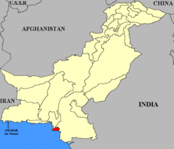
The Federal Capital Territory (FCT) around Karachi was the original capital territory of Pakistan. The FCT was created in 1948 from the city of Karachi and surrounding areas as the location for Pakistan's capital following independence. The FCT was bordered by the province of Sind to the northeast and the princely state of Las Bela to the northwest with the Arabian Sea to the south.
History
Karachi became the first capital of the new country of Pakistan in 1947. The FCT was created in 1948 to enable the federal government to operate from a nationally-held territory. At that time it had a population of 400,000 people which began to increase rapidly because of the political focus on the city and the fact that it was the major commercial seaport for western Pakistan. When the territory was absorbed into the province of West Pakistan the city had a population of about 1.9 million.
The main ethnic groups in the FCT were Sindhis and Baluchis. However these were soon outnumbered by Muhajir who had left India for Pakistan, resulting is dramatic demographic changes.
Geography and climate
The Federal Capital Territory occupied 2,103 km² compared to the current City-District of Karachi which occupies 3,527 km². Apart from Karachi city, the Federal Capital Territory also contained several small villages and towns which have now been subsumed in the metropolitan area of Karachi. The territory covered rolling plains bound by hills to the north and west, the river Indus to the east and the Arabian Sea to the south. Several smaller rivers flowed through the heart of the territory including the river Malir and the river Layari. The Port of Karachi was located in a protected bay to the southwest of the city, protected by several small islands. The climate of the territory was moderated by the influence of the sea with relatively mild winters and warm summers. There was low precipitation and high humidity for much of the year except during the short monsoon rains.
Economy and transport
Karachi was and still is the financial capital of Pakistan, accounting for the largest share of the nation's GDP and generating the largest share of the national revenue. The State Bank of Pakistan and most commercial banks had their headquarters in Karachi together with Pakistan's first and largest stock exchange - the KSE.
The FCT was served by the old Quaid-e-Azam International Airport (now Jinnah International Airport) terminal which is now used for Hajj flights and cargo facilities. In addition there was an airport at Mauripur which is now the Masroor Pakistan Air Force base. Karachi had the only major port in western Pakistan while Chittagong was the main port for eastern Pakistan. The city was linked to the rest of the country by railway with the main stations at Karachi City Station and Karachi Cantonment Station.