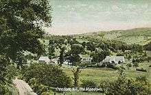
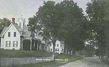
Freedom, New Hampshire
| Freedom, New Hampshire | |
|---|---|
| Town | |
 Location in Carroll County, New Hampshire | |
| Coordinates: 43°48′49″N 71°02′11″W / 43.81361°N 71.03639°WCoordinates: 43°48′49″N 71°02′11″W / 43.81361°N 71.03639°W | |
| Country | United States |
| State | New Hampshire |
| County | Carroll |
| Incorporated | 1831 |
| Government | |
| • Board of Selectmen |
Les Babb, Chair Ernie Day, Jr. Neal Boyle |
| • Town Administrator | Karen Hatch |
| Area | |
| • Total | 38.1 sq mi (98.7 km2) |
| • Land | 35.0 sq mi (90.6 km2) |
| • Water | 3.1 sq mi (8.1 km2) 8.23% |
| Elevation | 439 ft (134 m) |
| Population (2010) | |
| • Total | 1,489 |
| • Density | 42/sq mi (16.4/km2) |
| Time zone | Eastern (UTC-5) |
| • Summer (DST) | Eastern (UTC-4) |
| ZIP code | 03836 |
| Area code(s) | 603 |
| FIPS code | 33-27700 |
| GNIS feature ID | 0873601 |
| Website |
www |
Freedom is a town located in Carroll County, New Hampshire, United States. The population was 1,489 at the 2010 census.[1] The town's eastern boundary runs along the Maine state border. Ossipee Lake, with a resort and camps, is in the southwest of the town.
History
The town was once a part of Effingham called "North Effingham". Following an influx of new settlers from Maine, there was a conflict of culture and religion between them and people from the New Hampshire seacoast area who already populated Effingham. As a result, North Effingham separated into a town of its own. The community, incorporated in 1831, was appropriately named "Freedom".
The town was the setting for the children's fantasy book The Enormous Egg by Oliver Butterworth, first published in 1956 but reissued years later, and a 2001 broadcast of This American Life, "House on Loon Lake". The episode depicted an abandoned house explored by young boys in town for summer camp at Loon Lake.
Geography
Freedom is situated between the Lakes Region and the White Mountains. According to the United States Census Bureau, the town has a total area of 38.1 square miles (99 km2), of which 35.0 square miles (91 km2) is land and 3.1 square miles (8.0 km2) is water, comprising 8.23% of the town.[2] The highest point in the town is the summit of Cragged Mountain, at 1,806 feet (550 m) above sea level. Freedom is drained by the Ossipee River and lies fully within the Saco River watershed.[3]
Freedom is one of several sites for Nature's Classroom. It is also home to one of the permanent campsites of the Luethi-Peterson Camps and to Cragged Mountain Farm, a co-ed summer camp on Cragged Mountain started by Dr. Henry Utter in 1927, and still owned by the Utter family.
Demographics
| Historical population | |||
|---|---|---|---|
| Census | Pop. | %± | |
| 1840 | 926 | — | |
| 1850 | 910 | −1.7% | |
| 1860 | 917 | 0.8% | |
| 1870 | 737 | −19.6% | |
| 1880 | 714 | −3.1% | |
| 1890 | 630 | −11.8% | |
| 1900 | 594 | −5.7% | |
| 1910 | 542 | −8.8% | |
| 1920 | 467 | −13.8% | |
| 1930 | 390 | −16.5% | |
| 1940 | 352 | −9.7% | |
| 1950 | 315 | −10.5% | |
| 1960 | 363 | 15.2% | |
| 1970 | 387 | 6.6% | |
| 1980 | 720 | 86.0% | |
| 1990 | 935 | 29.9% | |
| 2000 | 1,303 | 39.4% | |
| 2010 | 1,489 | 14.3% | |
| Est. 2015 | 1,487 | [4] | −0.1% |
As of the census of 2010, there were 1,489 people, 699 households, and 457 families residing in the town. The population density was 42.5 people per square mile (16.4/km²). There were 1,580 housing units at an average density of 45.1 per square mile (17.4/km²). The racial makeup of the town was 98.8% White, 0.1% African American, 0.3% Asian, 0.1% some other race, and 0.7% from two or more races.[1]
There were 699 households out of which 19.0% had children under the age of 18 living with them, 56.9% were headed by married couples living together, 5.7% had a female householder with no husband present, and 34.6% were non-families. 28.9% of all households were made up of individuals, and 14.5% were someone living alone who was 65 years of age or older. The average household size was 2.12, and the average family size was 2.57.[1]

In the town the population was spread out with 15.6% under the age of 18, 4.9% from 18 to 24, 16.8% from 25 to 44, 35.9% from 45 to 64, and 26.9% who were 65 years of age or older. The median age was 53.1 years. For every 100 females there were 101.5 males. For every 100 females age 18 and over, there were 97.8 males.[1]
For the period 2007-11, the estimated median annual income for a household in the town was $47,375, and the median income for a family was $50,769. Male full-time workers had a median income of $40,536 versus $33,958 for females. The per capita income for the town was $32,537. About 6.0% of families and 7.2% of the population were below the poverty line, including 13.4% of those under the age of 18 and 3.6% of those 65 and older.[6]
The largest ancestry groups in Freedom as of 2007-11 were:
- 29.8% English
- 27.2% Irish
- 22.0% French and French Canadian
- 9.6% Scottish
- 7.7% Swedish
- 7.5% German
- 5.7% Scotch-Irish
- 5.2% Italian[7]
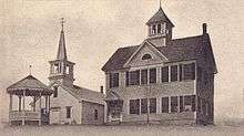
Sites of interest
- Allard House & Works Museum, Freedom Historical Society
Notable people
- Frank S. Black (summer resident), 32nd governor of New York
References
- 1 2 3 4 "Profile of General Population and Housing Characteristics: 2010 Demographic Profile Data (DP-1): Freedom town, Carroll County, New Hampshire". U.S. Census Bureau, American Factfinder. Retrieved March 8, 2013.
- ↑ "Geographic Identifiers: 2010 Demographic Profile Data (G001) - Freedom town, New Hampshire". U.S. Census Bureau American Factfinder. Retrieved November 7, 2011.
- ↑ Foster, Debra H.; Batorfalvy, Tatianna N.; Medalie, Laura (1995). Water Use in New Hampshire: An Activities Guide for Teachers. U.S. Department of the Interior and U.S. Geological Survey.
- ↑ "Annual Estimates of the Resident Population for Incorporated Places: April 1, 2010 to July 1, 2015". Retrieved July 2, 2016.
- ↑ "Census of Population and Housing". Census.gov. Retrieved June 4, 2016.
- ↑ "Selected Economic Characteristics: 2007-2011 American Community Survey 5-Year Estimates (DP03): Freedom town, Carroll County, New Hampshire". U.S. Census Bureau, American Factfinder. Retrieved March 8, 2013.
- ↑ "Selected Social Characteristics in the United States: 2007-2011 American Community Survey 5-Year Estimates (DP02): Freedom town, Carroll County, New Hampshire". U.S. Census Bureau, American Factfinder. Retrieved March 8, 2013.
External links
- Town of Freedom official website
- New Hampshire Economic and Labor Market Information Bureau Profile
- Freedom Public Library
- Freedom Old Home Week
- "House on Loon Lake" episode of This American Life
Municipalities and communities of Carroll County, New Hampshire, United States | ||
|---|---|---|
| Towns | 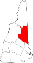 | |
| Township | ||
| CDPs | ||
| Other villages | ||