Fukaura, Aomori
| Fukaura 深浦町 | |||
|---|---|---|---|
| Town | |||
|
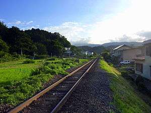
Gono Line near Mutsu-Yanagita Station | |||
| |||
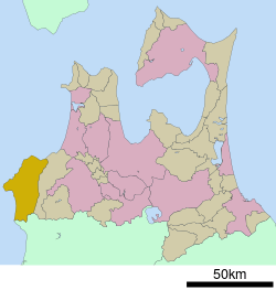 Location of Fukaura in Aomori Prefecture | |||
 Fukaura
| |||
| Coordinates: 40°38′52.3″N 139°55′39.1″E / 40.647861°N 139.927528°ECoordinates: 40°38′52.3″N 139°55′39.1″E / 40.647861°N 139.927528°E | |||
| Country | Japan | ||
| Region | Tōhoku | ||
| Prefecture | Aomori Prefecture | ||
| District | Nishitsugaru | ||
| Area | |||
| • Total | 488.89 km2 (188.76 sq mi) | ||
| Population (September 2015) | |||
| • Total | 8,592 | ||
| • Density | 17.6/km2 (46/sq mi) | ||
| Time zone | Japan Standard Time (UTC+9) | ||
| - Tree | Siebold’s Beech | ||
| - Flower | Far East Amur adonis | ||
| - Bird | Common gull | ||
| Phone number | 0173-74-2111 | ||
| Address | 84-2 Nashirozawa, Fukaura-machi, Nishitsugaru-gun, Aomori-ken 038-2324 | ||
| Website | Official website | ||


Fukaura (深浦町 Fukaura-machi) is a town located in Nishitsugaru District of Aomori Prefecture in the Tōhoku region of northern Japan. As of November 2013, the town had an estimated population of 8,592 and a population density of 17.6 persons per km². Its total area was 488.85 km2 (188.75 sq mi).
Geography
Fukaura occupies the far southwestern coastline of Aomori Prefecture, facing the Sea of Japan. The town has a cold humid continental climate (Köppen Dfa) characterized by warm short summers and long cold winters with heavy snowfall.
Neighbouring municipalities
- Aomori Prefecture
- Akita Prefecture
Climate
| Climate data for Fukaura (1981–2010) | |||||||||||||
|---|---|---|---|---|---|---|---|---|---|---|---|---|---|
| Month | Jan | Feb | Mar | Apr | May | Jun | Jul | Aug | Sep | Oct | Nov | Dec | Year |
| Record high °C (°F) | 13.1 (55.6) |
15.9 (60.6) |
22.5 (72.5) |
30.5 (86.9) |
33.3 (91.9) |
34.3 (93.7) |
36.7 (98.1) |
38.1 (100.6) |
35.4 (95.7) |
30.9 (87.6) |
24.5 (76.1) |
20.9 (69.6) |
38.1 (100.6) |
| Average high °C (°F) | 2.1 (35.8) |
2.5 (36.5) |
6.2 (43.2) |
12.7 (54.9) |
17.2 (63) |
21.3 (70.3) |
24.7 (76.5) |
27.1 (80.8) |
23.2 (73.8) |
17.2 (63) |
10.8 (51.4) |
5.1 (41.2) |
14.2 (57.5) |
| Average low °C (°F) | −2.6 (27.3) |
−2.4 (27.7) |
−0.2 (31.6) |
4.6 (40.3) |
9.3 (48.7) |
13.9 (57) |
18.4 (65.1) |
20.0 (68) |
15.6 (60.1) |
9.8 (49.6) |
4.4 (39.9) |
−0.1 (31.8) |
7.6 (45.6) |
| Record low °C (°F) | −14.4 (6.1) |
−15.2 (4.6) |
−11.9 (10.6) |
−4.6 (23.7) |
−1.2 (29.8) |
6.9 (44.4) |
9.1 (48.4) |
10.3 (50.5) |
4.8 (40.6) |
−1.5 (29.3) |
−5.9 (21.4) |
−14.4 (6.1) |
−15.2 (4.6) |
| Average precipitation mm (inches) | 95.3 (3.752) |
71.4 (2.811) |
71.7 (2.823) |
64.3 (2.531) |
80.0 (3.15) |
110.8 (4.362) |
175.8 (6.921) |
134.3 (5.287) |
136.9 (5.39) |
100.1 (3.941) |
78.9 (3.106) |
93.8 (3.693) |
1,213.3 (47.767) |
| Average snowfall cm (inches) | 171 (67.3) |
142 (55.9) |
66 (26) |
5 (2) |
0 (0) |
0 (0) |
0 (0) |
0 (0) |
0 (0) |
0 (0) |
6 (2.4) |
83 (32.7) |
473 (186.3) |
| Average precipitation days (≥ 0.5 mm) | 18.7 | 16.2 | 16.8 | 12.0 | 11.4 | 12.4 | 14.8 | 11.0 | 12.9 | 12.9 | 15.1 | 17.5 | 171.7 |
| Average snowy days | 27.0 | 24.3 | 12.3 | 0.8 | 0 | 0 | 0 | 0 | 0 | 0 | 1.0 | 12.4 | 77.8 |
| Average relative humidity (%) | 69 | 68 | 66 | 69 | 75 | 81 | 85 | 82 | 78 | 71 | 68 | 69 | 73.4 |
| Mean monthly sunshine hours | 26.9 | 46.5 | 110.1 | 173.0 | 191.2 | 182.5 | 156.6 | 179.2 | 152.3 | 131.2 | 64.9 | 31.6 | 1,446 |
| Source #1: 平年値(年・月ごとの値) | |||||||||||||
| Source #2: 観測史上1~10位の値(1月としての値) (records) | |||||||||||||
History
The area around Fukaura was controlled by the Nambu clan of Morioka Domain during the Edo period. It became a village in the Nishitsugaru District in 1889, and was elevated to town status on April1 1, 1926. On July 29, 1955, Fukura annexed the neighboring village of Otose. On March 31, 2005 it was merged with the neighboring village of Iwasaki.
Fukaura is the home town of four current sumo wrestlers: Kaiho, Aminishiki, Asofuji and Masatsukasa. It is believed to be the first time that four elite sekitori-ranked wrestlers have come from the same town.
Economy
The economy of Fukaura is heavily dependent on commercial fishing.
There is also a small tourism industry centered on the Shirakami Sanchi UNESCO World Heritage area, particularly the Juniko Lakes on its periphery.

Education
Fukaura has three elementary schools, three middle schools and one high school.
Transportation
Railway
Highway
Sister city relations
Noted people from Fukaura
- Aminishiki Ryūji – sumo wrestler
- Asōfuji Seiya – sumo wrestler
- Kaihō Ryōji – sumo wrestler
- Masatsukasa Kōshin – sumo wrestler
References
- ↑ "International Exchange". List of Affiliation Partners within Prefectures. Council of Local Authorities for International Relations (CLAIR). Retrieved 21 November 2015.
External links
| Wikimedia Commons has media related to Fukaura, Aomori. |
- Official website (Japanese)
| Core city | ||
|---|---|---|
| Special city | ||
| Cities | ||
| Higashitsugaru District | ||
| Kamikita District | ||
| Kitatsugaru District | ||
| Minamitsugaru District | ||
| Nakatsugaru District | ||
| Nishitsugaru District | ||
| Sannohe District | ||
| Shimokita District | ||