Yomogita, Aomori
| Yomogita 蓬田村 | |||
|---|---|---|---|
| Village | |||
|
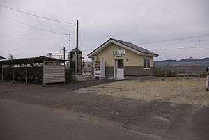
Yomogita Station | |||
| |||
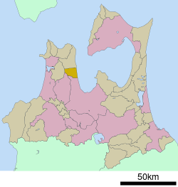 Location of Yomogita in Aomori Prefecture | |||
 Yomogita
| |||
| Coordinates: 40°58′N 140°30′E / 40.967°N 140.500°ECoordinates: 40°58′N 140°30′E / 40.967°N 140.500°E | |||
| Country | Japan | ||
| Region | Tōhoku | ||
| Prefecture | Aomori | ||
| District | Higashitsugaru | ||
| Area | |||
| • Total | 80.65 km2 (31.14 sq mi) | ||
| Population (February 2015) | |||
| • Total | 3,042 | ||
| • Density | 37.7/km2 (98/sq mi) | ||
| Time zone | Japan Standard Time (UTC+9) | ||
| City symbols | |||
| • Tree | Japanese black pine | ||
| • Flower | Rosa rugosa | ||
| • Bird | Whooper swan | ||
| Phone number | 0174-27-2111 | ||
| Address |
1-3 Shiooshi, Yomogita-mura, Higashitsugaru-gun, Aomori-ken 030-1211 | ||
| Website | Official website | ||


Yomogita (蓬田村 Yomogita-mura) is a village located in Higashitsugaru District of northeastern Aomori Prefecture in the Tōhoku region of Japan. As of February 2015, the village had an estimated population of 3,042 and a population density of 37.7 persons per km2. Its total area was 80.65 km2.
Geography
Yomogita occupies the eastern coastline of Tsugaru Peninsula, facing Mutsu Bay. The village has a cold maritime climate characterized by cool short summers and long cold winters with heavy snowfall.
Neighbouring municipalities
History
The area around Yomogita was controlled by the Nambu clan of Morioka Domain during the Edo period. During the cadastral reform of 1889, it was established as a village.
Economy
The economy of Yomogita is heavily dependent on agriculture (rice and tomatoes) and commercial fishing. Some of the locally caught seafood include sea urchin roe, sea cucumber, scallops, abalone and squid.
Education
Yomogita has one elementary school and one middle school.
Transportation
Railway
Highway
Noted people from Yomogita
- Hiroyuki Takei – manga artist
External links
![]() Media related to Yomogita, Aomori at Wikimedia Commons
Media related to Yomogita, Aomori at Wikimedia Commons
- Official website (Japanese)
- Yomogita Chamber of Commerce (Japanese)
- yomogitamura.com
| Core city | ||
|---|---|---|
| Special city | ||
| Cities | ||
| Higashitsugaru District | ||
| Kamikita District | ||
| Kitatsugaru District | ||
| Minamitsugaru District | ||
| Nakatsugaru District | ||
| Nishitsugaru District | ||
| Sannohe District | ||
| Shimokita District | ||