Gwinnett County, Georgia
| Gwinnett County, Georgia | |
|---|---|
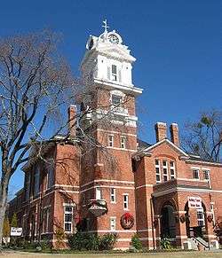 Gwinnett Historic Courthouse in Lawrenceville | |
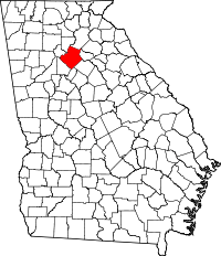 Location in the U.S. state of Georgia | |
 Georgia's location in the U.S. | |
| Founded | December 15, 1818 |
| Named for | Button Gwinnett |
| Seat | Lawrenceville |
| Largest city | Peachtree Corners |
| Area | |
| • Total | 437 sq mi (1,132 km2) |
| • Land | 430 sq mi (1,114 km2) |
| • Water | 6.4 sq mi (17 km2), 1.5% |
| Population (est.) | |
| • (2015) | 895,823 |
| • Density | 1,871/sq mi (722/km²) |
| Congressional districts | 4th, 7th, 10th |
| Time zone | Eastern: UTC-5/-4 |
| Website |
www |
Gwinnett County is a county in the north central portion of the U.S. state of Georgia. As of the 2010 census, the population was 859,304,[1] making it the second-most populous county in Georgia. Its county seat is Lawrenceville.[2] The county is named for Button Gwinnett, one of the signers of the Declaration of Independence.[3]
Gwinnett County is included in the Atlanta-Sandy Springs-Roswell, GA Metropolitan Statistical Area.
History
Created in 1818 by an act of the Georgia General Assembly, Gwinnett County was formed from parts of Jackson County (formerly part of Franklin County) and from lands gained through the cession of Indian lands. Named for Button Gwinnett, one of the signatories of the Declaration of Independence, the first county court was held at the home of Elisha Winn, and the county seat was placed at Lawrenceville.[4]
In 1861, all three of Gwinnett County’s representatives at the Georgia Constitutional Convention (1861) in Milledgeville voted against secession. Towards the end of the war, several skirmishes took place in Gwinnett County as part of the Atlanta Campaign.
The northeastern part of Gwinnett County was removed to form a part of the new Barrow County in 1914.
Geography
According to the U.S. Census Bureau, the county has a total area of 437 square miles (1,130 km2), of which 430 square miles (1,100 km2) is land and 6.4 square miles (17 km2) (1.5%) is water.[5]
It is located along the Eastern Continental Divide. A portion of the county to the northwest is a part of the Chattahoochee River National Recreation Area chain.
The regional reservoir, Lake Lanier, at the extreme north of the county, is the central cause to the Tri-state water dispute.
The southern and central portions of Gwinnett County are located in the Upper Ocmulgee River sub-basin of the Altamaha River basin. Most the county's northern edge, from south of Peachtree Corners to north of Buford, is located in the Upper Chattahoochee River sub-basin of the ACF River Basin (Apalachicola-Chattahoochee-Flint River Basin), while the county's eastern edge, north and south of Dacula, is located in the Upper Oconee River sub-basin of the same Altamaha River basin.[6]
Adjacent counties
- Forsyth County - north
- Hall County - northeast
- Jackson County - northeast
- Barrow County - east
- Walton County - southeast
- Rockdale County - south
- DeKalb County - southwest
- Fulton County - west
Transportation
Airport
The county maintains a regional airport under the name Gwinnett County Airport, formerly, Briscoe Field.
Major highways
-
 Interstate 85
 -
 Interstate 985
 -
 U.S. Route 23
 -
 U.S. Route 29
 -
 U.S. Route 78
 -
 State Route 8
 -
 State Route 10
 -
 State Route 13
 -
 State Route 20
 -
 State Route 84
 -
 State Route 120
 -
 State Route 124
 -
 State Route 140
 -
 State Route 141
 -
 State Route 264
 -
 State Route 316
 -
 State Route 317
 -
 State Route 324
 -
 State Route 347
 -
 State Route 365
 -
 State Route 378
 -
 State Route 403 (unsigned designation for I-85)
 -
 State Route 419 (unsigned designation for I-985)
Ronald Reagan Parkway
Transit Systems
- Xpress GA/ RTA Commuter buses and Gwinnett County Transit serve the county.
Demographics
| Historical population | |||
|---|---|---|---|
| Census | Pop. | %± | |
| 1820 | 4,589 | — | |
| 1830 | 13,289 | 189.6% | |
| 1840 | 10,804 | −18.7% | |
| 1850 | 11,257 | 4.2% | |
| 1860 | 12,940 | 15.0% | |
| 1870 | 12,431 | −3.9% | |
| 1880 | 19,531 | 57.1% | |
| 1890 | 19,899 | 1.9% | |
| 1900 | 25,585 | 28.6% | |
| 1910 | 28,824 | 12.7% | |
| 1920 | 30,327 | 5.2% | |
| 1930 | 27,853 | −8.2% | |
| 1940 | 29,087 | 4.4% | |
| 1950 | 32,320 | 11.1% | |
| 1960 | 43,541 | 34.7% | |
| 1970 | 72,349 | 66.2% | |
| 1980 | 166,903 | 130.7% | |
| 1990 | 352,910 | 111.4% | |
| 2000 | 588,448 | 66.7% | |
| 2010 | 805,321 | 36.9% | |
| Est. 2015 | 895,823 | [7] | 11.2% |
| U.S. Decennial Census[8] 1790-1960[9] 1900-1990[10] 1990-2000[11] 2010-2013[1] | |||
As of the 2010 United States Census, there were 805,321 people, 268,519 households, and 203,238 families residing in the county.[12] The population density was 1,871.2 inhabitants per square mile (722.5/km2). There were 291,547 housing units at an average density of 677.4 per square mile (261.5/km2).[13] The racial makeup of the county was 53.3% White, 23.6% black or African American, 10.6% Asian, 0.5% American Indian, 0.1% Pacific Islander, 8.8% from other races, and 3.1% from two or more races. Those of Hispanic or Latino origin made up 20.1% of the population.[12] In terms of ancestry, 8.3% were German, 7.8% were Irish, 7.7% were English, and 5.8% were American.[14]
Of the 268,519 households, 45.6% had children under the age of 18 living with them, 56.2% were married couples living together, 14.2% had a female householder with no husband present, 24.3% were non-families, and 19.1% of all households were made up of individuals. The average household size was 2.98 and the average family size was 3.40. The median age was 33.7 years.[12]
The median income for a household in the county was $63,219 and the median income for a family was $70,767. Males had a median income of $48,671 versus $39,540 for females. The per capita income for the county was $26,901. About 8.7% of families and 11.0% of the population were below the poverty line, including 15.1% of those under age 18 and 8.1% of those age 65 or over.[15]
Economy
- AGCO is headquartered in Duluth.
- American Megatrends is headquartered in Building 200, at 5555 Oakbrook Parkway, in unincorporated Gwinnett County, near Norcross.[16]
- NCR Corporation has its headquarters in unincorporated Gwinnett County, near Duluth.[17][18]
- Primerica is headquartered in unincorporated Gwinnett County, near Duluth.[19]
- Waffle House is headquartered in unincorporated Gwinnett County,[20] near Norcross.[21]
- Yerkes National Primate Research Center, the CDC's primate research center located on the campus of Emory University near Atlanta, maintains its high security Yerkes field station, which houses most of its primates, near Lawrenceville.
- Canon has its southeast region headquarters in Norcross.
- Datapath, A firm specializing in satellite communications and wireless communications systems is headquartered in unincorporated Gwinnett, near Duluth.
Government and politics
Under Georgia's "home rule" provision, county governments have free rein to legislate on all matters within the county, provided that such legislation does not conflict with state or federal law, or state or federal Constitutions.
Gwinnett County, Georgia is governed by a five-member Board of Commissioners, which exercises both legislative and executive authority within the county. The chairman of the Board is elected county-wide and serves full-time. The four other Commissioners are elected from single-member districts and serve part-time positions. The Board hires a County Administrator who oversees daily operations of the county's twelve executive departments. Gwinnett County has a police department that operates under the authority of the Board of Commissioners.
In addition to the Board of Commissioners, county residents also elect persons to the following positions: Sheriff, District Attorney, Probate Court Judge, Clerk of State/Superior Court, Tax Commissioner, State Court Solicitor, Chief Magistrate Judge (who appoints other Magistrate Court judges), Chief Superior Court Judge and Superior Court Judges, and Chief State Court Judge and State Court Judges.
Gwinnett County has the largest public school system in the State of Georgia. Members of the Board of Education are elected from special election districts in the county.
Gwinnett County Board of Commissioners
| District | Name | Party | First elected | Area(s) of Gwinnett County Represented | |
|---|---|---|---|---|---|
| At-Large (Chair) | Charlotte J. Nash | Republican | 2011 | All | |
| 1 | Jace Brooks | Duluth, Suwanee | |||
| 2 | Lynette Howard | Republican | 2010 | Berkeley Lake, Lilburn, Norcross | |
| 3 | Tommy Hunter | Republican | 2012 | Auburn, Dacula, Grayson, Loganville, Snellville | |
| 4 | John Heard | Republican | 2010 | Braselton, Buford, Lawrenceville, Rest Haven, Sugar Hill | |
United States Congress
| Senators | Name | Party | First Elected | Level | |
|---|---|---|---|---|---|
| Senate Class 2 | Johnny Isakson | Republican | 2004 | Senior Senator | |
| Senate Class 3 | David Perdue | Republican | 2014 | Junior Senator | |
| Representatives | Name | Party | First Elected | Area(s) of Gwinnett County Represented | |
| District 4 | Hank Johnson | Democratic | 2006 | Lilburn, Norcross | |
| District 7 | Rob Woodall | Republican | 2010 | Lilburn, Duluth, Lawrenceville, Suwanee, Buford, Snellville | |
| District 10 | Jody Hice | Republican | 2015 | Dacula, Loganville | |
Georgia General Assembly
Georgia State Senate
| District | Name | Party | First Elected | Area(s) of Gwinnett County Represented | |
|---|---|---|---|---|---|
| 5 | Curt Thompson | Democratic | 2005 | Lawrenceville, Lilburn, Norcross, Peachtree Corners | |
| 9 | P.K. Martin IV | Republican | 2015 | Dacula, Grayson, Lawrenceville, Lilburn, Loganville, Mountain Park, Snellville | |
| 40 | Fran Millar | Republican | 2001 | Norcross, Peachtree Corners | |
| 41 | Steve Henson | Democratic | 2003 | Lilburn | |
| 45 | Renee Unterman | Republican | 2003 | Auburn, Braselton, Buford, Lawrenceville, Rest Haven, Sugar Hill, Suwanee | |
| 48 | David Shafer | Republican | 2002 | Berkeley Lake, Duluth, Lawrenceville, Norcross, Peachtree Corners, Suwanee | |
| 55 | Gloria Butler | Democratic | 1999 | Grayson, Loganville, Mountain Park, Snellville | |
Georgia House of Representatives
Hospitals
- Gwinnett Medical Center (Lawrenceville)
- Gwinnett Medical Center – Duluth
- Eastside Medical Center - (Snellville) Formerly Emory Eastside Medical Center, the hospital was purchased by Hospital Corporation of America in 2011.
Media
The main newspaper of Gwinnett County, Georgia is the Gwinnett Daily Post.
The Spanish language newspaper El Nuevo Georgia has its headquarters in unincorporated Gwinnett County, near Norcross.[22][23]
Telemundo Atlanta and The Atlanta Journal-Constitution are both based out of Gwinnett.
The rap group Migos hails from Gwinnett County. Migos won the 2015 YouTube Music Award, as well as several other notable entertainment television awards. Net worth in 2015 was reported to be 4.2 million (USD).
Education
Primary and secondary schools
Gwinnett County Public Schools operates the public schools for residents in Gwinnett County, with the exception of residents inside the Buford city limits, which are served by the Buford City School District.
Private education
- Greater Atlanta Christian School, the second-largest independent school in Georgia, is located in Norcross.
- Seigakuin Atlanta International School, a private Japanese education system elementary and middle school, is located in Peachtree Corners.[24][25] The school moved from property at Oglethorpe University to its current address, former property of the Romanian First Baptist Church, in 2003.[26]
- Wesleyan School is located in Peachtree Corners.
Colleges and universities
- Georgia Gwinnett College is located in Lawrenceville, in Gwinnett County.
- Gwinnett Technical College is also located in Lawrenceville.
- Philadelphia College of Osteopathic Medicine is located in Suwanee.
Sports
Minor-league affiliates of the NHL Boston Bruins, and the MLB Atlanta Braves play home games and talent scout in the area.
Georgia Force of Arena Football League had also played at Arena at Gwinnett Center before the team folded in 2012.
| Club | Sport | League | Venue |
| Atlanta Gladiators | Ice hockey | ECHL | Infinite Energy Arena |
| Gwinnett Braves | Baseball | International League | Coolray Field |
Gwinnett also hosts the Gwinnett Rugby International Touring Squad, a Division 3 Men's Rugby Team.
On May 29, 2015, the Minnesota Swarm of the National Lacrosse League announced it was relocating, becoming the Georgia Swarm, and will play at The Arena at Gwinnett Center beginning with the 2016 season.
Communities
Cities
- Auburn (partly in Barrow County)
- Berkeley Lake
- Buford (partly in Hall County)
- Dacula
- Duluth
- Grayson
- Lawrenceville
- Lilburn
- Loganville (partly in Walton County)
- Norcross
- Peachtree Corners
- Snellville
- Sugar Hill
- Suwanee
Towns
- Braselton (partly in Jackson County, Hall County, and Barrow County)
- Rest Haven (partly in Hall County)
Census-designated places
Unincorporated communities
- Centerville
- Five Forks
- Mechanicsville
- Hamilton Mill
See also
References
- 1 2 "State & County QuickFacts". United States Census Bureau. Retrieved June 22, 2014.
- ↑ "City of Lawrenceville, Georgia - Home Page". www.lawrencevillega.org. Retrieved 2016-06-29.
- ↑ Gannett, Henry (1905). The Origin of Certain Place Names in the United States. Govt. Print. Off. p. 146.
- ↑ "History of Gwinnett County". www.gwinnetths.org. Gwinnett Historical SOciety. Retrieved 19 December 2014.
- ↑ "US Gazetteer files: 2010, 2000, and 1990". United States Census Bureau. 2011-02-12. Retrieved 2011-04-23.
- ↑ "Georgia Soil and Water Conservation Commission Interactive Mapping Experience". Georgia Soil and Water Conservation Commission. Retrieved 2015-11-18.
- ↑ "County Totals Dataset: Population, Population Change and Estimated Components of Population Change: April 1, 2010 to July 1, 2015". Retrieved July 2, 2016.
- ↑ "U.S. Decennial Census". United States Census Bureau. Retrieved June 22, 2014.
- ↑ "Historical Census Browser". University of Virginia Library. Retrieved June 22, 2014.
- ↑ "Population of Counties by Decennial Census: 1900 to 1990". United States Census Bureau. Retrieved June 22, 2014.
- ↑ "Census 2000 PHC-T-4. Ranking Tables for Counties: 1990 and 2000" (PDF). United States Census Bureau. Retrieved June 22, 2014.
- 1 2 3 "DP-1 Profile of General Population and Housing Characteristics: 2010 Demographic Profile Data". United States Census Bureau. Retrieved 2015-12-29.
- ↑ "Population, Housing Units, Area, and Density: 2010 - County". United States Census Bureau. Retrieved 2015-12-29.
- ↑ "DP02 SELECTED SOCIAL CHARACTERISTICS IN THE UNITED STATES – 2006-2010 American Community Survey 5-Year Estimates". United States Census Bureau. Retrieved 2015-12-29.
- ↑ "DP03 SELECTED ECONOMIC CHARACTERISTICS – 2006-2010 American Community Survey 5-Year Estimates". United States Census Bureau. Retrieved 2015-12-29.
- ↑ "Contact Us." American Megatrends. Retrieved on May 6, 2009.
- ↑ "Contact NCR." NCR Corporation. Retrieved on November 29, 2009.
- ↑ "OFFICIAL ZONING MAP OF THE CITY OF NORCROSS." City of Norcross. Retrieved on May 29, 2011.
- ↑ "Contact Us." Primerica. Retrieved on January 5, 2010.
- ↑ "Contact Us." Waffle House.that doesent make sense Retrieved on May 19, 2009.
- ↑ Woods, Mark. "If this is what it gets to, it's bad." The Florida Times-Union. May 3, 2009. Retrieved on May 19, 2009.
- ↑ "Contáctenos." El Nuevo Georgia. Retrieved on September 18, 2012.
- ↑ "Media Kit 2011." (English) (Archive) El Nuevo Georgia. p. 7. Retrieved on September 18, 2012. "5855 Jimmy Carter Blvd. Norcross, GA 30071"
- ↑ "Map" (Map). Seigakuin Atlanta International School. Retrieved on January 11, 2012. "5505 Winters Chapel Road, Atlanta, GA 30360 USA"
- ↑ "Relocating school has Japan ties." Atlanta Journal-Constitution. September 29, 2002. JJ1. Retrieved on January 11, 2012.
- ↑ "History." Seigakuin Atlanta International School. Retrieved on January 11, 2012.
External links
| Wikimedia Commons has media related to Gwinnett County, Georgia. |
- Official website of Gwinnett County Government
- Gwinnett County Parks and Recreation
- Gwinnett County historical marker
 |
Forsyth County | Hall County and Jackson County | | |
| Fulton County | |
Barrow County | ||
| ||||
| | ||||
| DeKalb County | Rockdale County | Walton County |
Municipalities and communities of Gwinnett County, Georgia, United States | ||
|---|---|---|
| Cities | | |
| Towns | ||
| CDP | ||
| Unincorporated communities | ||
| Footnotes | ‡This populated place also has portions in an adjacent county or counties | |
|  | |||||||
|
| ||||||||
| ||||||||
Template:Georgia
Coordinates: 33°58′N 84°02′W / 33.96°N 84.03°W