Alpharetta, Georgia
| Alpharetta, Georgia | |
|---|---|
| City | |
|
Alpharetta City Hall | |
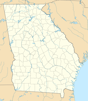
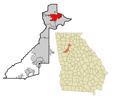 Location in Fulton County and the state of Georgia | |
 Alpharetta  Alpharetta 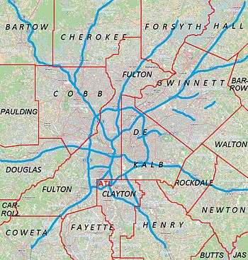 Alpharetta Location of Alpharetta in Metro Atlanta | |
| Coordinates: 34°04′24″N 84°16′52″W / 34.07333°N 84.28111°WCoordinates: 34°04′24″N 84°16′52″W / 34.07333°N 84.28111°W | |
| Country | United States |
| State | Georgia |
| County | Fulton |
| Incorporated | December 11, 1858 |
| Government | |
| • Mayor | David Belle Isle |
| Area | |
| • Total | 27.3 sq mi (70.7 km2) |
| • Land | 26.9 sq mi (69.7 km2) |
| • Water | 0.4 sq mi (1.0 km2) |
| Elevation | 1,135 ft (346 m) |
| Population (2010) | 57,551 |
| • Estimate (2014) | 63,038 |
| • Density | 2,342/sq mi (904.4/km2) |
| Time zone | EST (UTC-5) |
| • Summer (DST) | EDT (UTC-4) |
| ZIP codes | 30004, 30005, 30009, 30022 |
| Area code(s) | 770, 404, 678 |
| FIPS code | 13-01696 |
| GNIS feature ID | 0310497[1] |
| Website |
www |

Alpharetta is an affluent city and suburb of Atlanta located in north Fulton County, Georgia, United States. As of the 2010 census, Alpharetta's population was 57,551.[2] The estimated population in 2014 was 63,038.[3]
History
In the 1830s, the Cherokee people in Georgia and elsewhere in the South were forcibly relocated to the Indian Territory (present-day Oklahoma) under the Indian Removal Act. Pioneers and farmers later settled on the newly vacated land, situated along a former Cherokee trail stretching from the North Georgia mountains to the Chattahoochee River.[4]
One of the first permanent landmarks in the area was the New Prospect Camp Ground (also known as the Methodist Camp Ground), located beside a natural spring near what is now downtown Alpharetta.[4] It later served as a trading post for the exchanging of goods among settlers.[4]
Known as the town of Milton through July 1858, the city of Alpharetta was chartered on December 11, 1858, with boundaries extending in a 0.5-mile (0.80 km) radius from the city courthouse.[4] It served as the county seat of Milton County until 1931, when Milton County was merged with Fulton County to avoid bankruptcy during the Great Depression.[4]
The city's name is a variation of a fictional Indian girl, Alfarata, in a 19th-century song, "The Blue Juniata". The name of the city is also believed to have been derived from the first letter of the Greek alphabet.[5]
Government
Alpharetta is governed by a city council composed of six members and a mayor. The mayor and council members serve staggered four-year terms.
Mayors:
- David Belle Isle (R) 2012 – present
- Arthur Letchas (R) 2001 – 2011
- Chuck Martin (R) 1995 - 2002
- Jimmy Phillips 1979 - 1994
- George Wills
- Randall Moore
- Sindey Dees[6]
Geography
Alpharetta is located in northern Fulton County at 34°4′24″N 84°16′52″W / 34.07333°N 84.28111°W (34.073318, −84.281086).[7] It is bordered to the southeast by Johns Creek, to the south and west by Roswell, to the north by Milton, and to the northeast by unincorporated land in Forsyth County. Downtown Alpharetta is 26 miles (42 km) north of downtown Atlanta.
According to the United States Census Bureau, Alpharetta has a total area of 27.3 square miles (70.7 km2), of which 26.9 square miles (69.7 km2) is land and 0.39 square miles (1.0 km2), or 1.37%, is water.[2]
Major highways
Climate
Alpharetta has a humid subtropical climate (Köppen climate classification Cfa) and is part of USDA hardiness zone 7b.
| Climate data for Alpharetta, GA | |||||||||||||
|---|---|---|---|---|---|---|---|---|---|---|---|---|---|
| Month | Jan | Feb | Mar | Apr | May | Jun | Jul | Aug | Sep | Oct | Nov | Dec | Year |
| Average high °F (°C) | 50.4 (10.2) |
54.7 (12.6) |
63.4 (17.4) |
71.5 (21.9) |
77.9 (25.5) |
85.0 (29.4) |
87.1 (30.6) |
86.6 (30.3) |
80.9 (27.2) |
71.6 (22) |
62.0 (16.7) |
52.9 (11.6) |
70.3 (21.3) |
| Average low °F (°C) | 29.6 (−1.3) |
32.1 (0.1) |
38.6 (3.7) |
45.5 (7.5) |
54.6 (12.6) |
63.6 (17.6) |
67.0 (19.4) |
66.8 (19.3) |
59.5 (15.3) |
48.1 (8.9) |
38.1 (3.4) |
32.0 (0) |
48.0 (8.9) |
| Average precipitation inches (mm) | 3.96 (100.6) |
5.08 (129) |
4.54 (115.3) |
3.63 (92.2) |
4.28 (108.7) |
3.91 (99.3) |
4.84 (122.9) |
4.54 (115.3) |
4.38 (111.3) |
3.52 (89.4) |
4.15 (105.4) |
4.58 (116.3) |
51.41 (1,305.7) |
| Average snowfall inches (cm) | 0.6 (1.5) |
0.2 (0.5) |
0.1 (0.3) |
0 (0) |
0 (0) |
0 (0) |
0 (0) |
0 (0) |
0 (0) |
0 (0) |
0 (0) |
0 (0) |
0.9 (2.3) |
| Average precipitation days (≥ 0.01 in) | 9.8 | 9.5 | 9.0 | 8.0 | 9.0 | 8.5 | 10.2 | 8.7 | 6.4 | 6.4 | 7.8 | 9.6 | 102.9 |
| Average snowy days (≥ 0.1 in) | 0.4 | 0.4 | 0.1 | 0 | 0 | 0 | 0 | 0 | 0 | 0 | 0 | 0.1 | 1.0 |
| Source: NOAA [8] | |||||||||||||
Demographics
| Historical population | |||
|---|---|---|---|
| Census | Pop. | %± | |
| 1860 | 261 | — | |
| 1870 | 126 | −51.7% | |
| 1880 | 164 | 30.2% | |
| 1890 | 256 | 56.1% | |
| 1900 | 310 | 21.1% | |
| 1910 | 356 | 14.8% | |
| 1920 | 379 | 6.5% | |
| 1930 | 477 | 25.9% | |
| 1940 | 647 | 35.6% | |
| 1950 | 917 | 41.7% | |
| 1960 | 1,349 | 47.1% | |
| 1970 | 2,455 | 82.0% | |
| 1980 | 3,128 | 27.4% | |
| 1990 | 13,002 | 315.7% | |
| 2000 | 34,854 | 168.1% | |
| 2010 | 57,551 | 65.1% | |
| Est. 2015 | 63,693 | [9] | 10.7% |
As of the census of 2000, there were 34,854 people, 13,911 households, and 8,916 families residing in the city. The population density was 1,631.6 people per square mile (630.0/km²). There were 14,670 housing units at an average density of 686.7 per square mile (265.2/km²). The population has been gradually increasing over the last decade. During the workday, the city swells to more than 120,000 residents, workers, and visitors, due to the more than 3,600 businesses that are located in the city.[11]
According to the 2010 census, the racial composition of the city of Alpharetta was as follows:
- White: 72.0%
- Asian: 13.7%
- Black or African American: 11.2%
- Hispanic or Latino : 8.7%
- Other: 2.9%
- Two or more races: 2.8%
- Native American: 0.2%
- Native Hawaiian and Other Pacific Islander: 0.1%
There were 13,911 households out of which 36.2% had children under the age of 18 living with them, 54.1% were married couples living together, 7.3% had a female householder with no husband present, and 35.9% were non-families. 27.7% of all households were made up of individuals and 4.2% had someone living alone who was 65 or older. The average household size was 2.50 and the average family size was 3.13.
In the city, 27.0% of the population was under the age of 18, 7.2% from 18 to 24, 40.5% from 25 to 44, 19.4% from 45 to 64, and 5.8% who were 65 years of age or older. The median age was 33. For every 100 females, there were 98.3 males. For every 100 females age 18 and over, there were 94.9 males.
The median income for a household in the city was $95,888, and the median income for a family was $111,918. The per capita income for the city was $42,431.[12] Males had a median income of $79,275 versus $59,935 for females. About 2.9% of families and 1.2% of the population were below the poverty line, including .3% of those under age 18 and .6% of those age 65 or over.
Economy
Major companies
- Adecco
- ADP
- Alimera Sciences
- Alltel
- AT&T Inc.
- Ciena
- Comcast
- Costco Wholesale
- Cox Communications
- Eaton Corporation
- Emerson Electric
- E-Trade
- Equifax
- Ernst & Young
- Fiserv
- General Electric
- Hanjin Shipping
- Hansgrohe
- Hewlett-Packard
- Hi-Rez Studios
- IBM
- Infor
- IHG
- Ipswitch
- Lancope
- Landis+Gyr
- LexisNexis
- Lucent
- McKesson Corporation
- MetLife
- Microsoft
- Morgan Stanley
- NCR Corporation
- Nokia
- Nortel
- Philips
- Publix
- Ryder System
- SAP Ariba
- Scientific Games
- Sequence Health
- Siemens
- Systel
- Verifone
- Verint Systems
- Verizon
- Vossloh Kiepe Inc.
When NetBank existed, its headquarters were in Alpharetta.[13]
Top employers
According to the City's 2012 Comprehensive Annual Financial Report,[14] the top private sector employers in the city are:
| # | Employer | # of Employees |
|---|---|---|
| 1 | McKesson | 2,050 |
| 2 | ADP | 1,463 |
| 3 | LexisNexis | 1,289 |
| 4 | Comcast | 1,000 |
| 5 | UPS | 941 |
| 6 | Hewlett-Packard | 906 |
| 7 | Verizon Wireless | 3,598[15] |
| 8 | E-Trade | 765 |
| 9 | Cox Communications | 726 |
| 10 | RedPrairie | 672 |
| 11 | Hexaware Technologies | 600 |
Retail
Major retail complexes include North Point Mall. A 86-acre (35 ha) mixed-use development, Avalon, opened in 2014.
Attractions and events

The Downtown Alpharetta Welcome Center is located at 178 South Main Street and has more than 200 complimentary brochures providing information on the surrounding area. The center is open Monday — Friday from 9 a.m. - 5 p.m. and Saturday 10 a.m. - 4 p.m.[16]
The Alpharetta Family Skate Center (aka The Cooler) is on 10800 Davis Drive. It is also home to the Atlanta Sparks special needs hockey team.
The Alpharetta Brew Moon Fest is held the first Saturday in October on the streets of downtown Alpharetta.
The Scarecrow Harvest is held the first Saturday in October in downtown Alpharetta. The streets are lined with 100 scarecrows to celebrate its fall spirit.
The Alpharetta Arboretum at Wills Park was established in September 2008 and includes 26 trees. A brochure about the arboretum guides readers through a walking tour of the trees and is available at the Downtown Alpharetta Welcome Center.[17]
The Alpharetta Arboretum at Cogburn Road Park was established in December 2008 and showcases seven trees. A complimentary brochure for the arboretum is available at the Downtown Alpharetta Welcome Center and provides a starting point for a self-guided walking tour.[18]
The Alpharetta Farmers Market is a weekly farmers' market in the downtown area that opens every Saturday from 8 AM to 12:30 PM from April to October, and features farmers and gardeners from the surrounding area selling fresh vegetables, flowers, and edible goods such as jam. The market was named "Best Saturday Morning Excursion" in 2007 by Atlanta magazine.[19]
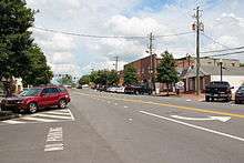
The Downtown Alpharetta Historic District is located in the center of Alpharetta at the intersection of North Main Street, South Main Street, Milton Avenue, and Academy Street. Around this area are several historic buildings dating from the late 19th century and older. The downtown area has been restored, replacing more modern buildings with period structures, and includes dining, shopping, and widened brick sidewalks.
The Mansell House and Gardens is a 1912 Queen Anne-style home that serves as a special event facility in Alpharetta. It also serves as home to the Alpharetta Historical Society.
The Milton Log Cabin was built by Future Farmers of America students during the 1934-35 school year and resembles life during the late 19th century.
Verizon Wireless Amphitheatre at Encore Park is a 12,000-capacity outdoor venue that serves as the summer home to the Grammy Award-winning Atlanta Symphony Orchestra and plays host to acts like the Dave Matthews Band, Rod Stewart and the Eagles.[20]
The Walk of Memories is located at American Legion Post 201 and pays tribute to veterans of the U.S. Armed Forces, community and friends, through a brick walk inscribed with the names of all Georgia residents killed in service including and following World War II. A separate section is reserved for those who served in the military and survived. A tank and helicopter are on display.
The Alpharetta Big Creek Greenway is a 6.1-mile-long (9.8 km), 12-foot-wide (3.7 m) concrete path that meanders through the woods along Big Creek, offering a place to walk, jog, inline skate and bike. The path includes additional mountain bike trails.[21]
The Taste of Alpharetta is an annual food festival featuring food from local restaurants, live music, and art exhibits.
The Wire and Wood Alpharetta Songwriters Festival in downtown Alpharetta is held in October.
Avalon is a multi-use development on the east side of downtown adjacent to State Route 400. It includes 500,000 square feet (46,000 m2) of retail space, a 12-screen Regal Cinemas theater, 105,000 square feet (9,800 m2) of office space over retail, 101 single-family residences and 250 luxury rental homes.
Famous past/present residents
- Trammell Starks, musician, composer of many songs featured on The Weather Channel in the early to mid 90's.[22]
Education
Primary and secondary schools
The city is served by Fulton County Schools.[23]
Elementary schools (Grades K-5)[24]
- Abbotts Hill Elementary School
- Alpharetta Elementary School
- Birmingham Falls Elementary School in Milton
- Cogburn Woods Elementary School in Milton
- Crabapple Crossing Elementary School in Milton
- Creek View Elementary School
- Hembree Springs Elementary School in Roswell
- Lake Windward Elementary School
- Manning Oaks Elementary School
- Mimosa Elementary School in Roswell
- New Prospect Elementary School
- Ocee Elementary School in Johns Creek
- Summit Hill Elementary School in Milton
- Midway Elementary School in Forsyth County
- Shiloh Point Elementary School in Cumming
- Big Creek Elementary in Cumming
Middle schools (Grades 6-8)[25]
- Autrey Mill Middle School in Johns Creek
- Elkins Pointe Middle School in Roswell
- Haynes Bridge Middle School
- Holcomb Bridge Middle School
- Hopewell Middle School in Milton
- Northwestern Middle School in Milton
- Taylor Road Middle School in Johns Creek
- Webb Bridge Middle School
- Piney Grove Middle School in Cumming
- Amana Academy,[26] a public charter school in Alpharetta for students in Kindergarten to 8th grade[27]
- Fulton Science Academy[28] (FSA), a private school in Roswell for students in 6th to 8th grade[29]
High schools (Grades 9-12)[30]
- Alpharetta High School serves most of Alpharetta
- Cambridge High School in Milton
- Centennial High School in Roswell
- Chattahoochee High School in Johns Creek
- Johns Creek High School in Johns Creek
- Milton High School in Milton
- Northview High School
- Roswell High School in Roswell
- South Forsyth High School in Cumming
- Independence High School, an alternative school located on the old Milton High School campus.
- Fulton Science Academy High School (formerly T. E. A. C. H.), a public charter school in Alpharetta for students in 9th to 12th grade.
Private schools
- The Lionheart School
- St. Francis Schools
- Bridgeway Christian Academy
- King's Ridge School
- Hayden's Way, Unique School for Unique Children
- Hayden's Academy at Hayden's Way
- Westwood Academy at Hayden's Way
- Veritas Classical Schools
- Mount Pisgah Christian School
Higher education
Georgia State University, Gwinnett Technical College and Reinhardt University have campuses located in Alpharetta.
Public libraries
Atlanta-Fulton Public Library System operates the Alpharetta Branch.[31]
References
- ↑ "US Board on Geographic Names". United States Geological Survey. 2007-10-25. Retrieved 2008-01-31.
- 1 2 "Geographic Identifiers: 2010 Census Summary File 1 (G001), Alpharetta city, Georgia". American FactFinder. U.S. Census Bureau. Retrieved April 28, 2016.
- ↑ "Annual Estimates of the Resident Population for Incorporated Places: April 1, 2010 to July 1, 2014". Retrieved June 4, 2015.
- 1 2 3 4 5 "City of Alpharetta website – History". Retrieved 2013-12-16.
- ↑ "Alpharetta entry at Georgia.gov". Retrieved 2015-08-13.
- ↑ "Alpharetta City Council Minutes from April 17, 2006" (PDF). Retrieved 2012-05-15.
- ↑ "US Gazetteer files: 2010, 2000, and 1990". United States Census Bureau. 2011-02-12. Retrieved 2011-04-23.
- ↑ "NowData - NOAA Online Weather Data". National Oceanic and Atmospheric Administration. Retrieved 2012-10-01.
- ↑ "Annual Estimates of the Resident Population for Incorporated Places: April 1, 2010 to July 1, 2015". Retrieved July 2, 2016.
- ↑ "Census of Population and Housing". Census.gov. Archived from the original on May 11, 2015. Retrieved June 4, 2015.
- ↑ "Alpharetta.ga.us". Alpharetta.ga.us. Retrieved 2012-05-15.
- ↑ "American FactFinder". Factfinder.census.gov. Retrieved 2012-05-15.
- ↑ NetBank (January 11, 2001). "NetBank Royal Centre Three, Suite 100 11475 Great Oaks Way Alpharetta, GA 30022". Archived from the original on January 11, 2001. Retrieved February 25, 2011.
- ↑ "City of Alpharetta CAFR" (PDF). Retrieved 2013-03-27.
- ↑ Verizon Wireless South Area Headquarters
- ↑ "Alpharetta GA Visitor Bureau Alpharetta Convention and Visitors Bureau". WeGoPlaces.com. 2006-12-03. Retrieved 2012-10-08.
- ↑ "Alpharetta Arboretum Inc. receiving state award". Northfulton.com. 2008-09-25. Retrieved 2012-10-08.
- ↑ "Travelers Journal". Travelersjournal.com. Retrieved 2012-10-08.
- ↑ "Alpharetta Farmers' Market". Alpharettafarmersmarket.com. Retrieved 2012-10-08.
- ↑ "Verizon Wireless Amphitheatre at Encore Park". Vzwamp.com. Retrieved 2012-10-08.
- ↑ "City of Alpharetta Website || Big Creek Greenway Trail". Alpharetta.ga.us. Retrieved 2012-10-08.
- ↑ http://www.booksbyhunter.net/twcmultimedia/starks/
- ↑ "Zoning Map : City of Alpharetta" (PDF). Alpharetta.ga.us. Retrieved October 26, 2008.
- ↑ "North Fulton Elementary Schools" (PDF). Fulton County School System. Retrieved April 17, 2010.
- ↑ "North Fulton Middle Schools" (PDF). Fulton County School System. Retrieved April 17, 2010.
- ↑ "Amanaacademy.org". Amanaacademy.org. 1999-12-31. Retrieved 2012-05-15.
- ↑ "Amana Academy". Amana Academy. 1999-12-31. Retrieved 2012-10-08.
- ↑ "Fultonscience.org". Fultonscience.org. Retrieved 2012-05-15.
- ↑ "FSA". Fultonscience.org. Retrieved 2012-10-08.
- ↑ "Highschool map" (PDF). Fulton County School System. Retrieved April 17, 2010.
- ↑ "Alpharetta Branch". Afpls.org. Retrieved 2015-08-11.
External links
| Wikivoyage has a travel guide for Alpharetta. |
| Wikimedia Commons has media related to Alpharetta, Georgia. |
- Official website
- Alpharetta Convention & Visitors Bureau home page
- Alpharetta Brew Moon Fest
- Scarecrow Harvest
- Wire and Wood Alpharetta Songwriters Festival
- Alpharetta Business District historical marker
- Alpharetta Business District historical marker
- Alpharetta Business District historical marker
- First Baptist Church of Alpharetta historical marker
- Alpharetta First United Methodist Church historical marker
Municipalities and communities of Fulton County, Georgia, United States | ||
|---|---|---|
| Cities | 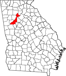 | |
| Unincorporated communities | ||
| Footnotes | ‡This populated place also has portions in an adjacent county or counties | |
|  | |||||||
|
| ||||||||
| ||||||||