Hachimantai
| Hachimantai 八幡平市 | |||
|---|---|---|---|
| City | |||
|
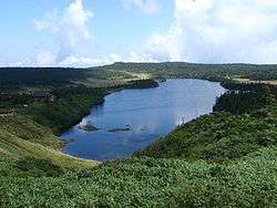
Lake Hachiman-numa | |||
| |||
 Location of Hachimantai in Iwate Prefecture | |||
 Hachimantai
| |||
| Coordinates: 39°55′N 141°5′E / 39.917°N 141.083°ECoordinates: 39°55′N 141°5′E / 39.917°N 141.083°E | |||
| Country | Japan | ||
| Region | Tōhoku | ||
| Prefecture | Iwate | ||
| Area | |||
| • Total | 826.25 km2 (319.02 sq mi) | ||
| Population (February 2014) | |||
| • Total | 27,146 | ||
| • Density | 31.5/km2 (82/sq mi) | ||
| Time zone | Japan Standard Time (UTC+9) | ||
| City symbols | |||
| • Tree | Pinus densiflora | ||
| • Flower | Gentiana scabra | ||
| • Bird | Copper pheasant | ||
| Phone number | 0195-76-2111 | ||
| Address | 62 Ōfuke dai-35 jiwari, Hachimantai-shi, Iwate-ken 028-7192 | ||
| Website | Official website | ||


Hachimantai (八幡平市 Hachimantai-shi) is a city located in Iwate Prefecture, Japan. As of February 2014, the city had an estimated population of 27,146 and a population density of 31.5 persons per km2. The total area was 826.25 km2.
History
The area of present-day Hachimantai was part of ancient Mutsu Province. It was under the control of the Nambu clan during the Edo period, who ruled Morioka Domain under the Tokugawa shogunate.
Geography
Hachimantai is located in mountainous far northwest Iwate Prefecture, bordered by Aomori Prefecture to the north and Akita Prefecture to the west. Part of Mount Hachimantai and Mount Iwate are within its borders. Parts of the city are within the borders of the Towada-Hachimantai National Park
Neighboring municipalities
- Aomori Prefecture
- Akita Prefecture
- Iwate Prefecture
Climate
The climate of Hachimantai is classified as Dfa per the Köppen climate classification system, the same as much of Hokkaido to the north.
The modern city of Hachimantai was established on September 1, 2005, from the merger of the towns of Ashiro and Nishine, and the village of Matsuo (all from Iwate District).
Economy
The local economy is based on agriculture, forestry and seasonal tourism.
Transportation
Railway
- East Japan Railway Company (JR East) – Hanawa Line
- Higashi-Ōbuke - Ōbuke - Tairadate - Kitamori - Matsuo-Hachimantai - Appi-Kōgen - Akasakata - Koyanohata - Arayashimmachi - Yokoma - Tayama - Anihata
Highway
- Tōhoku Expressway – Nishine IC, Iwatesan SA, Matsuo-Hachimantai IC, Maemoriyama PA, Ajiro JCT, Ajiro IC, Tayama PA
- Hachinohe Expressway – Ajiro JCT
- Japan National Route 282 – Nishine roadside station
Sister cities
-
 Miyako, Iwate – from October 1, 1986
 - Nago, Okinawa – from January 28, 1988
-
 Altenmarkt, Salzburg – from November 13, 1994 with former Matsuo Village
Local attractions
- Towada-Hachimantai National Park
- Appi Kogen Ski Resort
- Fudō Falls – One of Japan's Top 100 Waterfalls
- Matsuo mine, an abandoned iron mine
- Yakehashiri lava flow
- Matsukawa geothermal power plant – the first commercial geothermal plant in Japan
- Hachimantai hot spring resort
- Toushichi hot spring
- Matsuogawa hot spring
- East Hachimantai onsen resort
- Kanezawa spring
Notable people from Hachimantai
- Hideji Oda – manga artist
- Hanahikari Setsuo – sumo wrestler
External links
![]() Media related to Hachimantai at Wikimedia Commons
Media related to Hachimantai at Wikimedia Commons
- Official website (Japanese)
| Core city | ||
|---|---|---|
| Cities | ||
| Isawa District | ||
| Iwate District | ||
| Kamihei District | ||
| Kesen District | ||
| Kunohe District | ||
| Ninohe District | ||
| Nishiiwai District | ||
| Shimohei District | ||
| Shiwa District | ||
| Waga District | ||