Sumita, Iwate
| Sumita 住田町 | |||
|---|---|---|---|
| Town | |||
|
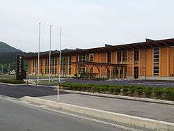
Sumita Town Hall | |||
| |||
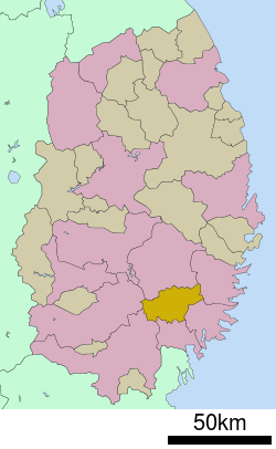 Location of Sumita in Iwate Prefecture | |||
 Sumita
| |||
| Coordinates: 39°08′31″N 141°34′33″E / 39.14194°N 141.57583°ECoordinates: 39°08′31″N 141°34′33″E / 39.14194°N 141.57583°E | |||
| Country | Japan | ||
| Region | Tōhoku | ||
| Prefecture | Iwate | ||
| District | Kesen | ||
| Government | |||
| • -Mayor | Kin'ichi Tada | ||
| Area | |||
| • Total | 334.83 km2 (129.28 sq mi) | ||
| Population (September 2016) | |||
| • Total | 5,950 | ||
| • Density | 18/km2 (50/sq mi) | ||
| Population total figure is for total residents, including resident aliens | |||
| Time zone | Japan Standard Time (UTC+9) | ||
| City symbols | |||
| • Tree | Cryptomeria | ||
| • Flower | Large-flowered cypripedium | ||
| • Bird | Copper pheasant | ||
| Phone number | 0192-46-2111 | ||
| Address | Setamai, Aza Kawamukai 88-1, Sumita-cho, Kensen-gun, Iwate-ken 029-2396 | ||
| Website | Official website | ||


Sumita (住田町 Sumita-chō) is a town located in Kesen District, Iwate Prefecture, Japan.
Geography
Sumita is located in a basin in southeastern Iwate Prefecture in the southern Kitakami Mountains, surrounded by peaks with an elevation of between 600 and 1500 meters an all sides. Approximately 90% of the town’s area is covered by forest and mountains.
Neighboring municipalities
- Iwate Prefecture
History
The area of present-day Sumita was part of ancient Mutsu Province. It was under the control of the Date clan during the Edo period, who ruled the Sendai Domain under the Tokugawa shogunate.
The villages of Kamiarisu, Shimoarisu and Setamai within Kesen District were created on April 1, 1889 with the establishment of the municipality system. Setamai became a town on April 29, 1940. The Kamiarisu and Shimoarisu merged with Setamai on April 1, 1955 to create the town of Sumita.
Economy
The local economy is largely based on forestry and agriculture.
Transportation
Railway
- East Japan Railway Company (JR East) – Kamaishi Line
Highway
- Japan National Route 107
- Japan National Route 340
- Japan National Route 283 – Rokando Interchange
References
External links
![]() Media related to Sumita, Iwate at Wikimedia Commons
Media related to Sumita, Iwate at Wikimedia Commons
- Official website (Japanese)
| Core city | ||
|---|---|---|
| Cities | ||
| Isawa District | ||
| Iwate District | ||
| Kamihei District | ||
| Kesen District | ||
| Kunohe District | ||
| Ninohe District | ||
| Nishiiwai District | ||
| Shimohei District | ||
| Shiwa District | ||
| Waga District | ||