Fudai, Iwate
| Fudai 普代村 | |||
|---|---|---|---|
| Village | |||
|
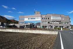
Fudai Village Hall | |||
| |||
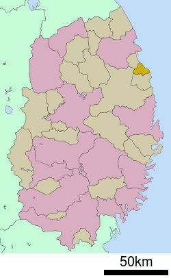 Location of Fudai in Iwate Prefecture | |||
 Fudai
| |||
| Coordinates: 40°00′19″N 141°53′09″E / 40.00528°N 141.88583°ECoordinates: 40°00′19″N 141°53′09″E / 40.00528°N 141.88583°E | |||
| Country | Japan | ||
| Region | Tōhoku | ||
| Prefecture | Iwate | ||
| District | Shimohei | ||
| Area | |||
| • Total | 80.84 km2 (31.21 sq mi) | ||
| Population (February 2014) | |||
| • Total | 2,945 | ||
| • Density | 69.69/km2 (180.5/sq mi) | ||
| Time zone | Japan Standard Time (UTC+9) | ||
| City symbols | |||
| • Tree | Japanese pagoda tree | ||
| • Flower | Lilium maculatum | ||
| • Bird | Japanese cormorant | ||
| Phone number | 0194-35-2111 | ||
| Address | dai-9 jiwari Doya 13-2, Fudai-mura, Shimohei-gun, Iwate 028-8392 | ||
| Website | Official website | ||


Fudai (普代村 Fudai-mura) is a village located in Shimohei District, Iwate, Japan. As of February 2014, the town had an estimated population of 2,945 and a population density of 69.69 persons per km2. The total area was 69.66 km2,[1] According to the 2010 Japanese census, the village population was 3,088 in the year 2010, down from 3,358 counted in the 2005 census.[2]
Geography
Fudai is a coastal mountainous community situated on the Sanriku Coast along the Pacific Ocean. The southern part of the village, an area called Kurosaki (黒崎), includes a part of the Rikuchu Kaigan National Park. It features an observation point to view scenic 100-metre (330 ft) seaside cliffs.[3]
Neighboring municipalities
- Iwate Prefecture
History
.JPG)
The area of present-day Fudai was part of ancient Mutsu Province, dominated by the Nambu clan during the Edo period, who ruled Hachinohe Domain under the Tokugawa shogunate. The village of Fudai was created within Kitahei District on April 1, 1889. Kitahei, Nakahei and Higashihei Districts were all merged into Minamihei District on March 29, 1896. In 1953, the national and prefectural governments targeted Fudai for consolidation with its southern neighbor, Tanohata following the Law for the Consolidation of Cities, Towns and Villages ("the great Shōwa mergers").[4] Merger talks continued intermittently between 1955 and 1960. The Tanohata delegation was not in favor of the merger, but because of the pressure from the prefecture to implement the government directive, they felt they were not at liberty to directly reject the proposal. At a party in May 1960 to celebrate the end of the long merger negotiations, the mayor of Tanohata drunkenly insulted the delegates from Fudai in a final effort to scuttle the negotiations.[4] The party was abandoned, and no further serious attempts were made to continue with the merger.[4]
The village was spared from the devastation brought to other coastal communities following the 2011 Tōhoku earthquake and tsunami thanks to a 15.5-metre (51 ft) floodgate that protected the town. The floodgate was built between 1972 and 1984 at a cost of ¥3.56 billion (approximately US$30 million in 2011) under the administration of Kotoku Wamura, the village mayor from 1947 to 1987. Initially derided as a waste of public funds, the floodgate protected the village and the inner cove from the worst of the tsunami waves.[5] After the 2011 tsunami, the villagers gave thanks at Wamura's grave. The village's only casualty was one missing person who went to inspect his boat in the fishing port, located outside of the wall's protection, immediately after the earthquake.[5]
Economy
The local economy is based on commercial fishing and to a lesser extent on agriculture.
Transportation
Railway
Highway
Local attractions
- Rikuchū-Kurosaki Light – one of the “50 Noteworthy Lighthouses of Japan”
References
- ↑ "Table 82: Population by Sex, Area, Population Density, Sex Ratio, Percent by Age (3 Groups), Ratio of Daytime Population to Nighttime Population, Employed Persons 15 Years of Age and Over based on Place of Usual Residence, Percent of Employed Persons 15 Years of Age and Over by Industry based on Place of Work, Number of Private Households, Members per Private Household, Percent to Private Households, Ratio of Owned Houses and Area of Floor Space per Household - Japan, Prefectures, Shi, Ku, Machi and Mura : 2005". Final Report of the 2005 Population Census. Statistics Bureau, Ministry of Internal Affairs and Communications (Japan). 26 January 2010. Retrieved 17 May 2011.
- ↑ "Table 2: Population and Households - Prefecture, All Shi, All Gun, Shi, Machi and Mura". 2010 Population Census, Preliminary Counts of the Population and Households. Statistics Bureau, Ministry of Internal Affairs and Communications (Japan). 25 February 2011. Retrieved 17 May 2011.
- ↑ "Introducing places of interest: Rikuchukaigan National Park". Ministry of the Environment (Japan). Retrieved 17 May 2011.
- 1 2 3 Bailey, Jackson H. (1991). Ordinary people, extraordinary lives : political and economic change in a Tōhoku village. Honolulu: University of Hawaii Press. p. 272. ISBN 978-0-8248-1299-7.
- 1 2 Hosaka, Tomoko A. (13 May 2011). "How one Japanese village defied the tsunami". Seattle Post-Intelligencer via Associated Press. AP. Retrieved 13 May 2011.
External links
![]() Media related to Fudai, Iwate at Wikimedia Commons
Media related to Fudai, Iwate at Wikimedia Commons
- Official website (Japanese)
| Core city | ||
|---|---|---|
| Cities | ||
| Isawa District | ||
| Iwate District | ||
| Kamihei District | ||
| Kesen District | ||
| Kunohe District | ||
| Ninohe District | ||
| Nishiiwai District | ||
| Shimohei District | ||
| Shiwa District | ||
| Waga District | ||