Hilton Brook
| Hilton Brook | |
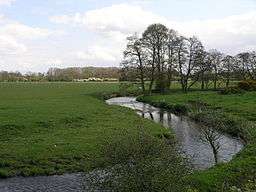 Sutton Brook near Sutton on the Hill | |
| Country | England |
|---|---|
| Counties | Derbyshire |
| District | South Derbyshire |
| Villages | Longford, Sutton on the Hill, Hilton |
| Tributaries | |
| - right | Bradley Brook, Shirley Brook, Limbersitch Brook |
| Source | |
| - location | Hulland, Derbyshire |
| - coordinates | 53°01′33″N 1°38′06″W / 53.0258°N 1.6351°W |
| Mouth | |
| - location | Egginton, Derbyshire |
| - coordinates | 52°50′37″N 1°36′28″W / 52.8435°N 1.6079°WCoordinates: 52°50′37″N 1°36′28″W / 52.8435°N 1.6079°W |
| Length | 26 km (16 mi) |
| Basin | 103 km2 (40 sq mi) [1] |
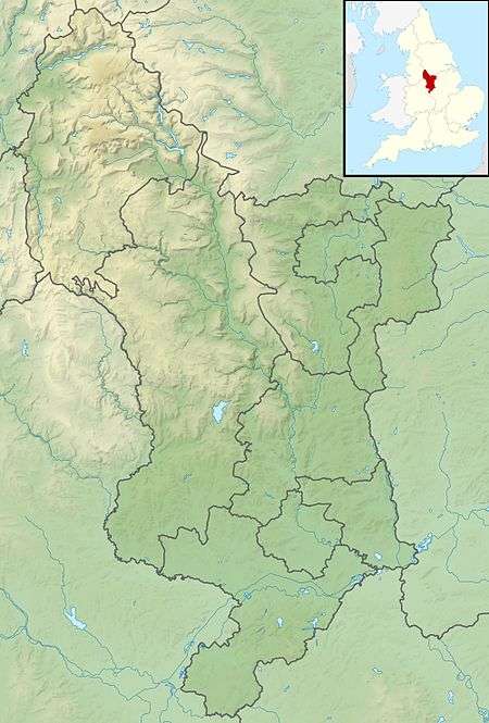 Confluence with the River Dove shown in Derbyshire | |
| Wikimedia Commons: Hilton Brook | |
| Progression : Hilton Brook—Dove—Trent—Humber | |
The Hilton Brook or Sutton Brook is a tributary of the River Dove in Derbyshire, England, and is 26 kilometres (16 miles) long.[2] Like many watercourses in the area, it has multiple names, often being named locally after the village it flows past.
Course
The source of the brook is to the north of Hulland village, where it is known as the Hulland-Hollow brook, it flows south to become the Spinneyford brook, this changes to the Brailsford brook, after the confluence with the Bradley brook. It then flows past the village of Ednaston, and takes the name of Longford brook in the middle reaches, after it is joined by the Shirley brook, near Longford. The name changes again, to the Sutton brook as it passes Sutton on the Hill, and finally becomes the Hilton brook as it flows past the village of the same name. The brook then flows in a south-easterly direction to join the River Dove north of Burton upon Trent near the village of Egginton.[3][4]
Catchment
The brook drains a catchment with a geology consisting of mainly Mercian mudstones and Siltstone, but with some Sandstone and Shales in the upper reaches. Hilton Brook has an area of 103 square kilometres,[1] and has been designated as main river by the Environment Agency from Longford to its confluence with the Dove.[5]
References
- 1 2 "Water Framework Directive Surface Water Classification Status and Objectives 2012 csv files". Environment-agency.gov.uk. Retrieved 20 April 2013.
- ↑ "Get-a-map online". Ordnance Survey. Retrieved 26 March 2013.
- ↑ "Environment Agency What's in your Backyard". Environment Agency. Retrieved 27 April 2013.
- ↑ Ordnance Survey (2009). Derby & Burton upon Trent. OS Landranger Map Series. Ordnance Survey. ISBN 0-319-22297-7.
- ↑ "Identifying Main River Flood Risk". Derbyshire County Council. Retrieved 20 April 2013.
| Unitary authorities | |
|---|---|
| Boroughs or districts | |
| Major settlements |
|
| Rivers | |
| Topics | |