Hsi Hseng
| Hsi Hseng ဆီဆိုင်မြို့ | |
|---|---|
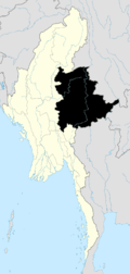
 Hsi Hseng Location in Burma | |
| Coordinates: 20°9′N 97°15′E / 20.150°N 97.250°ECoordinates: 20°9′N 97°15′E / 20.150°N 97.250°E | |
| Country |
|
| Division | Shan State |
| Districts | Taunggyi District |
| Township | Hsi Hseng Township |
| Time zone | MST (UTC+6.30) |
Hsi Hseng or Hsi-hseng (Burmese: ဆီဆိုင်မြို့) is a town in the Shan State of eastern Burma. It is located in Hsi Hseng Township in Taunggyi District and lies along National Highway 5. It is connected to Loisawn in the north and Tongkaw in the south.[1] The area is a known producer of opium and methamphetamine; poppy fields and a methamphetamine factory have been reported in Hsi Hseng.[2] Gee Dong was killed near Hsi Hseng in 1974.[3]
References
- ↑ Maps (Map). Google Maps.
- Bing Maps (Map). Microsoft and Harris Corporation Earthstar Geographics LLC. - ↑ British Broadcasting Corporation. Monitoring Service (1996). Summary of world broadcasts: Asia, Pacific. British Broadcasting Corporation. Retrieved 28 September 2011.
- Lintner, Bertil (1999). Burma in revolt: opium and insurgency since 1948. Silkworm Press. ISBN 978-974-7100-78-5. Retrieved 28 September 2011.
- International Campaign to Ban Landmines (2002). Landmine monitor report 2002: toward a mine-free world. Human Rights Watch. p. 628. ISBN 978-1-56432-277-7. Retrieved 28 September 2011. - ↑ Christensen, Russ; Ṅhakʻ, Chūʺ (2006). The Pa-O: rebels and refugees. Silkworm Books. p. 32. ISBN 978-974-9575-93-2. Retrieved 28 September 2011.
External links
Capital: Hsi Hseng | |

This article is issued from Wikipedia - version of the 10/18/2016. The text is available under the Creative Commons Attribution/Share Alike but additional terms may apply for the media files.