Kunhing
| Kunhing | |
|---|---|
| Town | |
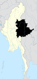
 Kunhing Location in Burma | |
| Coordinates: 21°18′10″N 98°25′36″E / 21.30278°N 98.42667°ECoordinates: 21°18′10″N 98°25′36″E / 21.30278°N 98.42667°E | |
| Country |
|
| State | Shan State |
| District | Loilem District |
| Township | Kunhing Township |
| Elevation[1] | 504 m (1,654 ft) |
| Time zone | MST (UTC+6.30) |
Kunhing (Kunhein) is located in Kunhing Township in the middle part of southern Shan state, Myanmar. The name Kunhein refers to "a thousand island" in the local Shan language.
Geographic
Kunhing is located by the Nam Pang River, an important tributary of the Salween.[2]
Population
As refers to 1988 census figures, it has less than 30,000 population; primarily Shans. Minorities are Akar, Lisu and Palaung.
Places of interest
Kunhing Bridge – over 4,000 metres (13,000 ft) in length crossing over two big islands in the Nam Pang River. It is one of the main bridges on the Taunggyi-Kengtung Road.
References
Capital: Kunhing | |
|

This article is issued from Wikipedia - version of the 11/16/2015. The text is available under the Creative Commons Attribution/Share Alike but additional terms may apply for the media files.