Mong Hpayak
| Mong Hpayak | |
|---|---|
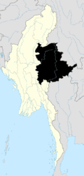
 Mong Hpayak Location in Burma | |
| Coordinates: 20°52′35″N 99°55′23″E / 20.87639°N 99.92306°ECoordinates: 20°52′35″N 99°55′23″E / 20.87639°N 99.92306°E | |
| Country | Burma (Myanmar) |
| Division | Shan State |
| Districts | Mong Hpayak |
| Township | Mong Hpayak |
| Population | |
| • Religions | Buddhism |
| Time zone | MST (UTC+6.30) |
| WOEID | 1017631 |
Mong Hpayak[1] (also Mong Hpyak, Mongphyat, Maingbyat, Meng-pen-ma; Mong is equivalent to Mueang) is a town in Mong Hpayak District of Shan State of Myanmar. It is the principal town of and administrative center for both the district and Mong Hpayak Township. The town is located on the Tachilek–Kengtung paved road.[2] As of 2005, a paved road was under construction from Mong Hpayak east to Mong Yawng.[2]
Notes
- ↑ "Möng Hpāyāk (Approved)" Mong Hpayak at GEOnet Names Server, United States National Geospatial-Intelligence Agency
- 1 2 "Road Construction in Shan State: A Lucrative Way to Turn Illegal Drug Profits into Legal Revenues" Undercurrents: Monitoring Development on Burma’s Mekong January 2005: pages 12-13
External links
- "Mong Hpayak Map — Satellite Images of Mong Hpayak" Maplandia World Gazetteer

This article is issued from Wikipedia - version of the 2/13/2016. The text is available under the Creative Commons Attribution/Share Alike but additional terms may apply for the media files.