Pangwaun Township
| Pangwaun | |
|---|---|
| Township | |
 Pangwaun | |
| Coordinates: 23°2′0″N 99°19′0″E / 23.03333°N 99.31667°E | |
| Country |
|
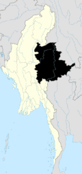
| State | Shan State |
| Self-Administered Division | Wa |
| Elevation[1] | 3,419 ft (1,042 m) |
| Time zone | MMT (UTC+6:30) |
Pangwaun Township, also known as Panwai and Panwine, is a township of the Wa Self-Administered Division of Shan State,[2] formerly and conterminously part of Hopang District. Prior to 2011, it belonged to Lashio District.[3] Its main town is Pangwaun.
The total population before 1995 was 33,418 and Wa people were 25,526 out of total.[4]
Pangwaun Constituency for People Assembly and Shan State Assembly was excluded in General Election of 2010.[5]
References
Template:Pangwaun Township

This article is issued from Wikipedia - version of the 5/18/2016. The text is available under the Creative Commons Attribution/Share Alike but additional terms may apply for the media files.