Mong Hsu
This article is about the town. For the present-day administrative division, see Mong Hsu Township. For the former Shan princely state, see Monghsu.
| Mong Hsu | |
|---|---|
| Town | |
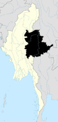
 Mong Hsu Location in Burma | |
| Coordinates: 21°55′N 98°23′E / 21.917°N 98.383°ECoordinates: 21°55′N 98°23′E / 21.917°N 98.383°E | |
| Country |
|
| State | Shan State |
| District | Loilem District |
| Township | Mong Hsu Township |
| Elevation[1] | 707 m (2,320 ft) |
| Time zone | MST (UTC+6.30) |
Mong Hsu is the principal town of Mong Hsu Township of Shan State.
History
It was the main town of one of the Shan States, Monghsu, known in ancient times as Hansawadi.[2]
In early 1990s, there is a major discovery rubies near Mong Hsu. Within a few years, Mong Hsu rubies constituted over 95% of faceted rubies entering world market.[3]
References

This article is issued from Wikipedia - version of the 11/26/2015. The text is available under the Creative Commons Attribution/Share Alike but additional terms may apply for the media files.