Pinlaung
| Pinlaung | |
|---|---|
| Town | |
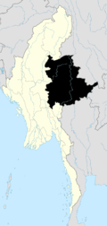
 Pinlaung Location in Burma | |
| Coordinates: 20°5′42″N 96°47′23″E / 20.09500°N 96.78972°ECoordinates: 20°5′42″N 96°47′23″E / 20.09500°N 96.78972°E | |
| Country |
|
| State | Shan State |
| District | Pa-O Self-Administered Zone |
| Township | Pinlaung Township |
| Time zone | MST (UTC+6.30) |
Pinlaung is a town and seat of Pinlaung Township, in the Pa-O Self-Administered Zone of Shan State of eastern-central Burma. It lies along National Road 54, north-west by road from Loikaw .[1][2]
References
- ↑ Google Maps (Map). Google.
- ↑ Bing Maps (Map). Microsoft and Harris Corporation Earthstar Geographics LLC.
External links

This article is issued from Wikipedia - version of the 2/13/2016. The text is available under the Creative Commons Attribution/Share Alike but additional terms may apply for the media files.