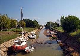
Jau-Dignac-et-Loirac
| Jau-Dignac-et-Loirac | ||
|---|---|---|
 | ||
| ||
 Jau-Dignac-et-Loirac | ||
|
Location within Nouvelle-Aquitaine region  Jau-Dignac-et-Loirac | ||
| Coordinates: 45°24′32″N 0°57′24″W / 45.4089°N 0.9567°WCoordinates: 45°24′32″N 0°57′24″W / 45.4089°N 0.9567°W | ||
| Country | France | |
| Region | Nouvelle-Aquitaine | |
| Department | Gironde | |
| Arrondissement | Lesparre-Médoc | |
| Canton | Saint-Vivien-de-Médoc | |
| Intercommunality | Pointe du Médoc | |
| Government | ||
| • Mayor (2008–2014) | Gino Cecchini | |
| Area1 | 41.23 km2 (15.92 sq mi) | |
| Population (2008)2 | 1,010 | |
| • Density | 24/km2 (63/sq mi) | |
| Time zone | CET (UTC+1) | |
| • Summer (DST) | CEST (UTC+2) | |
| INSEE/Postal code | 33208 / 33590 | |
| Elevation |
0–14 m (0–46 ft) (avg. 5 m or 16 ft) | |
|
1 French Land Register data, which excludes lakes, ponds, glaciers > 1 km² (0.386 sq mi or 247 acres) and river estuaries. 2 Population without double counting: residents of multiple communes (e.g., students and military personnel) only counted once. | ||

Jau-Dignac-et-Loirac is a commune in the Gironde department in Nouvelle-Aquitaine in southwestern France.
Population
| Historical population | ||
|---|---|---|
| Year | Pop. | ±% |
| 1962 | 872 | — |
| 1968 | 909 | +4.2% |
| 1975 | 808 | −11.1% |
| 1982 | 803 | −0.6% |
| 1990 | 836 | +4.1% |
| 1999 | 866 | +3.6% |
| 2008 | 1,010 | +16.6% |
See also
References
| Wikimedia Commons has media related to Jau-Dignac-et-Loirac. |
This article is issued from Wikipedia - version of the 11/9/2016. The text is available under the Creative Commons Attribution/Share Alike but additional terms may apply for the media files.