Salles, Gironde
| Salles | ||
|---|---|---|
 | ||
| ||
 Salles | ||
|
Location within Nouvelle-Aquitaine region  Salles | ||
| Coordinates: 44°33′10″N 0°52′05″W / 44.5528°N 0.8681°WCoordinates: 44°33′10″N 0°52′05″W / 44.5528°N 0.8681°W | ||
| Country | France | |
| Region | Nouvelle-Aquitaine | |
| Department | Gironde | |
| Arrondissement | Arcachon | |
| Canton | Belin-Béliet | |
| Intercommunality | Val de l'Eyre | |
| Government | ||
| • Mayor (2008–2014) | Vincent Nuchy | |
| Area1 | 137.98 km2 (53.27 sq mi) | |
| Population (2008)2 | 5,917 | |
| • Density | 43/km2 (110/sq mi) | |
| Time zone | CET (UTC+1) | |
| • Summer (DST) | CEST (UTC+2) | |
| INSEE/Postal code | 33498 / 33770 | |
| Elevation |
7–76 m (23–249 ft) (avg. 41.5 m or 136 ft) | |
|
1 French Land Register data, which excludes lakes, ponds, glaciers > 1 km² (0.386 sq mi or 247 acres) and river estuaries. 2 Population without double counting: residents of multiple communes (e.g., students and military personnel) only counted once. | ||
.svg.png)
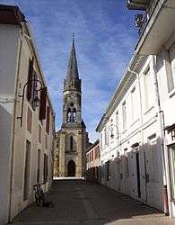
Salles is a commune in the Gironde department in Nouvelle-Aquitaine in southwestern France.
Population
| Historical population | ||
|---|---|---|
| Year | Pop. | ±% |
| 1793 | 2,837 | — |
| 1800 | 2,938 | +3.6% |
| 1806 | 2,953 | +0.5% |
| 1821 | 3,388 | +14.7% |
| 1831 | 3,618 | +6.8% |
| 1836 | 3,628 | +0.3% |
| 1841 | 3,840 | +5.8% |
| 1846 | 3,973 | +3.5% |
| 1851 | 3,918 | −1.4% |
| 1856 | 3,876 | −1.1% |
| 1861 | 3,966 | +2.3% |
| 1866 | 4,052 | +2.2% |
| 1872 | 4,015 | −0.9% |
| 1876 | 4,048 | +0.8% |
| 1881 | 3,872 | −4.3% |
| 1886 | 3,900 | +0.7% |
| 1891 | 3,884 | −0.4% |
| 1896 | 3,862 | −0.6% |
| 1901 | 3,866 | +0.1% |
| 1906 | 3,810 | −1.4% |
| 1911 | 3,756 | −1.4% |
| 1921 | 3,335 | −11.2% |
| 1926 | 3,307 | −0.8% |
| 1931 | 3,075 | −7.0% |
| 1936 | 2,848 | −7.4% |
| 1946 | 2,723 | −4.4% |
| 1954 | 2,840 | +4.3% |
| 1962 | 3,321 | +16.9% |
| 1968 | 3,353 | +1.0% |
| 1975 | 2,330 | −30.5% |
| 1982 | 2,313 | −0.7% |
| 1990 | 4,289 | +85.4% |
| 1999 | 5,257 | +22.6% |
| 2008 | 5,917 | +12.6% |
See also
References
| Wikimedia Commons has media related to Salles (Gironde). |
This article is issued from Wikipedia - version of the 11/9/2016. The text is available under the Creative Commons Attribution/Share Alike but additional terms may apply for the media files.