Créon
For the commune in the Landes department, see Créon-d'Armagnac.
| Créon | ||
|---|---|---|
 | ||
| ||
 Créon | ||
|
Location within Nouvelle-Aquitaine region  Créon | ||
| Coordinates: 44°46′31″N 0°20′49″W / 44.7753°N 0.3469°WCoordinates: 44°46′31″N 0°20′49″W / 44.7753°N 0.3469°W | ||
| Country | France | |
| Region | Nouvelle-Aquitaine | |
| Department | Gironde | |
| Arrondissement | Bordeaux | |
| Canton | Créon | |
| Intercommunality | Créonnais | |
| Government | ||
| • Mayor (2008–2014) | Jean-Marie Darmian | |
| Area1 | 8.02 km2 (3.10 sq mi) | |
| Population (2008)2 | 4,030 | |
| • Density | 500/km2 (1,300/sq mi) | |
| Time zone | CET (UTC+1) | |
| • Summer (DST) | CEST (UTC+2) | |
| INSEE/Postal code | 33140 / 33670 | |
| Elevation |
51–109 m (167–358 ft) (avg. 100 m or 330 ft) | |
|
1 French Land Register data, which excludes lakes, ponds, glaciers > 1 km² (0.386 sq mi or 247 acres) and river estuaries. 2 Population without double counting: residents of multiple communes (e.g., students and military personnel) only counted once. | ||
.svg.png)
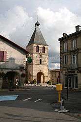
Créon is a commune in the Gironde department in Nouvelle-Aquitaine in southwestern France.
Population
| Historical population | ||
|---|---|---|
| Year | Pop. | ±% |
| 1793 | 877 | — |
| 1800 | 843 | −3.9% |
| 1806 | 910 | +7.9% |
| 1821 | 805 | −11.5% |
| 1831 | 913 | +13.4% |
| 1836 | 878 | −3.8% |
| 1841 | 896 | +2.1% |
| 1846 | 923 | +3.0% |
| 1851 | 1,004 | +8.8% |
| 1856 | 1,049 | +4.5% |
| 1861 | 1,069 | +1.9% |
| 1866 | 1,051 | −1.7% |
| 1872 | 1,085 | +3.2% |
| 1876 | 1,158 | +6.7% |
| 1881 | 1,142 | −1.4% |
| 1886 | 1,145 | +0.3% |
| 1891 | 1,131 | −1.2% |
| 1896 | 1,141 | +0.9% |
| 1901 | 1,116 | −2.2% |
| 1906 | 1,043 | −6.5% |
| 1911 | 1,049 | +0.6% |
| 1921 | 978 | −6.8% |
| 1926 | 999 | +2.1% |
| 1931 | 1,012 | +1.3% |
| 1936 | 1,003 | −0.9% |
| 1946 | 1,015 | +1.2% |
| 1954 | 1,026 | +1.1% |
| 1962 | 1,286 | +25.3% |
| 1968 | 1,560 | +21.3% |
| 1975 | 1,842 | +18.1% |
| 1982 | 2,205 | +19.7% |
| 1990 | 2,508 | +13.7% |
| 1999 | 2,856 | +13.9% |
| 2008 | 4,030 | +41.1% |
See also
References
| Wikimedia Commons has media related to Créon. |
This article is issued from Wikipedia - version of the 11/9/2016. The text is available under the Creative Commons Attribution/Share Alike but additional terms may apply for the media files.