Kankakee, Illinois
| Kankakee, Illinois Theakake | |
|---|---|
| City | |
| City of Kankakee | |
|
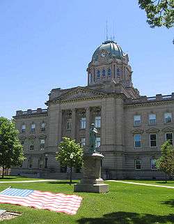
Kankakee County Courthouse, in Kankakee, Illinois | |
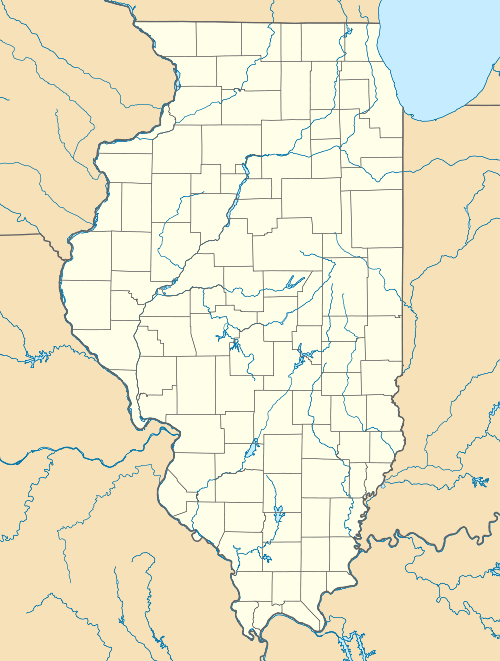 Kankakee, Illinois Location of Kankakee within Illinois | |
| Coordinates: 41°7′12″N 87°51′40″W / 41.12000°N 87.86111°WCoordinates: 41°7′12″N 87°51′40″W / 41.12000°N 87.86111°W | |
| Country | United States |
| State |
|
| County | Kankakee |
| Established | 1853 |
| Incorporated (city) | 1865 |
| Government | |
| • Type | Mayor-Council |
| • Mayor | Nina Epstein (R) |
| • City Council | 14 aldermen |
| Area | |
| • Total | 14.62 sq mi (37.9 km2) |
| • Land | 14.14 sq mi (36.6 km2) |
| • Water | 0.480 sq mi (1.24 km2) |
| Elevation[1] | 656 ft (200 m) |
| Population (2010)[2] | |
| • Total | 27,537 |
| • Estimate (2012) | 27,349 |
| • Density | 1,900/sq mi (730/km2) |
| Demonym(s) | Kankakeean |
| Time zone | CST (UTC-6) |
| • Summer (DST) | CDT (UTC-5) |
| ZIP codes | 60901 |
| Area code(s) | 815, 779 |
| FIPS code | 17-38934[1] |
| GNIS feature ID | 411300[1] |
| Website |
www |
Kankakee /kæŋkəˈki/ is a city in and the county seat of Kankakee County, Illinois, United States.[3] The city's name is probably derived from the Miami-Illinois word teeyaahkiki, meaning: "Open country/exposed land/land in open/land exposed to view,"[4][5][6][7][8] in reference to the area's prior status as a marsh. As of the 2010 census, the city population was 27,537. Kankakee is a principal city of the Kankakee-Bourbonnais-Bradley Metropolitan Statistical Area and the Chicago–Naperville–Michigan City, IL-IN-WI Combined Statistical Area, which includes all of Kankakee County.
History
The area of Kankakee was inhabited by the Potawatami beginning sometime in the 18th century. In 1833 the Potawatami signed a treaty with the United States government, agreeing to leave the region and move west. Kankakee was founded in 1854.[9]
Geography
Kankakee is located at 41°7′12″N 87°51′36″W / 41.12000°N 87.86000°W (41.12, −87.86).[10]
According to the 2010 census, Kankakee has a total area of 14.62 square miles (37.87 km2), of which 14.14 square miles (36.62 km2) (or 96.72%) is land and 0.48 square miles (1.24 km2) (or 3.28%) is water.[11]
Demographics
| Historical population | |||
|---|---|---|---|
| Census | Pop. | %± | |
| 1880 | 5,651 | — | |
| 1890 | 9,025 | 59.7% | |
| 1900 | 13,595 | 50.6% | |
| 1910 | 13,986 | 2.9% | |
| 1920 | 16,753 | 19.8% | |
| 1930 | 20,620 | 23.1% | |
| 1940 | 22,241 | 7.9% | |
| 1950 | 25,856 | 16.3% | |
| 1960 | 27,666 | 7.0% | |
| 1970 | 27,575 | −0.3% | |
| 1980 | 29,633 | 7.5% | |
| 1990 | 30,944 | 4.4% | |
| 2000 | 27,491 | −11.2% | |
| 2010 | 27,537 | 0.2% | |
| Est. 2015 | 26,676 | [12] | −3.1% |
As of the census[14] of 2000, there were 27,561 people, 10,020 households and 6,272 families residing within the city. The population density was 2,239.8 people per square mile (865.1/km²). There were 10,965 housing units at an average density of 893.4 per square mile (345.0/km²). The racial makeup of the city was 50.92% White, 41.07% African American, 0.27% Native American, 0.32% Asian, 0.03% Pacific Islander, 5.50% from other races, and 1.90% from two or more races. Hispanic or Latino of any race were 9.25% of the population.
There were 10,020 households out of which 34.4% had children under the age of 18 living with them, 36.4% were married couples living together, 21.2% had a female householder with no husband present, and 37.4% were non-families. 31.5% of all households were made up of individuals and 13.9% had someone living alone who was 65 years of age or older. The average household size was 2.60 and the average family size was 3.28.
In the city the population was spread out with 29.5% under the age of 18, 9.7% from 18 to 24, 28.7% from 25 to 44, 18.7% from 45 to 64, and 13.4% who were 65 years of age or older. The median age was 32 years. For every 100 females there were 91.8 males. For every 100 females age 18 and over, there were 86.2 males.
The median income for a household in the city was $30,469, and the median income for a family was $36,428. Males had a median income of $30,894 versus $22,928 for females. The per capita income for the city was $15,479. About 18.1% of families and 21.4% of the population were below the poverty line, including 29.3% of those under age 18 and 11.7% of those age 65 or over.
Government
Kankakee is governed by the mayor council system. The city council consists of fourteen members who are elected from seven wards (two per ward). The mayor and city clerk are elected in a citywide vote. Library service is provided by the Kankakee Public Library.
Transportation
Airport
Kankakee is served by the Greater Kankakee Airport, a general aviation facility located in the southern portion of Kankakee.[15]
The Kankakee Valley Airport Authority was formed in 1957. The location of the airport was chosen South of Kankakee in 1959. The Greater Kankakee Airport has been officially serving the Kankakee community since 1962. It is located 50 miles south of downtown Chicago and 70 miles north of Champaign, directly along Interstate 57 at the 308 exit. The airport is home to over 100 private hangars housing helicopter, singe engine aircraft, ultralights, and turbine powered aircraft.
In 1966 the main runway was expanded, successfully attracting a commercial carrier. Air Wisconsin, Inc. began operating in 1967. Due to the commercial operations the Airport was able to build the terminal building in 1968, which is still standing today.
The Greater Kankakee Airport made its Hollywood debut in the 1980 Steve McQueen movie "The Hunter," in which Ralph "Papa" Thorson comes to pick up the Trans Am at the airfield.
The Greater Kankakee Airport has received recognition over the years for its outstanding service to Kankakee County. The airport has been awarded the General Aviation – Publicly Owned Airport of the year award by the Illinois Division of Aeronautics in 2001 and 2012.
The airfield continues to serve the community today though general aviation. Over 100 private tenants and multiple businesses continue to utilize the field. In September 2013 the Army National Guard broke ground on the Army Aviation Support Facility, which will be completed in 2017. The facility will house 13 UH-60 Blackhawk helicopters. The Kankakee Valley Airport Authority looks forward to continue to support the surrounding area in the years to come.
Greater Kankakee Airport covers an area of 950 acres (380 ha) (384 ha) at an elevation of 629 feet (192 m) above mean sea level. It has two runways with asphalt surfaces: 4/22 is 5,981 by 100 feet (1,823 x 30 m) and 16/34 is 4,398 by 75 feet (1,341 x 23 m).
Railroads
Amtrak provides service to Kankakee from the Kankakee Amtrak Station.[16] Amtrak operates the City of New Orleans, the Illini, and the Saluki with each train running once daily in both directions.[17]
Highways
Interstate 57 runs east-west in the southern part of the city and turns north-south in the eastern part of Kankakee. United States Highways US 45 and US 52 run concurrently forming, along with Illinois Route IL 50, the major north-south thoroughfares through Kankakee. Illinois Route IL 17 is the major east-west road that bisects the city.
Public transportation
The River Valley Metro Mass Transit District operates the region's transit bus system. Service runs seven days a week to locations in Kankakee as well as the nearby cities of Aroma Park, Bradley, Bourbonnais, and Manteno. All of the Kankakee routes are stationed out of the Chestnut & North Schuyler Transfer Station.[18] The River Valley Metro Mass Transit District (RVMMTD; River Valley Metro or METRO, for short) is a transit agency that operates buses which serve Kankakee County, Illinois and surrounding areas.
River Valley Metro operates 12 fixed-regular bus routes and 2 commuter routes. The Midway and University Park commuter routes were added January 5, 2014. August 2015 River Valley Metro added a second Midway route to its schedule. January 2016 adds a second University Park route to its schedule.
Kankakee Valley Park District
Kankakee Valley Park District has 37 parks, comprising a total of 600 acres (2.4 km2). Facilities include an outdoor aquatic park, indoor ice skating rink, 1000 seat recreation center, dog park, campground and a 72 boat slip marina on the beautiful Kankakee River. Fishing is plentiful as the district has 13 riverfront parks as well as a 5-acre stocked quarry. The district also features 2 softball complexes that have both been recently inducted into the Softball Hall of Fame. The KVPD is home to annual State and World Series tournaments drawing nearly 50,000 spectators throughout the year. The KVPD also hosts one of the biggest BBQ Festivals in the Midwest every July. The KVPD is the proud home to our area youth baseball leagues as several teams throughout the system have gone on not only to win State Championships but to advance to the Little League World Series. [19]
Education
Higher education
Organized in 1966 by a group of citizens, Kankakee Community College was established to provide a post-secondary educational resource for the people of the Kankakee area. The college offered its first classes in September 1968. It serves as an educational, vocational, and recreational center for residents of Community College District 520, an area encompassing all or part of Kankakee County, Iroquois County, Ford County, Grundy County, Livingston County, and Will County and serving a population of approximately 150,000. In its College Credit Division, KCC awards associate degrees, associate in Applied Science degrees and certificates of completion. Students attend KCC both to prepare to transfer to four-year institutions and complete bachelor's degrees and to prepare to enter the job market directly from KCC. Kankakee Community College serves over 6,000 students annually and the average class size is 16. The ratio of part-time to full-time students at Kankakee Community College is 3 to 1.[20]
Primary and secondary education
Public schools are part of the Kankakee School District 111. In Kankakee, there are seven elementary schools (Aroma Park, Edison, Lafayette, Mark Twain, Montessori, Steuben, and Taft), two middle schools (Kennedy and King), one junior high school (Kankakee Junior High), and one high school (Kankakee High) in the district, the latter from 1966-83 having been separated to two separate high schools, Eastridge and Westview.[21] Kankakee is also home to three private high schools: Bishop Martin D. McNamara (Catholic), Grace Baptist Academy (nondenominational[22]), and Kankakee Trinity Academy (inter-denominational [23]).
In popular culture
- David Letterman donated two gazebos to Kankakee in 1999 after the city was rated the 354th best metropolitan area in the country to live out of 354 metropolitan areas.[24] The Kankakee, IL Metropolitan Statistical Area is also one of the smallest Metropolitan Statistical Areas in the United States and rates #338 in population.
- The movie The Unborn (2009) was partially filmed in Samuel H. Shapiro Developmental Center in Kankakee. Other movies to have been filmed in Kankakee County are The Hunter (1980), Child's Play (1988),[25] Chain Reaction (1996), Road to Perdition (2002), Adia (2006, short film), The Missing Peace (2006, short film), The Merry Gentleman (2008), and Demon Joe (2009).
- Kankakee is mentioned in several songs, including:
- "Innocent Bessie Brown", words and music by Irving Berlin, written in 1910, sung by the Broadway performer Ethel Green[26][27][28]
- "They Are Night Zombies!! They Are Neighbors!! They Have Come Back from the Dead!! Ahhhh!", words and music by Sufjan Stevens, from his 2005 album "Illinois".[29][30]
- "City of New Orleans", words and music by Steve Goodman.[31]
- This American Life on April 10, 2015, analysed Kankakee and its title of the worst city in America.[32]
Culture
- The April 1997 issue of Reader's Digest ranked Kankakee the 18th best city in the country to raise a family[33] in a comparison of 301 metropolitan areas in the U.S. The ratings were based on the factors that parents who were surveyed indicated were important for raising a family: low crime rate, low rate of drug or alcohol problems, quality public schools, health care, and environment, cost of living, economic growth, college availability and proximity to major city, and other considerations.
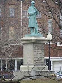
- In 1999, Kankakee County was rated last out of 354 metropolitan areas ranked in the United States and Canada by the Places Rated Almanac. Late night television host David Letterman gave the city two identical gazebos, hoping the town could turn itself around as the "Home Of The Twin Gazebos". The gazebos can still be seen in front of the Kankakee County Courthouse. City leaders have since improved on the ranking by bringing in a water park, ice rink, revitalizing downtown, and other community improvement projects.[34] Robert Bruss, who reviewed the Places Rated Almanac for Tribune Media Services, found the Places Rated Almanac to be "woefully lacking in accurate information."[35]
- Forbes.com rated Kankakee as the 112th Best Small Places For Business And Careers out of 200 small cities that were ranked in the United States in 2015. Out of only 6 places even rated in Illinois. Some of the factors they were ranked on were job growth, educational attainment, projected economic growth, income, employment and housing among others. It ranked #11 nationally in cost of doing business.
- Frank Lloyd Wright designed two houses in the Riverview section of the city, located on South Harrison Ave. The B. Harley Bradley House and the Warren Hickox House both still stand today.[36][37]
- The current Kankakee courthouse was built from 1909 to 1912 in the Neo-classical Revivalist style in the wake of the 1893 Columbian Exposition (the Chicago World's Fair) as part of the City Beautiful movement. The architect was Zachary Taylor Davis who had previously worked with Frank Lloyd Wright when both worked as draftsmen for Louis Sullivan.
- Kankakee is also home to the Kankakee Valley Theatre Association. This organization provides quality theatrical entertainment to the surrounding community. They put on an average of five shows a year, including two (2) youth productions under their children's theatre: Young Peoples Theatre (YPT).
- Gretchen Charlton Art Gallery. This not-for-profit gallery offers people of all ages the opportunity to learn about and appreciate the visual arts through exhibits, tours, workshops, and programs.
- Feed Arts & Cultural Center provides an environment for visual and performing artists of all levels and ages to pursue their work and to broaden their knowledge of the role of art in contemporary society. Some events include sing alongs, performing arts classes, photograph and art exhibits, open mic nights for poetry and short stories, among others.[38]
- Kankakee Municipal Band - Every summer, the Kankakee Municipal Band performs a series of free outdoor concerts. The band performs a wide variety of crowd pleasers including marches, Broadway show tunes, overtures and popular favorites. Concerts are held on Thursday evenings starting at 7:00 pm in historic Bird Park along the Kankakee River. The band performs at the Don Palzer Band Shell on the park's north side. Parking is free. Bring a lawn chair or blanket and enjoy a relaxing evening of Music Under The Stars.
- The Majestic Theater - Built in 1912 for $80,000, the Majestic Theater was one of the largest vaudeville theaters in Chicagoland. It also hosted the Marx Brothers in 1916! Now the Majestic Theater has been renovated and used for such events as weddings, banquets & concerts!
- The Paramount Theater - When the Kankakee Paramount opened on April 11, 1931, the Mayor of Kankakee designated the ensuing week as "Paramount Week." The most beautiful movie theater in Kankakee County, it was renovated, restored then reopened by December 15, 1988. 4 additional theaters were added in the art deco style of the original building and now has a total of 5 theaters.
Kankakee River
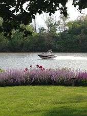
The Kankakee River is a river that runs through Kankakee. It is approximately 133 miles long and is a major attraction and is viewed as a defining landmark of Kankakee. The Kankakee River provides the town vital resources and an economic boost. The river water is refined at the Kankakee water company, and electricity is generated at the Kankakee River Dam. The fishing also provides a tourist attraction for outdoors men and women alike.
.jpg)
See also
References
- 1 2 3 "Kankakee". Geographic Names Information System. United States Geological Survey.
- ↑ "Annual Estimates of the Resident Population: April 1, 2010 to July 1, 2012". United States Census Bureau. Retrieved 8 August 2013.
- ↑ "Find a County". National Association of Counties. Retrieved 2011-06-07.
- ↑ Native American Place-Names of Indiana by Michael McCafferty, 2008, p. 57
- ↑ Native American Place-Names of Indiana by Michael McCafferty, 2008, p. 60
- ↑ Pioneer Hunters of the Kankakee by J. Lorenzo Werich, 1920
- ↑ Notes on the Northwest, Or Valley of the Upper Mississippi. by William J.A. Bradford, 1846
- ↑ Johnson, Vic. 1994. L'Riviere Theakiki--'The Fabulous River of 2,000 Bends', The Daily Journal (July 31, 1994), p. 24.
- ↑ article on St. Rose Cemetery
- ↑ "US Gazetteer files: 2010, 2000, and 1990". United States Census Bureau. 2011-02-12. Retrieved 2011-04-23.
- ↑ "G001 - Geographic Identifiers - 2010 Census Summary File 1". United States Census Bureau. Retrieved 2015-12-27.
- ↑ "Annual Estimates of the Resident Population for Incorporated Places: April 1, 2010 to July 1, 2015". Retrieved July 2, 2016.
- ↑ "Census of Population and Housing". Census.gov. Retrieved June 4, 2015.
- ↑ "American FactFinder". United States Census Bureau. Retrieved 2008-01-31.
- ↑ "Kankakee Valley Airport Authority". Kankakee Valley Airport Authority. Retrieved 2012-06-08.
- ↑ "Kankakee, IL (KKI)". Amtrak. Retrieved 2012-06-08.
- ↑ "City of New Orleans, Illini and Saluki" (PDF). Amtrak. May 7, 2012. Retrieved 2012-06-08.
- ↑ "Transfer Stations". River Valley Metro. Retrieved 2012-06-08.
- ↑ "US Board on Geographic Names". United States Geological Survey. 2007-10-25. Retrieved 2008-01-31.
- ↑ "Geographic Names Information System". United States Geological Survey. Retrieved 2008-01-31.
- ↑ "Kankakee School District Schools". Kankakee School District 111. Retrieved June 8, 2012.
- ↑ "Grace Baptist Academy". Grace Baptist Academy. Retrieved June 8, 2012.
- ↑ "Our Purpose". Kankakee Trinity Academy. Retrieved June 8, 2012.
- ↑ http://www.daily-journal.com/news/local/hey-david-letterman-we-re-polishing-our-image/article_020776b3-74fd-5da3-b949-d8023a2466bb.html?mode=jqm
- ↑ "Kirkbride Buildings Forum • View topic – Movies Filmed at Kankakee". Kirkbridebuildings.com. April 28, 2008. Retrieved October 17, 2011.
- ↑ "Innocent Bessie Brown (5 Oct 1910) Lyrics – Berlin Irving". Songlyrics.com. Retrieved October 17, 2011.
- ↑ Sheet Music Art Of Irving Berlin / Thomas Inglis. – Atglen, PA : Schiffer Pub., c2003 (p. 21 & 23)
- ↑ The Broadway League. "The official source for Broadway Information". IBDB. Retrieved October 17, 2011.
- ↑ "They Are Night Zombies Lyrics – Sufjan Stevens". Songlyrics.com. Retrieved October 17, 2011.
- ↑ Christopher, James (July 5, 2005). "Illinois – Sufjan Stevens". AllMusic. Retrieved October 17, 2011.
- ↑ http://www.allmusic.com/search/songs/city+of+new+orleans
- ↑ "554: Not It!". thisamericanlife.org. April 10, 2015.
- ↑ The Best Places to Raise a Family. 1997. Reader's Digest, April 1997, pp. 74-81
- ↑ "NGA GEOnet Names Server". National Geospatial-Intelligence Agency. 2008-01-30. Archived from the original on October 8, 2003. Retrieved 2008-01-31.
- ↑ Data in 'Places Rated' Raises Some Questions, The Orlando Sentinel, Sunday, October 1, 2000, p. 16
- ↑ Wright In Kankakee - Bradley House - Home
- ↑ Frank Lloyd Wright Field Guide: Includes All United States And International ... - Thomas A. Heinz, Frank Lloyd Wright - Google Books
- ↑ http://ferminbarbosa.squarespace.com/bio/
- List of Kankakee Valley Park District Activities and Offerings
- Description of Kankakee from Illinois.com
External links
| Wikivoyage has a travel guide for Kankakee. |
| Wikisource has the text of a 1905 New International Encyclopedia article about Kankakee, Illinois. |
-
 "Kankakee". Encyclopædia Britannica. 13 (9th ed.). 1881.
 - Official City page
- Kankakee Regional Chamber of Commerce
- The St. Joseph-Kankakee Portage--Its Location and Use by Marquette, La Salle and the French Voyageurs by George A. Baker, 1899, page 11
- "Kankakee Knows What's Coming," Life magazine, vol. 30, no. 1, January 1, 1951
Municipalities and communities of Kankakee County, Illinois, United States | ||
|---|---|---|
| Cities | ||
| Villages | ||
| Townships | ||
| Unincorporated communities |
| |
| Footnotes | ‡This populated place also has portions in an adjacent county or counties | |
| Major city |  | |
|---|---|---|
| Cities (over 30,000 in 2010) | ||
| Towns and villages (over 30,000 in 2010) |
| |
| Counties | ||
| Regions | ||
| Sub-regions | ||