Manteno, Illinois
| Village of Manteno | |
| Village | |
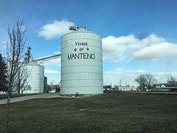 Downtown Manteno | |
| Motto: "Village of Values and Opportunities"[1] | |
| Country | United States |
|---|---|
| State | Illinois |
| County | Kankakee |
| Township | Manteno |
| Elevation | 688 ft (209.7 m) |
| Coordinates | 41°15′00″N 87°50′18″W / 41.250129°N 87.838282°WCoordinates: 41°15′00″N 87°50′18″W / 41.250129°N 87.838282°W |
| Area | 5.01 sq mi (12.98 km2) |
| - land | 4.98 sq mi (13 km2) |
| - water | 0.03 sq mi (0 km2), 0.6% |
| Population | 9,204 (2013) |
| Density | 2,143/sq mi (827.4/km2) |
| Founded | 1855 |
| Mayor | Timothy Nugent |
| Timezone | CST (UTC-6) |
| - summer (DST) | CDT (UTC-5) |
| Postal code | 60950 |
| Area code | 815/779 |
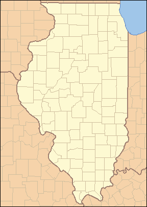 Location of Manteno within Illinois | |
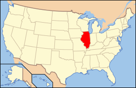 Location of Illinois in the United States | |
| Website: Village of Manteno, Illinois | |
Manteno is a village in Kankakee County, Illinois, United States. The population is 9,300 in 2012. It is part of the Kankakee-Bourbonnais-Bradley Metropolitan Statistical Area and the Chicago–Naperville–Michigan City, IL-IN-WI Combined Statistical Area.
History
Origins of village name
Manteno was named after Manteno Bourbonnais, a daughter of Francois Bourbonnais, Jr. (thus her grandfather was the man for whom the city of Bourbonnais was named) and his Potowatami wife.[2] A Potawatomi Indian name, it is a possible anglicization of manito or manitou, a Potawatomi word for spirit.
Oliver W. Barnard, an early settler in this area, spelled her name Mantenau in one of his books. Other 19th century books spell it Mawteno and Manteno.
Because she was a Metis, Manteno (spelled Monteno in the treaty, but considered incorrect, as the clerk also misspelled Bourbonnais) was given a section of land, now part of northeastern Kankakee County, by the treaty of Camp Tippecanoe of December 20, 1832.
Incorporation
Both Kankakee and Iroquois counties were part of Will County, Illinois before the State Legislature granted a plea of Kankakee's citizens and permitted them to incorporate in 1853.
The present Township of Manteno was then the east half of the Township of Rockville. On March 12, 1855, the town's petition that the area become the Township of Manteno was granted by the county's Board of Supervisors.
The village was incorporated on July 8, 1878.[3]
Geography
Manteno is located at 41°15′0″N 87°50′18″W / 41.25000°N 87.83833°W (41.250129, -87.838282).[4] The average elevation is 675 ft (206 m).
According to the 2010 census, Manteno has a total area of 5.014 square miles (12.99 km2), of which 4.98 square miles (12.90 km2) (or 99.32%) is land and 0.034 square miles (0.09 km2) (or 0.68%) is water.[5]
Demographics
| Historical population | |||
|---|---|---|---|
| Census | Pop. | %± | |
| 1880 | 632 | — | |
| 1890 | 627 | −0.8% | |
| 1900 | 932 | 48.6% | |
| 1910 | 1,229 | 31.9% | |
| 1920 | 1,182 | −3.8% | |
| 1930 | 1,149 | −2.8% | |
| 1940 | 1,537 | 33.8% | |
| 1950 | 1,789 | 16.4% | |
| 1960 | 2,225 | 24.4% | |
| 1970 | 2,864 | 28.7% | |
| 1980 | 3,155 | 10.2% | |
| 1990 | 3,488 | 10.6% | |
| 2000 | 6,414 | 83.9% | |
| 2010 | 9,204 | 43.5% | |
| Est. 2015 | 8,999 | [6] | −2.2% |
As of the census[8] of 2000, there were 6,414 people, 2,578 households, and 1,789 families residing in the village. The population density was 2,143.0 people per square mile (828.2/km²). There were 2,750 housing units at an average density of 918.8 per square mile (355.1/km²). The racial makeup of the village was 97.79% White, 0.27% African American, 0.17% Native American, 0.20% Asian, 0.02% Pacific Islander, 0.98% from other races, and 0.58% from two or more races. Hispanic or Latino of any race were 2.82% of the population.
There were 2,578 households out of which 32.5% had children under the age of 18 living with them, 57.8% were married couples living together, 8.7% had a female householder with no husband present, and 30.6% were non-families. 25.6% of all households were made up of individuals and 9.6% had someone living alone who was 65 years of age or older. The average household size was 2.48 and the average family size was 3.00.
In the village the population was spread out with 26.3% under the age of 18, 7.3% from 18 to 24, 30.3% from 25 to 44, 21.6% from 45 to 64, and 14.5% who were 65 years of age or older. The median age was 36 years. For every 100 females there were 97.5 males. For every 100 females age 18 and over, there were 93.4 males.
The median income for a household in the village was $48,599, and the median income for a family was $56,077. Males had a median income of $46,359 versus $25,675 for females. The per capita income for the village was $22,826. About 3.9% of families and 5.3% of the population were below the poverty line, including 5.8% of those under age 18 and 3.9% of those age 65 or over.
Economy
Manteno, Illinois is located approximately 50 miles (80 km) south of Chicago's loop. There is a combination of industrial and agricultural employers in town. Farmers Elevator Company of Manteno stands as the tallest site in town, with the ability to house 2 million bushels of corn or soybeans at any one time.
Manteno is home to Sears and K-Mart Distribution Centers, both of which contain 1.5 million square feet (140,000 m²) of warehouse area. The Diversatech Industrial Park is on the east side of town. It contains many diversified industrial plants and warehousing complexes.
Interstate 57 runs north and south along the west side of Manteno for access to Chicago or Kankakee.
Manteno was the home of Manteno State Hospital, one of the largest psychiatric hospitals in the country when it opened in 1928. It received its first patients in 1930 and closed in 1985. That closure and the 1983 closure of Hilman Hospital, a general medical hospital, brought economic stagnation to the town.
The North half of the original campus of the Manteno State Hospital has been turned into a Veterans home. Some buildings have been torn down and housing has been put up. A lot of the buildings have been renovated, and very few buildings on the south side of the campus are left in original condition, but yet still abandoned.
Although the town once had direct access to Chicago via a commuter line, that railroad hasn't operated since the 1920s. The Metra Electric station in University Park Illinois serves Manteno.
Education
Manteno Public Schools are part of the Manteno Community Unit School District 5. The district has an elementary school, middle school and high school. Students attend Manteno High School.[9] The schools together have about 2,200 students.
Notable people
- Adam Kinzinger, U.S. Representative for Illinois's 16th congressional district; lives in Manteno
- George R. Lawrence, photography and aviation pioneer; lived in Manteno and is buried there
- John Moisant, aviator, lived in Manteno
- Charles A. Spring, Presbyterian leader and son of Samuel Spring; helped establish the First Presbyterian Church of Manteno (1859)
References
- ↑ "Village of Manteno, Illinois". Village of Manteno, Illinois. Retrieved August 31, 2012.
- ↑ "Profile for Manteno, Illinois, IL". ePodunk. Retrieved August 31, 2012.
- ↑ "Manteno, Illinois". City-data.com. Retrieved August 31, 2012.
- ↑ "US Gazetteer files: 2010, 2000, and 1990". United States Census Bureau. 2011-02-12. Retrieved 2011-04-23.
- ↑ "G001 - Geographic Identifiers - 2010 Census Summary File 1". United States Census Bureau. Retrieved 2015-10-26.
- ↑ "Annual Estimates of the Resident Population for Incorporated Places: April 1, 2010 to July 1, 2015". Retrieved July 2, 2016.
- ↑ "Census of Population and Housing". Census.gov. Retrieved June 4, 2015.
- ↑ "American FactFinder". United States Census Bureau. Retrieved 2008-01-31.
- ↑ "Manteno Community Unit School District 5". Manteno Community Unit School District 5. Retrieved August 31, 2012.
External links
- Manteno Web Site
- Manteno Village Hall Web Site
- Official Manteno Guide
- Manteno Restaurant List
- City-Data.com
Municipalities and communities of Kankakee County, Illinois, United States | ||
|---|---|---|
| Cities | ||
| Villages | ||
| Townships | ||
| Unincorporated communities |
| |
| Footnotes | ‡This populated place also has portions in an adjacent county or counties | |
| Major city |  | |
|---|---|---|
| Cities (over 30,000 in 2010) | ||
| Towns and villages (over 30,000 in 2010) |
| |
| Counties | ||
| Regions | ||
| Sub-regions | ||
