La Penne
| La Penne | ||
|---|---|---|
|
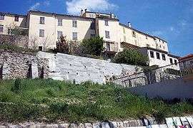
A general view of the village | ||
| ||
 La Penne | ||
|
Location within Provence-A.-C.d'A. region  La Penne | ||
| Coordinates: 43°55′40″N 6°56′53″E / 43.92790°N 6.948°ECoordinates: 43°55′40″N 6°56′53″E / 43.92790°N 6.948°E | ||
| Country | France | |
| Region | Provence-Alpes-Côte d'Azur | |
| Department | Alpes-Maritimes | |
| Arrondissement | Nice | |
| Canton | Puget-Théniers | |
| Intercommunality | Vallées d'Azur | |
| Government | ||
| • Mayor (2008–2014) | Danièle Raybaud | |
| Area1 | 18.08 km2 (6.98 sq mi) | |
| Population (2008)2 | 302 | |
| • Density | 17/km2 (43/sq mi) | |
| Time zone | CET (UTC+1) | |
| • Summer (DST) | CEST (UTC+2) | |
| INSEE/Postal code | 06093 / 06260 | |
| Elevation |
520–1,436 m (1,706–4,711 ft) (avg. 800 m or 2,600 ft) | |
|
1 French Land Register data, which excludes lakes, ponds, glaciers > 1 km² (0.386 sq mi or 247 acres) and river estuaries. 2 Population without double counting: residents of multiple communes (e.g., students and military personnel) only counted once. | ||

La Penne is a commune in the Alpes-Maritimes department in southeastern France.
Population
| Historical population | ||
|---|---|---|
| Year | Pop. | ±% |
| 1962 | 117 | — |
| 1968 | 124 | +6.0% |
| 1975 | 116 | −6.5% |
| 1982 | 120 | +3.4% |
| 1990 | 145 | +20.8% |
| 1999 | 164 | +13.1% |
| 2008 | 302 | +84.1% |
See also
References
External links
| Wikimedia Commons has media related to La Penne. |
This article is issued from Wikipedia - version of the 1/30/2015. The text is available under the Creative Commons Attribution/Share Alike but additional terms may apply for the media files.