La Bollène-Vésubie
| La Bollène-Vésubie | ||
|---|---|---|
|
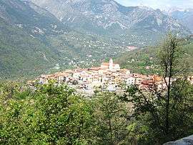
The village of La Bollène Vésubie seen from the north side of the Col de Turini | ||
| ||
 La Bollène-Vésubie | ||
|
Location within Provence-A.-C.d'A. region  La Bollène-Vésubie | ||
| Coordinates: 43°59′26″N 7°19′54″E / 43.9906°N 7.3317°ECoordinates: 43°59′26″N 7°19′54″E / 43.9906°N 7.3317°E | ||
| Country | France | |
| Region | Provence-Alpes-Côte d'Azur | |
| Department | Alpes-Maritimes | |
| Arrondissement | Nice | |
| Canton | Roquebillière | |
| Government | ||
| • Mayor (2008–2014) | Alain Margaritora | |
| Area1 | 35.57 km2 (13.73 sq mi) | |
| Population (2008)2 | 574 | |
| • Density | 16/km2 (42/sq mi) | |
| Time zone | CET (UTC+1) | |
| • Summer (DST) | CEST (UTC+2) | |
| INSEE/Postal code | 06020 / 06450 | |
| Elevation |
465–2,122 m (1,526–6,962 ft) (avg. 650 m or 2,130 ft) | |
|
1 French Land Register data, which excludes lakes, ponds, glaciers > 1 km² (0.386 sq mi or 247 acres) and river estuaries. 2 Population without double counting: residents of multiple communes (e.g., students and military personnel) only counted once. | ||
.svg.png)
La Bollène-Vésubie (Occitan: La Bolena) is a commune in the Alpes-Maritimes department in the Provence-Alpes-Cote-d'Azur region in southeastern France.
Its inhabitants are called Bollénois; in the Niçois dialect of Langue d'Oc the name is la Boulèna, the inhabitants lu Boulenasc.
Population
| Historical population | ||
|---|---|---|
| Year | Pop. | ±% |
| 1962 | 257 | — |
| 1968 | 243 | −5.4% |
| 1975 | 247 | +1.6% |
| 1982 | 262 | +6.1% |
| 1990 | 308 | +17.6% |
| 1999 | 413 | +34.1% |
| 2008 | 574 | +39.0% |
See also
References
External links
| Wikimedia Commons has media related to La Bollène-Vésubie. |
This article is issued from Wikipedia - version of the 12/3/2016. The text is available under the Creative Commons Attribution/Share Alike but additional terms may apply for the media files.