Gars, Alpes-Maritimes
| Gars | ||
|---|---|---|
|
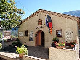
The town hall of Gars | ||
| ||
 Gars | ||
|
Location within Provence-A.-C.d'A. region  Gars | ||
| Coordinates: 43°51′59″N 6°48′14″E / 43.8664°N 6.8039°ECoordinates: 43°51′59″N 6°48′14″E / 43.8664°N 6.8039°E | ||
| Country | France | |
| Region | Provence-Alpes-Côte d'Azur | |
| Department | Alpes-Maritimes | |
| Arrondissement | Grasse | |
| Canton | Saint-Auban | |
| Intercommunality | Monts d'Azur | |
| Government | ||
| • Mayor (2008–2014) | Marino Cassez | |
| Area1 | 15.57 km2 (6.01 sq mi) | |
| Population (2008)2 | 60 | |
| • Density | 3.9/km2 (10.0/sq mi) | |
| Time zone | CET (UTC+1) | |
| • Summer (DST) | CEST (UTC+2) | |
| INSEE/Postal code | 06063 / 06850 | |
| Elevation |
640–1,649 m (2,100–5,410 ft) (avg. 732 m or 2,402 ft) | |
|
1 French Land Register data, which excludes lakes, ponds, glaciers > 1 km² (0.386 sq mi or 247 acres) and river estuaries. 2 Population without double counting: residents of multiple communes (e.g., students and military personnel) only counted once. | ||
.svg.png)
Gars is a commune in the Alpes-Maritimes department in southeastern France.
Population
The inhabitants are called Garcinois.
| Historical population | ||
|---|---|---|
| Year | Pop. | ±% |
| 1962 | 63 | — |
| 1968 | 73 | +15.9% |
| 1975 | 64 | −12.3% |
| 1982 | 83 | +29.7% |
| 1990 | 70 | −15.7% |
| 1999 | 49 | −30.0% |
| 2008 | 60 | +22.4% |
See also
References
| Wikimedia Commons has media related to Gars. |
This article is issued from Wikipedia - version of the 2/18/2016. The text is available under the Creative Commons Attribution/Share Alike but additional terms may apply for the media files.