Le Cannet-des-Maures
For the commune in the Alpes-Maritimes department, see Le Cannet.
| Le Cannet-des-Maures | ||
|---|---|---|
|
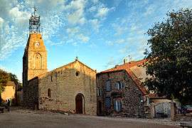
The church of Sainte-Catherin, in Le Cannet-des-Maures | ||
| ||
 Le Cannet-des-Maures | ||
|
Location within Provence-A.-C.d'A. region  Le Cannet-des-Maures | ||
| Coordinates: 43°23′30″N 6°20′27″E / 43.3916°N 6.3407°ECoordinates: 43°23′30″N 6°20′27″E / 43.3916°N 6.3407°E | ||
| Country | France | |
| Region | Provence-Alpes-Côte d'Azur | |
| Department | Var | |
| Arrondissement | Draguignan | |
| Canton | Le Luc | |
| Intercommunality | Cœur du Var | |
| Government | ||
| • Mayor (1983–2008) | Alain Fabre | |
| Area1 | 73.64 km2 (28.43 sq mi) | |
| Population (2006)2 | 3,964 | |
| • Density | 54/km2 (140/sq mi) | |
| Time zone | CET (UTC+1) | |
| • Summer (DST) | CEST (UTC+2) | |
| INSEE/Postal code | 83031 / 83340 | |
| Elevation | 52–628 m (171–2,060 ft) | |
|
1 French Land Register data, which excludes lakes, ponds, glaciers > 1 km² (0.386 sq mi or 247 acres) and river estuaries. 2 Population without double counting: residents of multiple communes (e.g., students and military personnel) only counted once. | ||
.svg.png)
Le Cannet-des-Maures is a commune in the Var department in the Provence-Alpes-Côte d'Azur region in southeastern France.
History
The town was called "Cannet" until the French Revolution, and later "Le Cannet".
See also
References
| Wikimedia Commons has media related to Le Cannet-des-Maures. |
This article is issued from Wikipedia - version of the 1/29/2015. The text is available under the Creative Commons Attribution/Share Alike but additional terms may apply for the media files.