Méounes-lès-Montrieux
| Méounes-lès-Montrieux | ||
|---|---|---|
|
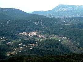
A view of Méounes-lès-Montrieux from the nearby hillside | ||
| ||
 Méounes-lès-Montrieux | ||
|
Location within Provence-A.-C.d'A. region  Méounes-lès-Montrieux | ||
| Coordinates: 43°16′55″N 5°58′15″E / 43.2819°N 5.9708°ECoordinates: 43°16′55″N 5°58′15″E / 43.2819°N 5.9708°E | ||
| Country | France | |
| Region | Provence-Alpes-Côte d'Azur | |
| Department | Var | |
| Arrondissement | Brignoles | |
| Canton | Roquebrussane | |
| Intercommunality | Val d'Issole | |
| Government | ||
| • Mayor (2008–2014) | Jean-François Massué | |
| Area1 | 40.92 km2 (15.80 sq mi) | |
| Population (2006)2 | 1,790 | |
| • Density | 44/km2 (110/sq mi) | |
| Time zone | CET (UTC+1) | |
| • Summer (DST) | CEST (UTC+2) | |
| INSEE/Postal code | 83077 / 83136 | |
| Elevation |
178–784 m (584–2,572 ft) (avg. 275 m or 902 ft) | |
|
1 French Land Register data, which excludes lakes, ponds, glaciers > 1 km² (0.386 sq mi or 247 acres) and river estuaries. 2 Population without double counting: residents of multiple communes (e.g., students and military personnel) only counted once. | ||
.svg.png)
Méounes-lès-Montrieux is a commune in the Var department in the Provence-Alpes-Côte d'Azur region in southeastern France.
Places of interest
Charterhouse of Montrieux (from “mont rivis”, the mount of the stream), founded in 1137.
Famous People
- Augustin Du Seuil (bookbinder) or Dussueil, bookbinder to the king in the 18th century.
See also
References
External links
| Wikimedia Commons has media related to Méounes-lès-Montrieux. |
This article is issued from Wikipedia - version of the 10/30/2015. The text is available under the Creative Commons Attribution/Share Alike but additional terms may apply for the media files.