Le Thoronet
| Le Thoronet | ||
|---|---|---|
|
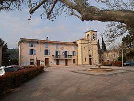
The town hall, church and village square | ||
| ||
 Le Thoronet | ||
|
Location within Provence-A.-C.d'A. region  Le Thoronet | ||
| Coordinates: 43°27′10″N 6°18′16″E / 43.4528°N 6.3044°ECoordinates: 43°27′10″N 6°18′16″E / 43.4528°N 6.3044°E | ||
| Country | France | |
| Region | Provence-Alpes-Côte d'Azur | |
| Department | Var | |
| Arrondissement | Draguignan | |
| Canton | Lorgues | |
| Intercommunality | Cœur du Var | |
| Area1 | 37.53 km2 (14.49 sq mi) | |
| Population (2006)2 | 2,049 | |
| • Density | 55/km2 (140/sq mi) | |
| Time zone | CET (UTC+1) | |
| • Summer (DST) | CEST (UTC+2) | |
| INSEE/Postal code | 83136 / 83340 | |
| Elevation |
75–444 m (246–1,457 ft) (avg. 180 m or 590 ft) | |
|
1 French Land Register data, which excludes lakes, ponds, glaciers > 1 km² (0.386 sq mi or 247 acres) and river estuaries. 2 Population without double counting: residents of multiple communes (e.g., students and military personnel) only counted once. | ||
.svg.png)
Le Thoronet is a commune in the Var department in the Provence-Alpes-Côte d'Azur region in southeastern France.
It is known for the romanesque Le Thoronet Abbey, built in the 12th and 13th century.
See also
References
| Wikimedia Commons has media related to Le Thoronet. |
This article is issued from Wikipedia - version of the 6/23/2015. The text is available under the Creative Commons Attribution/Share Alike but additional terms may apply for the media files.