List of sovereign states and dependent territories in Europe
The list below includes all entities falling even partially under any of the various common definitions of Europe, geographical or political. Fifty-six sovereign states, six of which have limited recognition, are listed with territory in Europe and/or membership in international European organisations. There are eight areas that are not integral parts of a European state or have special political status.
Geographical boundaries of Europe
Under the commonly used geographic definition, the border between Asia and Europe stretches along the Ural Mountains,[1] Ural River, and Caspian Sea in the east,[2] the Greater Caucasus range[3] and the Black Sea, with its outlets, the Bosporus and Dardanelles, in the south.[4][5][5] Based on that division, transcontinental states Azerbaijan, Georgia, Kazakhstan, Russia, and Turkey have territory both in Europe and Asia.
The island of Cyprus in West Asia is proximate to Anatolia (or Asia Minor) and is on the Anatolian Plate [6] but is often considered part of Europe and is a current member of the European Union (EU). Armenia is entirely in West Asia also but is a member of certain European organisations.[7] Sometimes Israel is considered as part of geopolitical Europe as well. The island of Malta is on the African Plate.
Although the Mediterranean Sea provides a clearer divide between Africa and Europe, some traditionally European islands such as Malta, Sicily, Pantelleria and the Pelagian Islands are located on the African continental plate.[8] The island of Iceland is part of the Mid-Atlantic Ridge, straddling the Eurasian Plate and the North American Plate.[9]
Some territories geographically outside Europe have strong connections with European states. Greenland has socio-political connections with Europe and is part of the Kingdom of Denmark, but closer to the continent of North America and usually grouped with it.[10]
Other territories are part of European countries but are geographically located in other continents, such as the French overseas departments,[11] the Spanish cities of Ceuta and Melilla on the coast of Africa,[12] and the Dutch Caribbean territories of Bonaire, Saba and Sint Eustatius.[13]
Sovereign states
A sovereign state is a political association with effective sovereignty over a population for whom it makes decisions in the national interest.[14] According to the Montevideo convention, a state must have a permanent population, a defined territory, a government, and the capacity to enter into relations with other states.[15]
Recognized states
There are 50 internationally recognized sovereign states with territory located within the common definition of Europe and/or membership in international European organisations, of which 44 have their capital city within Europe. All except the Vatican City are members of the United Nations (UN),[16] and all except Belarus, Kazakhstan and Vatican City are members of the Council of Europe.[17] 28 of these countries have also been member states of the EU since 2013, which means they are highly integrated with each other and share their sovereignty with EU institutions.
Each entry in the list below has a map of its location in Europe. Territory in Europe is shown in dark-green; territory not geographically in Europe is shown in a lighter shade of green. The lightest shade of green represents states in the EU and is shown on the maps of all territories within the EU.
| * | = Member of the EU[18] |
| Flag | Map | English short and formal names [19][20][21] |
Domestic short and formal names [19][20] |
Capital [21][22][23] |
Population [a][24] |
Area [a][25] |
|---|---|---|---|---|---|---|
 |
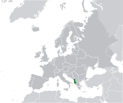 |
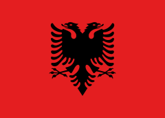
Albania[i] Republic of Albania |
Albanian: Shqipëri / Shqipëria — Republika e Shqipërisë | Tirana Albanian: Tiranë |
3,020,209 | 28,748 km2 (11,100 sq mi) |
 |
 |
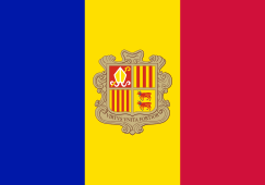
Andorra Principality of Andorra |
Catalan: Andorra — Principat d'Andorra | Andorra la Vella Catalan: Andorra la Vella |
85,458 | 468 km2 (181 sq mi) |
 |
 |
Armenia[b] Republic of Armenia |
Armenian: Հայաստան — Հայաստանի Հանրապետություն (Hayastan — Hayastani Hanrapetut'yun) | Yerevan Armenian: Երևան (Yerevan) |
3,060,631 | 29,743 km2 (11,484 sq mi) |
 |
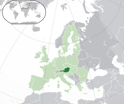 |
Austria* Republic of Austria |
German: Österreich — Republik Österreich | Vienna German: Wien |
8,223,062 | 83,871 km2 (32,383 sq mi) |
 |
 |
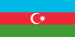
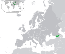
Azerbaijan[b] Republic of Azerbaijan |
Azerbaijani: Azǝrbaycan — Azǝrbaycan Respublikası | Baku Azerbaijani: Bakı |
9,686,210 | 86,600 km2 (33,436 sq mi) |
 |
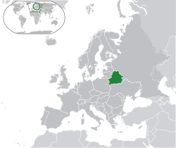 |
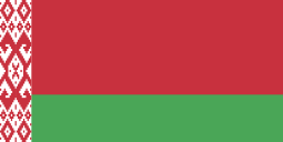
Belarus Republic of Belarus |
Belarusian: Беларусь — Рэспубліка Беларусь Russian: Беларусь — Республика Беларусь (Bielarus' — Respublika Belaruś) |
Minsk Belarusian: Мінск (Minsk) |
9,608,058 | 207,600 km2 (80,155 sq mi) |
 |
 |
Belgium* Kingdom of Belgium |
Dutch: België — Koninkrijk België French: Belgique — Royaume de Belgique German: Belgien — Königreich Belgien |
Brussels Dutch: Brussel French: Bruxelles German: Brüssel |
11,239,755 | 30,528 km2 (11,787 sq mi) |
 |
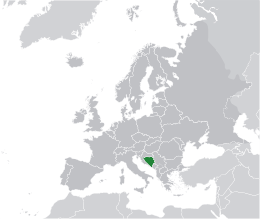 |
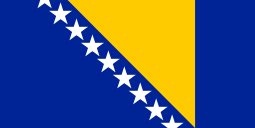
Bosnia and Herzegovina | Bosnian, Croatian, Serbian Latin: Bosna i Hercegovina Bosnian, Serbian Cyrillic: Босна и Херцеговина |
Sarajevo Bosnian, Croatian, Serbian Latin: Sarajevo Bosnian, Serbian Cyrillic: Сарајево |
3,871,643 | 51,197 km2 (19,767 sq mi) |
 |
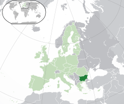 |
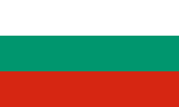
Bulgaria* Republic of Bulgaria |
Bulgarian: България — Република България (Bǎlgarija — Republika Bǎlgarija) | Sofia Bulgarian: София (Sofia) |
6,924,716 | 110,879 km2 (42,811 sq mi) |
 |
 |
Croatia* Republic of Croatia |
Croatian: Hrvatska — Republika Hrvatska | Zagreb Croatian: Zagreb |
4,470,534 | 56,594 km2 (21,851 sq mi) |
 |
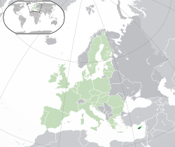 |
Cyprus*[c] Republic of Cyprus |
Greek: Κύπρος — Κυπριακή Δημοκρατία (Kýpros — Kypriakí Dimokratí) Turkish: Kıbrıs — Kıbrıs Cumhuriyeti |
Nicosia Greek: Λευκωσία (Lefkosia) Turkish: Lefkoşa |
1,172,458 | 9,251 km2 (3,572 sq mi) |
 |
 |
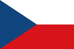
Czech Republic* | Czech: Česko — Česká republika | Prague Czech: Praha |
10,538,275 | 78,867 km2 (30,451 sq mi) |
 |
 |
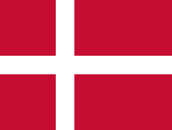
Denmark*[f] Kingdom of Denmark |
Danish: Danmark — Kongeriget Danmark | Copenhagen Danish: København |
5,569,077 | 2,210,000 km2 (853,286 sq mi) |
 |
 |
Estonia* Republic of Estonia |
Estonian: Eesti — Eesti Vabariik | Tallinn Estonian: Tallinn |
1,257,921 | 45,228 km2 (17,463 sq mi) |
 |
 |
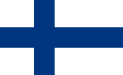
Finland* Republic of Finland |
Finnish: Suomi — Suomen tasavalta Swedish: Finland — Republiken Finland |
Helsinki Finnish: Helsinki Swedish: Helsingfors |
5,268,799 | 338,145 km2 (130,559 sq mi) |
 |
 |
France* French Republic |
French: France — République française | Paris French: Paris |
66,259,012 | 643,427 km2 (248,429 sq mi) |
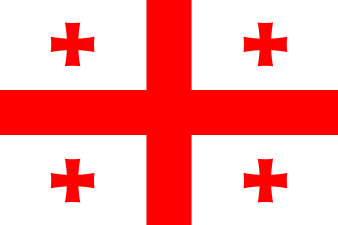 |
 |
Georgia[b] | Georgian: საქართველო (Sak'art'velo) | Tbilisi / T'bilisi Georgian: თბილისი (T'bilisi) |
4,935,880 | 69,700 km2 (26,911 sq mi) |
 |
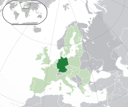 |
Germany* Federal Republic of Germany |
German: Deutschland — Bundesrepublik Deutschland | Berlin German: Berlin |
80,996,685 | 357,022 km2 (137,847 sq mi) |
 |
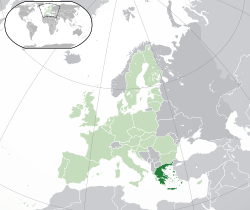 |
Greece* Hellenic Republic |
Greek: Ελλάς — Ελληνική Δημοκρατία (Ellás — Elliniki Dimokratia) | Athens Greek: Αθήνα (Athína) |
10,816,286 | 131,957 km2 (50,949 sq mi) |
 |
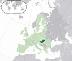 |
Hungary* | Hungarian: Magyarország | Budapest Hungarian: Budapest |
9,919,128 | 93,028 km2 (35,918 sq mi) |
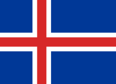 |
 |
Iceland Republic of Iceland |
Icelandic: Ísland — Lýðveldið Ísland | Reykjavík Icelandic: Reykjavík |
317,351 | 103,000 km2 (39,769 sq mi) |
 |
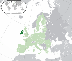 |
Ireland*[d][26] | English: Ireland Irish: Éire |
Dublin English: Dublin Irish: Baile Átha Cliath |
4,832,765 | 70,273 km2 (27,133 sq mi) |
 |
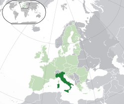 |
Italy* Italian Republic |
Italian: Italia — Repubblica Italiana | Rome Italian: Roma |
61,680,122 | 301,340 km2 (116,348 sq mi) |
 |
 |
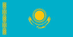
Kazakhstan[e] Republic of Kazakhstan |
Kazakh: Қазақстан — Қазақстан Республикасы (Qazaqstan — Qazaqstan Respūblīkasy) Russian: Казахстан — Республика Казахстан (Kazahstan — Respublika Kazahstan) |
Astana Kazakh: Астана Russian: Астана (Astana) |
17,948,816 | 2,724,900 km2 (1,052,090 sq mi) |
 |
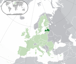 |
Latvia* Republic of Latvia |
Latvian: Latvija — Latvijas Republika | Riga Latvian: Rīga |
2,165,165 | 64,589 km2 (24,938 sq mi) |
 |
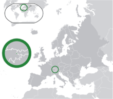 |
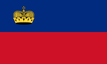
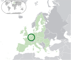
Liechtenstein Principality of Liechtenstein |
German: Liechtenstein — Fürstentum Liechtenstein | Vaduz German: Vaduz |
37,313 | 160 km2 (62 sq mi) |
 |
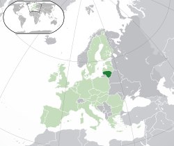 |
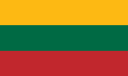
Lithuania* Republic of Lithuania |
Lithuanian: Lietuva — Lietuvos Respublika | Vilnius Lithuanian: Vilnius |
2,943,472 | 65,300 km2 (25,212 sq mi) |
 |
 |
Luxembourg* Grand Duchy of Luxembourg |
German: Luxemburg — Großherzogtum Luxemburg French: Luxembourg — Grand-Duché de Luxembourg Luxembourgish: Groussherzogtum Lëtzebuerg |
Luxembourg German: Luxemburg French: Luxembourg Luxembourgish: Lëtzebuerg |
520,672 | 2,586 km2 (998 sq mi) |
 |
 |
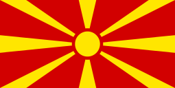
Macedonia[i] Republic of Macedonia |
Macedonian: Македонија — Република Македонија (Makedonija — Republika Makedonija) | Skopje Macedonian: Скопје (Skopje) |
2,091,719 | 25,713 km2 (9,928 sq mi) |
 |
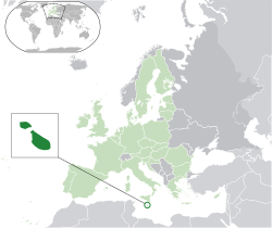 |
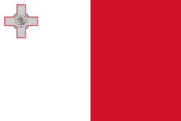
Malta* Republic of Malta |
English: Malta — Republic of Malta Maltese: Malta — Repubblika ta' Malta |
Valletta English: Valletta Maltese: Valletta |
412,655 | 316 km2 (122 sq mi) |
 |
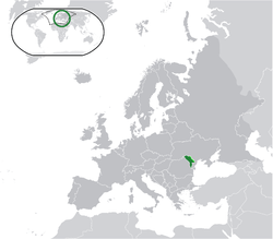 |
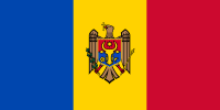
Moldova Republic of Moldova |
Romanian: Moldova — Republica Moldova | Chișinău Romanian: Chișinău |
3,583,288 | 33,851 km2 (13,070 sq mi) |
 |
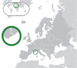 |
Monaco Principality of Monaco |
French: Monaco — Principauté de Monaco | Monaco French: Monaco |
30,508 | 2 km2 (0.8 sq mi) |
 |
 |
Montenegro[i] | Montenegrin: Црна Гора (Crna Gora) | Podgorica Montenegrin: Подгорица (Podgorica) |
650,036 | 13,812 km2 (5,333 sq mi) |
 |
 |
Netherlands*[f][g][13] Kingdom of the Netherlands |
Dutch: Nederland — Koninkrijk der Nederlanden | Amsterdam (capital) The Hague (seat of government) Dutch: Amsterdam Dutch: 's-Gravenhage / Den Haag |
16,877,351 | 41,543 km2 (16,040 sq mi) |
 |
 |
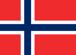
Norway Kingdom of Norway |
Bokmål: Norge — Kongeriket Norge Nynorsk: Noreg — Kongeriket Noreg |
Oslo Norwegian: Oslo |
5,147,792 | 323,802 km2 (125,021 sq mi) |
 |
 |
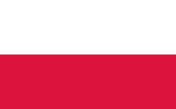
Poland* Republic of Poland |
Polish: Polska — Rzeczpospolita Polska | Warsaw Polish: Warszawa |
38,346,279 | 312,685 km2 (120,728 sq mi) |
 |
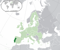 |
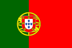
Portugal* Portuguese Republic |
Portuguese: Portugal — República Portuguesa | Lisbon Portuguese: Lisboa |
10,427,301 | 92,090 km2 (35,556 sq mi) |
 |
 |
Romania* | Romanian: România | Bucharest Romanian: București |
21,729,871 | 238,391 km2 (92,043 sq mi) |
 |
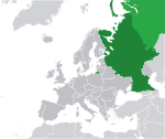 |
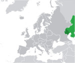
Russia[e] Russian Federation |
Russian: Росси́я — Российская Федерация (Rossija — Rossijskaja Federacija) | Moscow Russian: Москва (Moskva) |
146,267,288 | 17,098,242 km2 (6,601,668 sq mi) |
 |
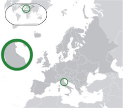 |
San Marino Republic of San Marino |
Italian: San Marino — Repubblica di San Marino | San Marino Italian: San Marino |
32,742 | 61 km2 (24 sq mi) |
 |
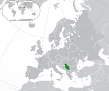 |
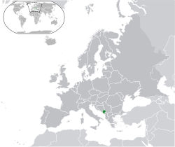
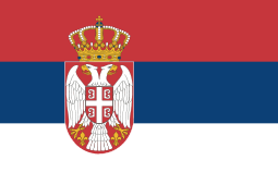
Serbia[i] Republic of Serbia |
Serbian: Србија — Република Србија, Srbija – Republika Srbija | Belgrade Serbian: Београд, Beograd |
7,209,764 | 88,361 km2 (34,116 sq mi) |
 |
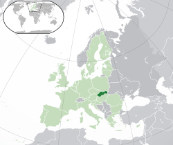 |
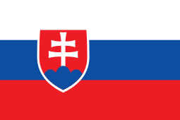
Slovakia* Slovak Republic |
Slovak: Slovensko — Slovenská republika | Bratislava Slovak: Bratislava |
5,443,583 | 49,035 km2 (18,933 sq mi) |
 |
 |
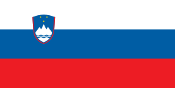
Slovenia* Republic of Slovenia |
Slovene: Slovenija — Republika Slovenija | Ljubljana Slovene: Ljubljana |
1,988,292 | 20,273 km2 (7,827 sq mi) |
 |
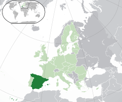 |
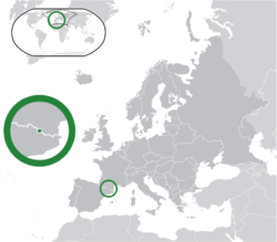
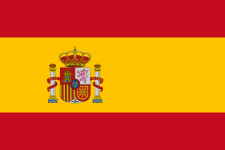
Spain* Kingdom of Spain |
Spanish: Reino de España | Madrid Spanish: Madrid |
47,737,941 | 505,370 km2 (195,124 sq mi) |
 |
 |
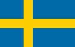
Sweden* Kingdom of Sweden |
Swedish: Sverige — Konungariket Sverige | Stockholm Swedish: Stockholm |
9,723,809 | 450,295 km2 (173,860 sq mi) |
 |
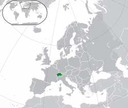 |
Switzerland Swiss Confederation |
German: Schweiz — Schweizerische Eidgenossenschaft French: Suisse — Confédération Suisse Italian: Svizzera — Confederazione Svizzera Romansh: Svizra — Confederaziun svizra |
Bern / Berne German: Bern French: Berne Italian: Berna |
8,061,516 | 41,277 km2 (15,937 sq mi) |
 |
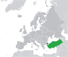 |
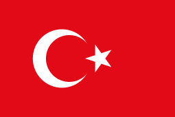
Turkey[e][i] Republic of Turkey |
Turkish: Türkiye — Türkiye Cumhuriyeti | Ankara Turkish: Ankara |
76,667,864 | 783,562 km2 (302,535 sq mi) |
 |
.svg.png) |
Ukraine | Ukrainian: Украïна (Ukraina) | Kiev Ukrainian: Київ (Kyiv) |
44,291,413 | 603,550 km2 (233,032 sq mi) |
 |
 |
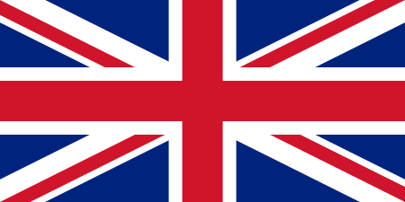
United Kingdom*[h] United Kingdom of Great Britain and Northern Ireland |
English: United Kingdom — United Kingdom of Great Britain and Northern Ireland | London English: London |
63,742,977 | 243,610 km2 (94,058 sq mi) |
 |
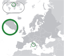 |
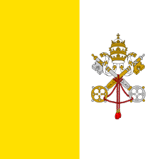
Vatican City Vatican City State |
Italian: Città del Vaticano — Stato della Città del Vaticano Latin: Sancta Sedes[27] |
Vatican City Italian: Città del Vaticano |
842 | 0.44 km2 (0.17 sq mi) |
States with limited recognition
The following six entities in Europe have partial diplomatic recognition by one or more UN member states (and therefore are defined as states by the constitutive theory of statehood) or have no diplomatic recognition by any UN member state but are defined as states by the declarative theory of statehood and are recognised by one or more Non-UN member states. None are members of the UN, Council of Europe or EU.
| Flag | Map | English short and formal names | Status | Domestic short and formal names | Capital | Population[a] | Area[a] |
|---|---|---|---|---|---|---|---|
 |
 |
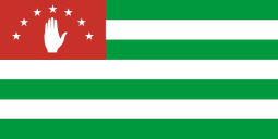
Abkhazia[b] Republic of Abkhazia |
Claimed as an autonomous republic of Georgia. Recognised by four UN states.[28] | Abkhaz: Аҧсны (Apsny) Russian: Абха́зия (Abhazia) |
Sukhumi Abkhaz: Аҟəа (Akwa) Russian: Сухуми |
250,000 [29] | 8,660 km2 (3,344 sq mi)[30] |
 |
 |
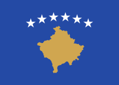
Kosovo Republic of Kosovo[19] |
Recognised by 110 UN member states;[31] Serbia does not recognise the 2008 Kosovo declaration of independence, and considers it an autonomous province. | Albanian: Kosova / Kosovë — Republika e Kosovës Serbian: Косово — Република Косово, Kosovo – Republika Kosovo |
Pristina[22] Albanian: Prishtina, Prishtinë Serbian: Приштина, Priština |
1,836,529[24] | 10,887 km2 (4,203 sq mi)[25] |
 |
 |
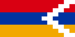
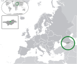
Nagorno-Karabakh[b] Nagorno-Karabakh Republic |
Claimed as part of Azerbaijan. De facto independent state,[32] recognised by 3 non-UN states. | Armenian: Լեռնային Ղարաբաղ — Լեռնային Ղարաբաղ Հանրապետություն (Lernayin Gharabaghi — Lernayin Gharabaghi Hanrapetut’yun)[33] | Stepanakert Armenian: Ստեփանակերտ (Khankendi) |
141,400[34] | 7,000 km2 (2,703 sq mi)[35] |
 |
 |
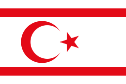
Northern Cyprus[c] Turkish Republic of Northern Cyprus |
Claimed as part of the Republic of Cyprus. Recognised by Turkey.[36] | Turkish: Kuzey Kıbrıs — Kuzey Kıbrıs Türk Cumhuriyeti | Nicosia Turkish: Lefkoşa |
294,906[37] | 3,355 km2 (1,295 sq mi)[25] |
 |
 |
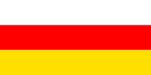
South Ossetia[b] Republic of South Ossetia |
Claimed as part of Georgia. Recognised by four UN states.[28] | Ossetian: Хуссар Ирыстон — Республикæ Хуссар Ирыстон (Khussar Iryston — Respublikæ Khussar Iryston) Russian: Южная Осетия — Республика Южная Осетия (Yuzhnaya Osetiya — Respublika Yuzhnaya Osetiya) |
Tskhinvali Ossetian: Цхинвал or Чъреба (Chreba) |
70,000[38] | 3,900 km2 (1,506 sq mi)[39] |
.svg.png) |
.svg.png) |
Transnistria / Trans-Dniester Pridnestrovian Moldavian Republic |
Claimed as a territorial unit of Moldova. De facto independent state,[32] recognised by 3 non-UN states. | Moldovan: Нистрянэ — Република Молдовеняскэ Нистрянэ (Transnistria — Republica Moldovenească Nistreană) Russian: Приднестрóвье — Приднестрóвская Молдáвская Респýблика (Pridnestrov'ye — Pridnestrovskaya Moldavskaya Respublika) Ukrainian: Придністров'я — Придністровська Молдавська Республіка (Prydnistrov'ya — Pridnistrovs'ka Moldavs'ka Respublika) |
Tiraspol Moldovan: Тираспол Russian: Тирáсполь Ukrainian: Тирасполь |
530,000[40] | 3,500 km2 (1,351 sq mi)[41] |
Dependent territories
The following six European entities are dependent territories.[42]
| * | = Part of the EU, although there may be special arrangements |
| Flag | Map | English short and formal names[19][21] | Legal status | Domestic short and formal names | Capital[22] | Population[24] | Area[25] |
|---|---|---|---|---|---|---|---|
| |
 |
Akrotiri and Dhekelia [c] Sovereign Base Areas of Akrotiri and Dhekelia |
British overseas territory | English: Akrotiri and Dhekelia — Sovereign Base Areas of Akrotiri and Dhekelia | Episkopi Cantonment English: Episkopi Cantonment |
15,700 | 254 km2 (98 sq mi) |
 |
 |
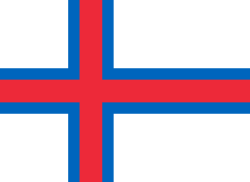
Faroe Islands / Faeroe Islands | Constituent country of the Kingdom of Denmark | Faroese: Føroyar Danish: Færøerne |
Tórshavn Faroese: Tórshavn Danish: Thorshavn |
49,947 | 1,393 km2 (538 sq mi) |
 |
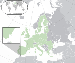 |
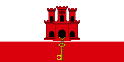
Gibraltar*[43] | British overseas territory | English: Gibraltar | Gibraltar English: Gibraltar |
29,185 | 6.5 km2 (2.5 sq mi) |
 |
 |
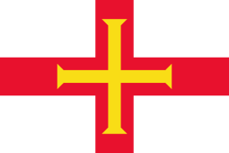
Guernsey[h] Bailiwick of Guernsey |
Crown Dependency in right of Guernsey[44][45][46] | English: Guernsey — Bailiwick of Guernsey French: Guernesey — Bailliage de Guernesey Guernésiais: Guernesey — Bailliage de Guernesey |
Saint Peter Port English: Saint Peter Port French: Saint Pierre Port Guernésiais: Saint Pierre Port |
65,849 | 78 km2 (30 sq mi) |
 |
 |
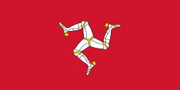
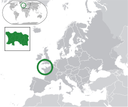
Isle of Man[h] | Crown Dependency in right of Man[46][47][48] | English: Isle of Man Manx: Mannin — Ellan Vannin |
Douglas English: Douglas Manx: Doolish |
86,866 | 572 km2 (221 sq mi) |
 |
 |
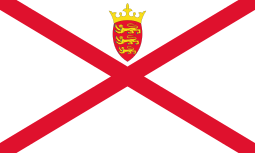
Jersey[h] Bailiwick of Jersey |
Crown Dependency in right of Jersey[44][45][46] | English: Jersey — Bailiwick of Jersey French: Jèrri — Bailliage de Jèrri Jèrriais: Jèrri — Bailliage de Jèrri |
Saint Helier English: Saint Helier French: Saint-Hélier Jèrriais: Saint Hélyi |
96,513 | 118 km2 (46 sq mi) |
Special areas of internal sovereignty
The following places are considered integral parts of their controlling state, but have a political arrangement which was decided through an international agreement.
| * | = Part of the EU, although there may be special arrangements |
| Flag | Map | English short and formal names | Legal status | Domestic short and formal names | Capital | Population | Area |
|---|---|---|---|---|---|---|---|
 |
 |
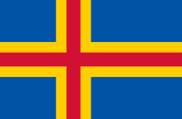
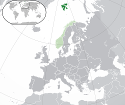
Åland*[49] Åland Islands[21] |
Self-governing area of Finland, significant autonomy as the result of the Åland crisis[50] | Swedish: Åland — Landskapet Åland | Mariehamn[21] Swedish: Mariehamn |
27,500[51] | 6,787 km2 (2,620 sq mi)[51] |
| |
 |
Northern Ireland* | Part of the United Kingdom, devolved government determined by the Good Friday Agreement[52] | Northern Ireland[53] | Belfast[53] | 1,810,863 [54] | 14,130 km2 (5,456 sq mi)[53] |
| |
 |
Svalbard[19] | Special territory of Norway, determined by the Svalbard Treaty[55] | Norwegian: Svalbard | Longyearbyen[21][22] Norwegian: Longyearbyen |
2,019[24] | 62,045 km2 (23,956 sq mi)[25] |
See also
- Lists of European countries:
- International organisations in Europe
- List of former sovereign states in Europe
- Predecessors of sovereign states in Europe
- Timeline of European nations
- Geopolitical divisions of Europe
Notes
- ^ a b c d e f Area and population numbers include integral areas located outside of Europe. The area and population of states with separatist regions includes that of the separatist regions.
- ^ a b c d e f Part of Transcaucasian Region, at the crossroads of Europe and Asia. Physiographically, Armenia falls entirely in Western Asia, while Georgia and Azerbaijan are mostly in Asia with small portions north of the Caucasus Mountains divide in Europe.
- ^ a b c The island of Cyprus is located on the Cyprian arc on the edge of the Asian Anatolian Plate and is physiographically associated with Asia, but it is part of European organisations such as the EU.
- ^ The terms Republic of Ireland and Poblacht na hÉireann are not official long names and are used only as a legal description meant to differentiate the state from the island.
- ^ a b c Kazakhstan, Russia and Turkey have territory in both Europe (dark green) and Asia (light green).
- ^ a b Denmark and the Netherlands are constituent countries of the Kingdom of Denmark and the Kingdom of the Netherlands respectively. Both are members of the EU; however, the other constituent countries of their kingdoms are not. In international organisations, the terms Denmark and Netherlands are often used as short forms of their respective kingdoms as a whole.
- ^ The Netherlands is also known as "Holland", but this is the improper name of the whole country as it refers only to a small region inside the country. See Netherlands (terminology).
- ^ a b c d The United Kingdom consists of the countries of England, Northern Ireland, Scotland and Wales. The UK is responsible for the foreign relations and ultimate good governance of the Crown dependencies of Guernsey, the Isle of Man and Jersey, which are otherwise separate. The mainlands of England, Scotland and Wales make up the island of Great Britain (or simply Britain), which is sometimes used synonymously with the United Kingdom.
- ^ a b c d e f EU candidate country.
References
- ↑ Charles T. Evans (2009-07-01). "Ural Mountains". Novaonline.nvcc.edu. Retrieved 2011-02-17.
- ↑ "The Ural River". Geography.howstuffworks.com. 2008-03-30. Retrieved 2011-02-17.
- ↑ Charles T. Evans (2009-07-01). "Caucasus Mountains". Novaonline.nvcc.edu. Retrieved 2011-02-17.
- ↑ Charles T. Evans (2009-07-01). "Black Sea". Novaonline.nvcc.edu. Retrieved 2011-02-17.
- 1 2 Microsoft Encarta Online Encyclopaedia 2007. Europe. Archived from the original on 31 October 2009. Retrieved 2007-12-27.
- ↑ Shimon Wdowinski; Zvi Ben-Avraham; Ronald Arvidsson; Goran Ekström (2006). "Seismotectonics of the Cyprian Arc" (PDF). Geophysics Journal International. 164 (164): 176–181. Bibcode:2006GeoJI.164..176W. doi:10.1111/j.1365-246X.2005.02737.x. Retrieved 2011-03-05.
- ↑ "Council of Europe in Brief". Coe.int. Retrieved 2011-02-17.
- ↑ "Geological Development of the Sicilian-Tunisian Platform held in Italy (University of Urbino) on November 4, 5, 6, 1992". Oai.dtic.mil. 1992-11-06. Retrieved 2011-02-17.
- ↑ "Understanding plate motions [This Dynamic Earth, USGS]". Pubs.usgs.gov. 1994-06-09. Retrieved 2011-03-03.
- ↑ "CIA - The World Factbook". Cia.gov. Retrieved 2011-02-17.
- ↑ Richard Connor (2010-01-11). "French overseas territories vote to remain close to Paris". Dw-world.de. Retrieved 2011-02-17.
- ↑ "Regions and territories: Ceuta, Melilla". BBC News. 2010-10-06. Retrieved 2011-02-17.
- 1 2 "Netherlands". Cia.gov. Retrieved 2011-02-17.
- ↑ "Untying the Sovereign State: A Double Reading of the Anarchy Problematique". Mil.sagepub.com. 1988-06-01. Retrieved 2011-02-24.
- ↑ "Montevideo Convention on the Rights and Duties of States - Council on Foreign Relations". Cfr.org. Retrieved 2011-02-24.
- ↑ "United Nations Member States". United Nations. Retrieved 24 February 2011.
- ↑ "47 countries, 1 Europe". Council of Europe. Retrieved 17 February 2011.
- ↑ "Member States". Europa. Retrieved 17 February 2011.
- 1 2 3 4 5 "Field Listing :: Names". Central Intelligence Agency. Retrieved 30 September 2016.
- 1 2 "UNGEGN List of Country Names" (PDF). United Nations Statistics Division. 2007. Retrieved 2011-02-24.
- 1 2 3 4 5 6 "List of countries, territories and currencies". Europa. 9 August 2011. Retrieved 10 August 2011.
- 1 2 3 4 "Field Listing :: Capital". Central Intelligence Agency. Retrieved 17 February 2011.
- ↑ "UNGEGN World Geographical Names". United Nations Group of Experts on Geographical Names. 13 September 2010. Retrieved 24 February 2011.
- 1 2 3 4 "Country Comparison :: Population". Central Intelligence Agency. July 2014. Retrieved 17 October 2014.
- 1 2 3 4 5 "Field Listing :: Area". Central Intelligence Agency. Retrieved 3 March 2011.
- ↑ "Republic of Ireland Act, 1948". No. 22/1948. 1948. Retrieved 2008-12-16.
- ↑ "Holy See (Vatican City)". Cia.gov. Retrieved 2011-02-24.
- 1 2 "Tuvalu Retracts Recognition Of Abkhazia, South Ossetia". Radio Free Europe/Radio Liberty. 2014-03-31.
- ↑ "Regions and territories: Abkhazia". BBC News. 2011-02-08. Retrieved 2011-02-17.
- ↑ "Abkhazia (autonomous republic, Georgia)". Britannica.com. Retrieved 2011-03-03.
- ↑ "Countries that have recognized the Republic of Kosova". Ministry of Foreign Affairs of Kosovo.
- 1 2 Ker-Lindsay, James (2012). The Foreign Policy of Counter Secession: Preventing the Recognition of Contested States. Oxford University Press. p. 53.
...there are three other territories that have unilaterally declared independence and are generally regarded as having met the Montevideo criteria for statehood but have not been recognized by any states: Transnistria, Nagorny Karabakh, and Somaliland.
. - ↑ "Country Overview". nkrusa.org. Retrieved 2011-03-07.
- ↑ "Official website of the President of the Nagorno Karabagh Republic". President.nkr.am. 2010-01-01. Retrieved 2011-02-17.
- ↑ "Nagorno-Karabakh (region, Azerbaijan)". Britannica.com. Retrieved 2011-03-03.
- ↑ "Cyprus". Encyclopædia Britannica.
- ↑ "Turkish Cyprus announces population as 294,906". World Bulletin. 2011-12-09. Retrieved 2014-01-09.
- ↑ "Regions and territories: South Ossetia". BBC News. 2011-02-08. Retrieved 2011-02-17.
- ↑ "South Ossetia". Hartford-hwp.com. Retrieved 2011-03-09.
- ↑ "Trans-Dniester profile". BBC News. 2011-01-20. Retrieved 2011-02-17.
- ↑ "Transdniestria (separatist enclave, Moldova)". Britannica.com. Retrieved 2011-03-03.
- ↑ "CIA - The World Factbook - Field Listing :: Dependency status". Cia.gov. 1920-02-09. Retrieved 2011-02-17.
- ↑ Mark Oliver, Sally Bolton, Jon Dennis and Matthew Tempest (2004-08-04). "Gibraltar; Politics". Guardian. Retrieved 2011-02-17.
- 1 2 Supreme Court decision
- 1 2 Queen and Crown dependencies page of the official website of the British Monarchy
- 1 2 3 Ministry of Justice's fact sheet on the UK’s relationship with the Crown Dependencies
- ↑ Supreme Court decision "The Channel Islands, like the Isle of Man (although it has a rather different history), are not part of the United Kingdom. Nor have they ever been British colonies, or British Overseas Territories as the few remaining colonies are now termed. They are Crown Dependencies, enjoying a unique relationship with the United Kingdom and the rest of the British Commonwealth through the Crown, in the person of the Sovereign."
- ↑ Queen and Crown dependencies page of the official website of the British Monarchy
- ↑ European Commission for Democracy through Law (1996). Local self-government, territorial integrity, and protection of minorities: proceedings of the UniDem Seminar organised in Lausanne on 25–27 April 1996, in co-operation with the Swiss Institute of Comparative Law. Strasbourg: Council of Europe. pp. 32–35. ISBN 92-871-3173-2.
- ↑ "Independence". Visitaland.com. Retrieved 2011-03-03.
- 1 2 "Åland Official Tourist Gateway - Facts". Visitaland.com. Retrieved 2011-02-17.
- ↑ "Good Friday Agreement". Encyclopedia Britannica. Retrieved 7 July 2015.
- 1 2 3 "The Countries of the UK". Office for National Statistics. Office for National Statistics (United Kingdom). Retrieved 7 July 2015.
- ↑ Northern Ireland Statistics & Research Agency (December 2012). "Census 2011 Key Statistics for Northern Ireland" (PDF). Retrieved 14 January 2013.
- ↑ "The Svalbard Treaty". Governor of Svalbard. 2008-04-09. Retrieved 2011-03-03.
| Sovereign states |
| .svg.png) | |||||||||||||
|---|---|---|---|---|---|---|---|---|---|---|---|---|---|---|---|
Dependencies and other territories |
| ||||||||||||||