List of heritage sites in Table Mountain
This is a list of the heritage sites in Table Mountain as recognized by the South African Heritage Resources Agency.[1]
| SAHRA identifier | Site name | Description | Town | District | NHRA status | Coordinates | Image |
|---|---|---|---|---|---|---|---|
| 9/2/018/0022 | Table Mountain | Provincial Heritage Site | 33°57′37″S 18°25′05″E / 33.960207°S 18.418032°E | 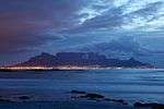 | |||
| 9/2/018/0022-066 | Erf 3559, Hout Bay | Table Mountain | Provincial Heritage Site | 34°00′24″S 18°22′40″E / 34.006716°S 18.377874°E | 
| ||
| 9/2/018/0022-069 | Erf 3560, Hout Bay | Table Mountain | Provincial Heritage Site | 34°00′25″S 18°22′42″E / 34.006854°S 18.378228°E |
| ||
| 9/2/018/0022-070 | Erf 1174, Tamboerskloof | Table Mountain | Provincial Heritage Site | 33°55′35″S 18°23′55″E / 33.926491°S 18.398731°E |
| ||
| 9/2/018/0022-071 | Erf 2977, Hout Bay | Table Mountain | Provincial Heritage Site | 34°00′26″S 18°22′17″E / 34.007214°S 18.371351°E |
| ||
| 9/2/018/0022-072 | Erf 12, Fresnaye | Table Mountain | Provincial Heritage Site | 33°55′49″S 18°23′08″E / 33.930250°S 18.385486°E |
| ||
| 9/2/018/0022-073 | Erf 3079, Hout Bay | Table Mountain | Provincial Heritage Site | 34°02′00″S 18°21′00″E / 34.033333°S 18.350000°E |  | ||
| 9/2/018/0022-074 | Erf 1, Fresnaye | Table Mountain | Provincial Heritage Site | 33°55′30″S 18°23′15″E / 33.925030°S 18.387549°E |
| ||
| 9/2/018/0022-075 | Erf 1171, Tamboerskloof | Table Mountain | Provincial Heritage Site | 33°55′45″S 18°24′15″E / 33.929167°S 18.404167°E |
| ||
| 9/2/018/0022-076 | Erf 1175, Tamboerskloof | Table Mountain | Provincial Heritage Site | 33°55′45″S 18°24′15″E / 33.929167°S 18.404167°E |
| ||
| 9/2/018/0022-077 | Erf 1173, Tamboerskloof | Table Mountain | Provincial Heritage Site | 33°55′45″S 18°24′15″E / 33.929167°S 18.404167°E |
| ||
| 9/2/018/0022-078 | Erf 1815, Vredehoek | Table Mountain | Provincial Heritage Site | 33°56′15″S 18°25′30″E / 33.937500°S 18.425000°E |
| ||
| 9/2/018/0022-079 | Erf 1762, Hout Bay | Table Mountain | Provincial Heritage Site | 34°02′00″S 18°21′00″E / 34.033333°S 18.350000°E |
| ||
| 9/2/018/0022-080 | Erf 1140, Tamboerskloof | Table Mountain | Provincial Heritage Site | 33°55′45″S 18°24′15″E / 33.929167°S 18.404167°E |
| ||
| 9/2/018/0022-081 | Erf 1033, Tamboerskloof | Table Mountain | Provincial Heritage Site | 33°55′45″S 18°24′15″E / 33.929167°S 18.404167°E |
| ||
| 9/2/018/0022-082 | Erf 1362, Fresnaye | Table Mountain | Provincial Heritage Site | 33°55′30″S 18°23′15″E / 33.925030°S 18.387549°E |
| ||
| 9/2/018/0022-083 | Erf 1243, Fresnaye | Table Mountain | Provincial Heritage Site | 33°55′30″S 18°23′15″E / 33.925030°S 18.387549°E |
| ||
| 9/2/018/0022-084 | Erf 13, Fresnaye | Table Mountain | Provincial Heritage Site | 33°55′30″S 18°23′15″E / 33.925030°S 18.387549°E |
| ||
| 9/2/018/0022-085 | Erf 1250, Fresnaye | Table Mountain | Provincial Heritage Site | 33°55′30″S 18°23′15″E / 33.925030°S 18.387549°E |
| ||
| 9/2/018/0022-086 | Erf 1251, Fresnaye | Table Mountain | Provincial Heritage Site | 33°55′30″S 18°23′15″E / 33.925030°S 18.387549°E |
| ||
| 9/2/018/0022-087 | Erf 1244, Fresnaye | Table Mountain | Provincial Heritage Site | 33°55′30″S 18°23′15″E / 33.925030°S 18.387549°E |
| ||
| 9/2/018/0022-088 | Erf 1172, Tamboerskloof | Table Mountain | Provincial Heritage Site | 33°55′45″S 18°24′15″E / 33.929167°S 18.404167°E |
| ||
| 9/2/018/0022-089 | Erf 512, Fresnaye | Table Mountain | Provincial Heritage Site | 33°55′30″S 18°23′15″E / 33.925030°S 18.387549°E |
| ||
| 9/2/018/0022-091 | Erf 2, Fresnaye | Table Mountain | Provincial Heritage Site | 33°55′30″S 18°23′15″E / 33.925030°S 18.387549°E |
| ||
| 9/2/018/0022-092 | Erf 1231, Fresnaye | Table Mountain | Provincial Heritage Site | 33°55′30″S 18°23′15″E / 33.925030°S 18.387549°E |
| ||
| 9/2/018/0022-093 | Erf 1242, Fresnaye | Table Mountain | Provincial Heritage Site | 33°55′30″S 18°23′15″E / 33.925030°S 18.387549°E |
| ||
| 9/2/018/0022-094 | Erf 14, Fresnaye | Table Mountain | Provincial Heritage Site | 33°55′30″S 18°23′15″E / 33.925030°S 18.387549°E |
| ||
| 9/2/018/0022-095 | Erf 1412, Fresnaye | Table Mountain | Provincial Heritage Site | 33°55′30″S 18°23′15″E / 33.925030°S 18.387549°E |
| ||
| 9/2/018/0022-096 | Erf 3, Fresnaye | Table Mountain | Provincial Heritage Site | 33°55′30″S 18°23′15″E / 33.925030°S 18.387549°E |
| ||
| 9/2/018/0022-097 | Erf 1033, Tamboerskloof | Table Mountain | Provincial Heritage Site | 33°55′45″S 18°24′15″E / 33.929167°S 18.404167°E |
| ||
| 9/2/018/0022-098 | Erf 1738, Hout Bay | Table Mountain | Provincial Heritage Site | 34°02′00″S 18°21′00″E / 34.033333°S 18.350000°E |
| ||
| 9/2/018/0022-100 | Erf 1749, Hout Bay | Table Mountain | Provincial Heritage Site | 34°02′00″S 18°21′00″E / 34.033333°S 18.350000°E |
| ||
| 9/2/018/0022-102 | Erf 1759, Hout Bay | Table Mountain | Provincial Heritage Site | 34°02′00″S 18°21′00″E / 34.033333°S 18.350000°E |
| ||
| 9/2/018/0022-103 | Erf 1734, Hout Bay | Table Mountain | Provincial Heritage Site | 34°02′00″S 18°21′00″E / 34.033333°S 18.350000°E |
| ||
| 9/2/018/0022-104 | Erf 1737, Hout Bay | Table Mountain | Provincial Heritage Site | 34°02′00″S 18°21′00″E / 34.033333°S 18.350000°E |
| ||
| 9/2/018/0022-105 | Erf 1756, Hout Bay | Table Mountain | Provincial Heritage Site | 34°02′00″S 18°21′00″E / 34.033333°S 18.350000°E |
| ||
| 9/2/018/0022-106 | Erf 2939, Hout Bay | Table Mountain | Provincial Heritage Site | 34°02′00″S 18°21′00″E / 34.033333°S 18.350000°E |
| ||
| 9/2/018/0022-108 | Erf 614, Vredehoek | Table Mountain | Provincial Heritage Site | 33°56′15″S 18°25′30″E / 33.937500°S 18.425000°E |
| ||
| 9/2/018/0022-113 | Erf 956, Tamboerskloof | Table Mountain | Provincial Heritage Site | 33°55′45″S 18°24′15″E / 33.929167°S 18.404167°E | 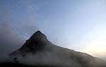 | ||
| 9/2/018/0022-114 | Erf 1139, Vredehoek | Table Mountain | Provincial Heritage Site | 34°02′00″S 18°21′00″E / 34.033333°S 18.350000°E |
| ||
| 9/2/018/0022-118 | Erf 658, Oranjezicht | Table Mountain | Provincial Heritage Site | 33°56′30″S 18°24′50″E / 33.941667°S 18.413889°E |
| ||
| 9/2/018/0022-119 | Erf 1966, Oranjezicht | Table Mountain | Provincial Heritage Site | 33°56′30″S 18°24′50″E / 33.941667°S 18.413889°E |
| ||
| 9/2/018/0022-120 | Erf 1137, Tamboerskloof | Table Mountain | Provincial Heritage Site | 33°55′45″S 18°24′15″E / 33.929167°S 18.404167°E |
| ||
| 9/2/018/0022-122 | Erf 2084, Vredehoek | Table Mountain | Provincial Heritage Site | 33°56′15″S 18°25′30″E / 33.937500°S 18.425000°E |
| ||
| 9/2/018/0022-124 | Erf 12713, Woodstock | Table Mountain | Provincial Heritage Site | 33°55′50″S 18°26′50″E / 33.930556°S 18.447222°E |
| ||
| 9/2/018/0022-130 | Erf 1213, Vredehoek | Table Mountain | Provincial Heritage Site | 33°56′15″S 18°25′30″E / 33.937500°S 18.425000°E |
| ||
| 9/2/018/0022/02 | 902 Oudekraal | Table Mountain | Table Mountain |
| |||
| 9/2/018/0022/02/1 | Portion 3 of Farm 902, Oudekraal (White House Site), Table Mountain Chain | Table Mountain | Table Mountain |
| |||
| 9/2/018/0022/03 | The Roundhouse | Table Mountain | 33°56′37″S 18°23′06″E / 33.943518°S 18.384940°E |
|
References
- ↑ "Western Cape Provincial Heritage Sites (previously National Monuments)" (PDF). 19 September 2002. Retrieved 2013-01-28.
Lists of South African Heritage Resources | ||||||||||||||||||||||||||||||||||||
|---|---|---|---|---|---|---|---|---|---|---|---|---|---|---|---|---|---|---|---|---|---|---|---|---|---|---|---|---|---|---|---|---|---|---|---|---|
| SAHRA Heritage sites |
| |||||||||||||||||||||||||||||||||||
| World heritage sites | ||||||||||||||||||||||||||||||||||||
This article is issued from Wikipedia - version of the 9/14/2015. The text is available under the Creative Commons Attribution/Share Alike but additional terms may apply for the media files.