List of heritage sites in Paarl
This is a list of the heritage sites in Paarl as recognized by the South African Heritage Resource Agency.[1]
| SAHRA identifier | Site name | Description | Town | District | NHRA status | Coordinates | Image |
|---|---|---|---|---|---|---|---|
| 9/2/068/0037 | DE RUST LOCAL AREA, GENERAL | De Rust | Paarl | 
| |||
| 9/2/069/0001 | Dal Josafat, Paarl District (SAHRA owned) | Paarl | Paarl | 33°42′00″S 19°01′00″E / 33.700011°S 19.016634°E | 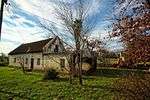 | ||
| 9/2/069/0001/001 | Roggeland, Daljosafat, Paarl District | The Goede Rust was originally granted in 1693. The farms in this valley were for centuries in the hands of the French Huguenots and their descendants. There are approximately 14 historic buildings in the Cape Dutch or Victorian Style, the most important o Type of site: Farm Complex. | Paarl | Paarl | Provincial Heritage Site | 33°41′25″S 19°00′09″E / 33.690246°S 19.002485°E |  |
| 9/2/069/0001/001-01 | Main House, Roggeland, Daljosafat, Paarl District | Type of site: Farmhouse. | Paarl | Paarl | Provincial Heritage Site | 33°41′25″S 19°00′09″E / 33.690246°S 19.002485°E |
|
| 9/2/069/0001/001-02 | Wine cellar, Roggeland, Daljosafat, Paarl District | Type of site: Wine Cellar. | Paarl | Paarl | Provincial Heritage Site | 33°41′25″S 19°00′09″E / 33.690246°S 19.002485°E |
|
| 9/2/069/0001/001-03 | Jonkershuis, Roggeland, Daljosafat, Paarl District | Type of site: Jonkershuis. | Paarl | Paarl | Provincial Heritage Site | 33°41′25″S 19°00′09″E / 33.690246°S 19.002485°E |
|
| 9/2/069/0001/001-04 | Cottage, Roggeland, Daljosafat, Paarl District | Type of site: Labourer's Cottage. | Paarl | Paarl | Provincial Heritage Site | 33°41′25″S 19°00′09″E / 33.690246°S 19.002485°E |
|
| 9/2/069/0001/002 | Non Pareille, Daljosafat, Paarl District | Type of site: Farm Complex. STATEMENT OF SIGNIFICANCE
The Daljosafat Cultural Landscape is signifincant because of its idyllic setting, rich history associated with living heritage and a distinctive cultural environment. It boats a distinct Cape Vernacular Architecture with an aest |
Paarl | Paarl | National Heritage Site | 33°41′25″S 19°00′09″E / 33.690246°S 19.002485°E |
|
| 9/2/069/0001/002-01 | Main House, Non Pareille, Daljosafat, Paarl District | Type of site: Farmhouse. | Paarl | Paarl | Provincial Heritage Site | 33°41′25″S 19°00′09″E / 33.690246°S 19.002485°E |
|
| 9/2/069/0001/002-02 | Wine cellar, Non Pareille, Daljosafat, Paarl District | Type of site: Wine Cellar. | Paarl | Paarl | Provincial Heritage Site | 33°41′25″S 19°00′09″E / 33.690246°S 19.002485°E |
|
| 9/2/069/0001/002-03 | Jonkershuis, Non Pareille, Daljosafat, Paarl District | Type of site: Jonkershuis. | Paarl | Paarl | Provincial Heritage Site | 33°41′25″S 19°00′09″E / 33.690246°S 19.002485°E |
|
| 9/2/069/0001/002-04 | Cow shed, Non Pareille, Daljosafat, Paarl District | Type of site: Cow Shed. | Paarl | Paarl | Provincial Heritage Site | 33°41′25″S 19°00′09″E / 33.690246°S 19.002485°E |
|
| 9/2/069/0001/002-05 | Large shed, Non Pareille, Daljosafat, Paarl District | Type of site: Shed. | Daljosafat | Paarl | Provincial Heritage Site | 33°41′25″S 19°00′09″E / 33.690246°S 19.002485°E |
|
| 9/2/069/0001/002-06 | Cottage #1, Non Pareille, Daljosafat, Paarl District | Type of site: Labourer's Cottage. | Paarl | Paarl | Provincial Heritage Site | 33°41′25″S 19°00′09″E / 33.690246°S 19.002485°E |
|
| 9/2/069/0001/003 | Goede Rust, Daljosafat, Paarl District | Type of site: Farm Complex. | Paarl | Paarl | Provincial Heritage Site | 33°41′25″S 19°00′09″E / 33.690246°S 19.002485°E |
|
| 9/2/069/0001/003-01 | Main House, Goede Rust, Daljosafat, Paarl District | Type of site: Farmhouse. | Paarl | Paarl | Provincial Heritage Site | 33°41′25″S 19°00′09″E / 33.690246°S 19.002485°E |
|
| 9/2/069/0001/003-02 | Wine cellar, Goede Rust, Daljosafat, Paarl District | Type of site: Wine Cellar. | Paarl | Paarl | Provincial Heritage Site | 33°41′25″S 19°00′09″E / 33.690246°S 19.002485°E |
|
| 9/2/069/0001/003-03 | Wagon House, Goede Rust, Daljosafat, Paarl District | Type of site: Wagon House. | Paarl | Paarl | Provincial Heritage Site | 33°41′25″S 19°00′09″E / 33.690246°S 19.002485°E |
|
| 9/2/069/0001/003-04 | Cottage, Goede Rust, Daljosafat, Paarl District | Type of site: Labourer's Cottage. | Paarl | Paarl | Provincial Heritage Site | 33°41′25″S 19°00′09″E / 33.690246°S 19.002485°E |
|
| 9/2/069/0001/003-05 | Labourers' cottage #1, Goede Rust, Daljosafat, Paarl District | Type of site: Labourer's Cottage. | Paarl | Paarl | Provincial Heritage Site | 33°41′25″S 19°00′09″E / 33.690246°S 19.002485°E |
|
| 9/2/069/0001/003-06 | Labourers' cottage #2, Goede Rust, Daljosafat, Paarl District | Type of site: Labourer's Cottage. | Paarl | Paarl | Provincial Heritage Site | 33°41′25″S 19°00′09″E / 33.690246°S 19.002485°E |
|
| 9/2/069/0001/005 | Hugo Cemetery, Daljosafat, Paarl District | This is a complex of three separate farms which had been consolidated. The farms Goede Rust and Non Pareille were originally granted in 1690 and Roggeland in 1693. These farms were for centuries in the hands of the French Hueguenots and their desce Type of site: Graveyard. The farms Non Pareille and Goede Rust were originally granted in 1690 and Roggeland in 1693. These farms were for centuries in the hands of the French Huguenots and their descendants. There are approximately 14 historic buildings in the Cape Dutch or Vic | Paarl, Daljosafat | Paarl | Provincial Heritage Site | 33°41′31″S 19°00′07″E / 33.691820°S 19.001888°E |
|
| 9/2/069/0001/4 | see 9/2/069/0052 | Paarl | Paarl | National Monument |
| ||
| 9/2/069/0002 | PAARL MUNICIPAL AREA, GENERAL | Paarl | Paarl | National Monument |
| ||
| 9/2/069/0002-280 | 159 and 161 Main Street, Paarl | An elongated house, now with a hipped iron roof and loft-windows and divided into 2 units, each with a door flanked by windows dating from c1870. But the central facade section is set forward under an eaves-line string-course suggesting a former gable, th. | Paarl | Paarl | Provincial Heritage Site | 33°46′38″S 18°57′25″E / 33.777095°S 18.957058°E |  |
| 9/2/069/0003 | Bien Donne, Groot Drakenstein, Paarl District | The house is H-shaped, and has been both restored and much altered inside. The original front, with its straight-sided but elaborately decorated gable dated 1800 and its shuttered casements, is intact, but the back, on the roadside and now the entrance, w Granted in 1691 to Pierre Lombard. This impressive H-shaped gabled house was built by Dawid de Villiers in 1800. Bought by Rhodes Fruit Farms in 1929, and transferred to the government in 1936 as a fruit research centre.
This farm was granted in 1699 to Type of site: Farm Complex. |
Paarl | Provincial Heritage Site | 33°51′48″S 18°58′37″E / 33.863330°S 18.976940°E | 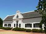 | |
| 9/2/069/0004 | 108 Main Street, Paarl | This elongated house with its Victorian verandah dates from the 1850s and was presumably an earlier Cape Dutch house that was later Victorianised. The property forms an integral part of the historic core of Paarl. | Paarl | Paarl | Provincial Heritage Site | 33°44′53″S 18°57′44″E / 33.748190°S 18.962311°E |  |
| 9/2/069/0005 | 232 Main Street, Paarl | Paarl | Paarl | National Monument | 33°44′22″S 18°57′46″E / 33.739392°S 18.962644°E |
| |
| 9/2/069/0006 | De Nieuwe Plantatie, Plantasie Street, Paarl | Type of site: House Previous use: House. Current use: Hotel. | Paarl | Paarl | Provincial Heritage Site | 33°45′06″S 18°57′31″E / 33.751544°S 18.958730°E |  |
| 9/2/069/0007 | La Concordia, Cecelia Street, Paarl | These properties form an integral part of the historical and architectural nucleus of Paarl. The houses on these erven, the majority of which date from the nineteenth century, are representative of the Cape Dutch, Georgian, Victorian and Edwardian building. | Paarl | Paarl | Provincial Heritage Site | 33°45′34″S 18°58′12″E / 33.759459°S 18.970095°E |
|
| 9/2/069/0008 | D'Olijfboom, 469 Main Street, Paarl | T- shaped house, one of the few in the northern part of the Main Street. It has a square gable dated 1852 and late-straight end-gables with pseudo-pediments (ie a horizontal string-course dividing off a small triangle at the top). The door and windows of Said to stand on a deduction from Optenhorst. These properties form an integral part of the historical and architectural nucleus of Paarl. The houses on these erven, the majority of which date from the nineteenth century are representative of the Cape Dutch, Georgian. Victorian and Edwardian styles o | Paarl | Paarl | Provincial Heritage Site | 33°43′12″S 18°57′49″E / 33.720110°S 18.963557°E |  |
| 9/2/069/0009 | Gideon Malherbe House, 11 Parsonage Avenue, Paarl | This double-storeyed 5-bay house - a good example of the restrained, Georgian-based architecture of the early-Victorian period with the noble proportions of its tall sash windows. In this Georgian house, then the residence of Gideon J. Malherbe, the "Genootskap van Regte Afrikaners" was founded on 14 August 1875. The object of this Society was ".. to stand for our language, our nation and our country". The well-known printing pr Current use: Museum. | Paarl | Paarl | Provincial Heritage Site | 33°44′03″S 18°57′48″E / 33.734260°S 18.963405°E |
|
| 9/2/069/0010 | Old Zion Church, Zion Street, Paarl | A large, T-shaped whitewashed church with its entrance in one of the ends of the 'cross-bar' of the T. It has a low-pitched iron roof, and the facade, in which the entrance is set, facing down the little street, has a straight gable topped by a small belf Type of site: Church. | Paarl | Paarl | Provincial Heritage Site | 33°44′37″S 18°57′40″E / 33.743657°S 18.961215°E |  |
| 9/2/069/0011 | The Huguenot Monument and Memorial Museum Complex, Franschhoek,Paarl | Franschhoek | Paarl | National Monument | 33°54′49″S 19°07′28″E / 33.913666°S 19.124475°E | 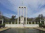 | |
| 9/2/069/0012 | 1ain Street, Paarl | These properties form an integral part of the historical and architectural nucleus of Paarl. The houses on these erven, the majority of which date from the nineteenth century, are representative of the Cape Dutch, Georgian, Victorian and Edwardian building | Paarl | Paarl | Provincial Heritage Site | 33°44′43″S 18°57′45″E / 33.745256°S 18.962404°E | 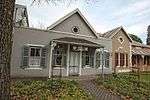 |
| 9/2/069/0013 | 169 Main Street, Paarl | Paarl | Paarl | Provincial Heritage Site | 33°44′42″S 18°57′54″E / 33.744971°S 18.965005°E | 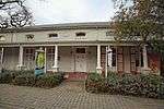 | |
| 9/2/069/0014 | FRANSCHHOEK MUNICIPAL AREA, PAARL DISTRICT, GENERAL | Franschhoek | Paarl | National Monument |
| ||
| 9/2/069/0015 | Old Post Office & old gaol, 227/227A Main Street, Paarl | Paarl | Paarl | 33°44′22″S 18°57′46″E / 33.739573°S 18.962648°E |
| ||
| 9/2/069/0016 | Eendevlei Farm, Paarl District | Paarl | Paarl | Pending Register |
| ||
| 9/2/069/0017 | Onderdal School, Daljosafat, Paarl District | The historical Onderdal school building, with the adjoining teachers residence. The Onderdal School was founded in 1847. Building work on the new school commenced late in 1854 and the building was inaugurated on 31 May 1855. The school was officially opened on 5 June 1855 and was used until 1968, when it was finally closed. Founder m Type of site: School. Previous use: School. Current use: Dwelling and school museum. Historical and architectural interest | Paarl | Paarl | Provincial Heritage Site | 33°41′25″S 19°00′09″E / 33.690246°S 19.002485°E |
|
| 9/2/069/0018 | School complex, Simondium, Paarl District | Paarl | Paarl | National Monument | 33°50′27″S 18°57′36″E / 33.840968°S 18.959952°E |
| |
| 9/2/069/0018/001 | Het Sticht, Simondium, Paarl District | Type of site: Church | Paarl | Provincial Heritage Site | 33°51′01″S 18°57′58″E / 33.850196°S 18.966147°E |
| |
| 9/2/069/0019 | Nederburg, Paarl District | A large late H-shaped house with a stoep right round it.
Ornate front rococo gable. It has weak wingless scrolls at its base; the inner pilasters run up only as high as the head of the gable window, from which level they are linked with the edge mould b The farm was granted to Philippus Bemardus Wolfaart, who arrived at the Cape in the eighteenth century. At the end of 1791, when the Dutch East India Company offered many of its properties for sale in an attempt to pay off its debts, Wolfaart obtained a st. |
Paarl | Paarl | Heritage Area | 33°43′11″S 19°00′09″E / 33.719687°S 19.002598°E | 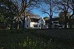 |
| 9/2/069/0019/001 | Main House, Nederburg, Paarl District | Type of site: Farmhouse. | Paarl | Provincial Heritage Site | 33°43′13″S 19°00′07″E / 33.720285°S 19.002048°E | 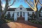 | |
| 9/2/069/0020 | 132A Main Street, Paarl | Type of site: House Current use: Residential. | Paarl | Paarl | Provincial Heritage Site | 33°46′37″S 18°57′26″E / 33.776956°S 18.957152°E | 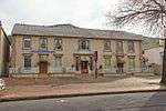 |
| 9/2/069/0021 | Bethel Boys Hostel, Mill Street, Paarl | This imposing double-storied house, with its Victorian and Edwardian characteristics, dates from the second half of the eighteenth century. The front gable bears the date 1764. This imposing double-storied house, with its Victorian and Edwardian characteristics, dates from the second half of the eighteenth century. The front gable bears the date 1764. | Paarl | Paarl | Provincial Heritage Site | 33°43′47″S 18°57′32″E / 33.729774°S 18.959000°E |  |
| 9/2/069/0022 | Kleinbosch, Dal Josafat, Paarl | Paarl | Paarl | National Monument | 33°41′30″S 19°01′29″E / 33.691547°S 19.024838°E |
| |
| 9/2/069/0022/001 | Cemetery, Kleinbosch, Daljosafat, Paarl District | The farm Kleinbosch was granted in 1692 to Francois du Toit, the Huguenot ancestor of the Du Toit family in South Africa. It became a true family farm and in 1792 Guilliam du Toit built the present building on it. As was the custom of the time, a cemetery Type of site: Graveyard. This cemetery was laid out in about 1700 by the Hugenot ancestor, Francois du Toit, on his farm Kleinbosch. Three of the founders of the "Genootskap van Regte Afrikaners", namely the Rev. S. J. du Toit, D. F. du Toit and P. J. Malherbe, are also buried he | Paarl | Paarl | Provincial Heritage Site | 33°41′25″S 19°00′09″E / 33.690246°S 19.002485°E |
|
| 9/2/069/0022/002 | Homestead, Kleinbosch, Daljosafat, Paarl District | The farm Kleinbosch was granted to the Huguenot progenitor Francois du Toit. The H-shaped house was erected by his grandson, Guillaume. The date 1792 appears on the concavo-convex front gable. Type of site: Farmhouse Previous use: residential. Current use: House. | Paarl | Provincial Heritage Site | 33°41′25″S 19°01′40″E / 33.690346°S 19.027843°E |
| |
| 9/2/069/0022/003 | Hugenote Gedenkskool, Kleinbosch, Daljosafat, Paarl District | In 1881 the "Genootskap van Regte Afrikaners" decided to establish the Huguenot Memorial School. The building was erected in 1882-1883 and served as a school until 1910. It was originally a Georgian double storeyed building and was the first school to use Type of site: School. | Paarl | Provincial Heritage Site | 33°41′22″S 19°01′36″E / 33.689319°S 19.026632°E | 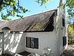 | |
| 9/2/069/0022/004 | Malherbehuis, Kleinbosch, Daljosafat, Paarl District | This Victorian house dates from the middle of the nineteenth century and was originally the dwelling of Petrus Jacobus Malherbe, founder member of the "Genootskap van Regte Afrikaners". Type of site: Farm House. This house was originally the dwelling of Petrus Jacobus Malherbe, founder member of the "Genootskap van Regte Afrikaners". | Paarl | Provincial Heritage Site | 33°41′24″S 19°01′34″E / 33.690132°S 19.026196°E |
| |
| 9/2/069/0023 | 74 Main Street, Paarl | These properties form an integral part of the historical and architectural nucleus of Paarl. The houses on these erven, the majority of which date from the nineteenth century are representative of the Cape Dutch, Georgian. Victorian and Edwardian styles o | Paarl | Paarl | Provincial Heritage Site | 33°45′11″S 18°57′42″E / 33.752978°S 18.961598°E | 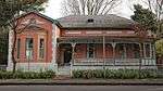 |
| 9/2/069/0024 | Windmill, Rhebokskloof, Paarl District | Paarl | Paarl | National Monument |
| ||
| 9/2/069/0025 | Mooikelder Farm, Paarl District | Paarl | Paarl | 33°41′10″S 18°56′58″E / 33.686178°S 18.949457°E |
| ||
| 9/2/069/0026 | Vergenoegd, 188 Main Street, Paarl | This building was erected between 1790 and 1800 and was the office of the Landdrost of Paarl.
There is considerable difference of opinion on the early history of this building, since the repeated sub division of properties in towns often makes it difficu. |
Paarl | Paarl | Provincial Heritage Site | 33°44′31″S 18°57′43″E / 33.742034°S 18.962033°E |  |
| 9/2/069/0027 | 140 Main Street, Paarl | These properties form an integral part of the historical and architectural nucleus of Paarl. The houses on these erven, the majority of which date from the nineteenth century, are representative of the Cape Dutch, Georgian, Victorian and Edwardian building | Paarl | Paarl | Provincial Heritage Site | 33°44′49″S 18°57′44″E / 33.746873°S 18.962175°E | 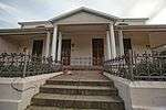 |
| 9/2/069/0028 | The Mountain Commonage, Paarlberg, Paarl | The huge, grey, granite bosses from which the Paarl Mountain derives its name had their origin some 550 million years ago as a molten mass, cooling gradually, deep under the surface of the earth. Millions of centuries passed and the overlying rocks were e. The area is proclaimed in order to ensure the preservation of its outstanding natural beauty. | Paarl | Paarl | Provincial Heritage Site | 33°44′40″S 18°56′33″E / 33.744500°S 18.942404°E | 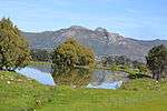 |
| 9/2/069/0029 | Fredericksburg, Drakenstein, Franschhoek District | Franschhoek | Paarl | National Monument |
| ||
| 9/2/069/0030 | Boekenhoutskloof, Franschhoek, Paarl District | Franschhoek | Paarl | 33°56′34″S 19°06′28″E / 33.942657°S 19.107876°E |
| ||
| 9/2/069/0031 | Laborie, Main Street, Paarl | Paarl | Paarl | 33°45′55″S 18°57′28″E / 33.765275°S 18.957727°E | 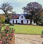 | ||
| 9/2/069/0031-001 | Main House, Laborie, Main Street, Paarl | This historic manor house was erected before 1800, even though the front gable bears this date. It is an important example of the Cape Dutch architectllral style. Type of site: Farmhouse. | Paarl | Paarl | Provincial Heritage Site | 33°45′56″S 18°57′26″E / 33.765686°S 18.957084°E | |
| 9/2/069/0031-002 | Wine cellar, Laborie, Main Street, Paarl | This wine cellar dated from the early nineteenth century. Type of site: Wine Cellar. | Paarl | Paarl | Provincial Heritage Site | 33°45′59″S 18°57′28″E / 33.766327°S 18.957832°E |  |
| 9/2/069/0032 | 419 Main Street, Paarl | A rectangular house of double depth of 1832, its roof now of iron and with clipped ends, and loft-windows. The outside woodwork, including an 8-panelled front door, is intact, and there is an outside chimney. | Paarl | Paarl | Provincial Heritage Site | 33°43′29″S 18°57′49″E / 33.724685°S 18.963691°E |
|
| 9/2/069/0033 | 96 Main Street, Paarl | Paarl | Paarl | National Monument | 33°44′59″S 18°57′43″E / 33.749794°S 18.961807°E |
| |
| 9/2/069/0034 | 98 Main Street, Paarl | Almost identical to no 96, but with a shallower plan; it is probably an older house, altered to match its neighbour. These properties form an integral part of the historical and architectural nucleus of Paarl. The houses on these erven, the majority of which date from the nineteenth century are representative of the Cape Dutch, Georgian. Victorian and Edwardian styles o | Paarl | Paarl | Provincial Heritage Site | 33°44′58″S 18°57′42″E / 33.749420°S 18.961713°E | 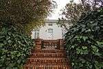 |
| 9/2/069/0035 | Burgundy, Franschhoek, Paarl District | Pierre de Villiers, eldest of the three brothers who had moved Franschhoek in 1694 after their farming efforts at Paarl had proved unsuccessful. The youngest, Jacques, settled at La Bri, Abraham at Champagne and Pierre at Burgundy - all three farm names b Type of site: Farm Complex. | Franschhoek | Paarl | Provincial Heritage Site | 33°55′46″S 19°06′40″E / 33.929310°S 19.110973°E |
|
| 9/2/069/0036 | Swiss Farm Excelsior, Paarl District | Paarl | Paarl | National Monument |
| ||
| 9/2/069/0037 | 103-107 Main Street, Paarl | An elongated Plan building from c1850 with iron roof and loft-windows. These properties form an integral part of the historical and architectural nucleus of Paarl. The houses on these erven, the majority of which date from the nineteenth century are representative of the Cape Dutch, Georgian. Victorian and Edwardian styles o | Paarl | Paarl | Provincial Heritage Site | 33°46′37″S 18°57′26″E / 33.776809°S 18.957217°E | 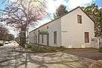 |
| 9/2/069/0038 | 427 Main Street, Paarl | Paarl | Paarl | National Monument | 33°43′27″S 18°57′51″E / 33.724110°S 18.964046°E |
| |
| 9/2/069/0039 | Lemoenkloof Guest House, 394 and 396A Main Street, Paarl | Paarl | Paarl | Provincial Heritage Site | 33°43′23″S 18°57′46″E / 33.723016°S 18.962847°E | 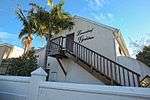 | |
| 9/2/069/0040 | Patriot Building, 223-227 Main Street, Paarl | Paarl | Paarl | National Monument | 33°44′29″S 18°57′46″E / 33.741448°S 18.962863°E |
| |
| 9/2/069/0041 | Boschendal, Groot Drakenstein, Paarl District | This farm was originally granted to the Huguenot Jean le Long in 1685, Afterwards the property became the home of Jacques de Villiers and his wife Marguerite Gardiol. Their grandson, Paul, built the historic manor- house in 1812. The farm remained in the Type of site: Farm Complex. | Paarl | Provincial Heritage Site | 33°52′39″S 18°58′25″E / 33.877533°S 18.973646°E | %2C_Groot_Drakenstein%2C_Paarl_District.JPG) | |
| 9/2/069/0042 | L'Ormarins, Groot Drakenstein, Paarl District | Paarl | Paarl | National Monument | 33°52′20″S 18°59′56″E / 33.872313°S 18.998810°E |
| |
| 9/2/069/0043 | 37 Berg Street, Franschhoek, Paarl District | Franschhoek | Paarl | 33°54′48″S 19°07′12″E / 33.913397°S 19.120015°E |
| ||
| 9/2/069/0044 | Dutch Reformed Church, Franschhoek, Paarl District | This church, with its neo-Gothic and Cape-Dutch architectural features, was built at the instance of the Rev. P. N. Ham, shortly after the local congregation had broken away, in 1845, from the Paarl congregation. The oldest part of the church building was Type of site: Church Current use: Church : Dutch Reformed. | Franschhoek | Paarl | Provincial Heritage Site | 33°54′34″S 19°07′09″E / 33.909488°S 19.119164°E | 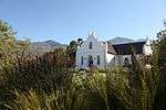 |
| 9/2/069/0045 | La Rochelle Hostel, Academy Street, Franschhoek, Paarl District | Franschhoek | Paarl | National Monument | 33°54′37″S 19°07′19″E / 33.910290°S 19.122081°E |
| |
| 9/2/069/0046 | Bellingham Homestead, Groot Drakenstein, Paarl District | The Bellinchamp Homestead, an imposing Cape Dutch house dating from the seventeenth century that is surrounded by beautiful landscaped gardens and bordered by a ring-wall, together with the outbuildings within the ring- wall which date from the eighteenth Also known as Bellegam. Dates to 1695, when granted to a Van Vuuren (Burman J, Waters of the Western Cape)
Portion 2 of the farm Bellingham No. 1022 consists of an area of land measuring 2,5753 hectares with the main farmhouse, several outbuildings, a pe Type of site: Farmhouse. |
Paarl | Provincial Heritage Site | 33°52′57″S 19°01′15″E / 33.882397°S 19.020807°E |
| |
| 9/2/069/0047 | Pontac, Zion Street, Paarl | In 1723 the property Pontak, just over 2 morgen in size, was granted to Jan Labuschagne (whether his ancestors had come from Pontaix in Dauphine is not certain; the name suggests it). The homestead still stands, at the head of Pontak St, but who of the ma Type of site: Farmstead. | Paarl | Paarl | Provisional Protection | 33°44′29″S 18°57′35″E / 33.741507°S 18.959712°E |
|
| 9/2/069/0048 | Meerlust, Paarl | Paarl | Paarl | Provincial Monument | 34°01′01″S 18°45′26″E / 34.017003°S 18.757097°E |
| |
| 9/2/069/0049 | 13 Parsonage Street, Paarl | Paarl | Paarl | 33°44′02″S 18°57′49″E / 33.733795°S 18.963671°E |
| ||
| 9/2/069/0050 | Keerweder, Franschhoek, Paarl district | Paarl | Paarl | Pending Register |
| ||
| 9/2/069/0051 | 1 Theron Street, Paarl | Paarl | Paarl | 33°44′44″S 18°57′40″E / 33.745472°S 18.961108°E |
| ||
| 9/2/069/0052 | Vlakkeland, Daljosafat, Paarl District | This Cape-Dutch complex, as well as the surrounding ring wall, presumably dates from the years 1790-1800 and was previously the farmstead of the farm Vlakkeland which was granted to Jean Roux, a Huguenot, in 1694. Type of site: Farm Complex. | Paarl | Provincial Heritage Site | 33°41′12″S 18°59′43″E / 33.686750°S 18.995394°E |
| |
| 9/2/069/0053 | Schoongezicht, Daljosafat, Paarl District | This H-shaped Cape-Dutch house has impressive gables, windows and casements as well as a beautiful interior. This property was granted in 1694 to Abraham Vivier and was sold in 1723 to Francois du Toit. The original part of the house was erected about 1770, while the front gable dates back to 1826. This H-shaped Cape-Dutch house has impressive gables, windows an Type of site: Farmstead. | Paarl | Provincial Heritage Site | 33°41′47″S 19°00′43″E / 33.696291°S 19.012071°E |
| |
| 9/2/069/0054 | 511 Main Street, Paarl | Paarl | Paarl | National Monument | 33°42′52″S 18°57′48″E / 33.714513°S 18.963267°E |
| |
| 9/2/069/0055 | 15 Plein Street, Paarl | Paarl | Paarl | 33°43′36″S 18°57′38″E / 33.726572°S 18.960657°E |
| ||
| 9/2/069/0056 | Plaisir de Merle, Simodium, Paarl District | Paarl | Paarl | 33°50′03″S 18°57′16″E / 33.834152°S 18.954416°E |
| ||
| 9/2/069/0057 | 3 Zeederberg Street, Paarl | This dwelling with its cast-iron decorated verandah and portico, the original section of which dates from the 1830's, was Victorianised in 1890. The property together with the two adjacent buildings that have already been declared forms a unique architect | Paarl | Paarl | Provincial Heritage Site | 33°44′41″S 18°57′40″E / 33.744775°S 18.961028°E |
|
| 9/2/069/0058 | 5 Dirkie Uys Street, Franschhoek, Paarl District | Franschhoek | Paarl | National Monument | 33°54′47″S 19°07′23″E / 33.912949°S 19.123066°E |
| |
| 9/2/069/0059 | Rhone, Groot Drakenstein, Paarl District | The original grant of this farm, made in 1691, was to a Huguenot, Jean Gardé. From 1702 to 1902, however, the farm saw a succession of, different owners; with the result that it has close historical ties with families such as the Malans, Jordaans and Hau Type of site: Farm Complex. | Paarl | Provincial Heritage Site | 33°53′10″S 18°58′09″E / 33.885981°S 18.969119°E | 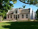 | |
| 9/2/069/0060 | Les Chenes, Paarl District | Franschhoek | Paarl | National Monument |
| ||
| 9/2/069/0061 | Cabriere, Klip Street, Franschhoek, Paarl District | Franschhoek | Paarl |
| |||
| 9/2/069/0062 | Rozenburg House, 2 Rozenburg Street, Paarl | This dwelling with its Georgian and Victorian characteristics was rebuilt during the 1850's to its present form. This properrty also forms an integral part of the historical core of Paarl. | Paarl | Paarl | Provincial Heritage Site | 34°45′05″S 18°57′48″E / 34.751271°S 18.963464°E |  |
| 9/2/069/0063 | 66 Huguenot Street, Franschhoek | Franschhoek | Paarl | National Monument | 33°54′30″S 19°07′03″E / 33.908453°S 19.117438°E |
| |
| 9/2/069/0064 | Klein Cabriere, Cabriere Street, Franschhoek | Franschhoek | Paarl | 33°54′40″S 19°06′59″E / 33.911155°S 19.116375°E |
| ||
| 9/2/069/0065 | 44-50 Huguenot Street, Franschhoek | Franschhoek | Paarl | 33°54′37″S 19°07′08″E / 33.910241°S 19.118891°E |
| ||
| 9/2/069/0066 | Zomerlust, 193 Main Street, Paarl | Paarl | Paarl | 33°44′34″S 18°57′48″E / 33.742874°S 18.963450°E |
| ||
| 9/2/069/0067 | Goede Hoop, Groot Drakenstein, Paarl District | Paarl | Paarl |
| |||
| 9/2/069/0068 | 78 and 80 Main Street, Paarl | These properties form an integral part of the historical and architectural nucleus of Paarl. The houses on these erven, the majority of which date from the nineteenth century are representative of the Cape Dutch, Georgian. Victorian and Edwardian styles o | Paarl | Paarl | Provincial Heritage Site | 33°45′09″S 18°57′42″E / 33.752367°S 18.961688°E |  |
| 9/2/069/0069 | Dutch Reformed Church, Main Street, Paarl | This historic cruciform church with its “strooidak” or thatched roof stands in High Street, Suider Paarl. It is the church of the third oldest Dutch Reformed congregation in South Africa, the congregation of Paarl, formerly known as Drakenstein. This cong Type of site: Church Current use: Church : Dutch Reformed. The Strooidakkerk, Paarl, was consecrated in 1805 and is one of the oldest Dutch Reformed Church buildings, still in use, in the Republic.
It has a great tradition and its architectural merit is considerable. |
Paarl | Paarl | Provincial Heritage Site | 33°44′45″S 18°57′46″E / 33.745935°S 18.962713°E |  |
| 9/2/069/0069/01 | Grave of DS Marais, Strooidakkerk Cemetery, Paarl | Paarl | Paarl | National Monument |
| ||
| 9/2/069/0070 | La Terra De Luc, Paarl District | Paarl | Paarl | 33°53′57″S 19°06′16″E / 33.899034°S 19.104354°E |
| ||
| 9/2/069/0071 | Old Parsonage Museum, Main Street, Paarl | Simon van der Stel's "Colony of Drakenstein" quickly developed along the Berg River Valley. On both sides of the road that runs down the valley from Fransch hoek through Simondium to Paarl and Wellington, there are farms and fine old Cape Dutch houses wit Type of site: Parsonage Previous use: House. Current use: Museum. | Paarl | Paarl | Provincial Heritage Site | 33°43′57″S 18°57′51″E / 33.732403°S 18.964197°E |  |
| 9/2/069/0072 | Jan Joubertsgat Bridge, Franschhoek Pass, Paarl District | The first farms in Franschhoek, then still known as “Olifantshoek”, were granted to the French Huguenots in 1688. The surrounding mountains entirely cut off the picturesque valley from the interior to the east. Elephant tracks and Bushman footpaths crosse Type of site: Bridge Current use: Bridge. | Franschhoek | Paarl | Provincial Heritage Site | 33°56′18″S 19°09′41″E / 33.938284°S 19.161294°E | 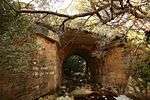 |
| 9/2/069/0073 | Gymnasium Primary School, Gymnasium Street, Paarl | The original building of the Gymnasium school was opened on 12 January 1858. The school played a leading part in the struggle for the retention of the Dutch language and also in the Afrikaans Language-movement.
The old Gymnasium School is situated on the Type of site: School Current use: Primary school. The original building of the Gymnasium school was opened on 12 January 1858. The school played a leading part in the struggle for the retention of the Dutch language and also in the Afrikaans Language-movement. |
Paarl | Paarl | Provincial Heritage Site | 33°43′58″S 18°57′44″E / 33.732875°S 18.962330°E |  |
| 9/2/069/0074 | Printing Press of Genootskap van Regte Afrikaners, Hugenot Museum, Paarl | Some of the most valuable objects in the Huguenot Museum in Paarl are the small printing press, the proof press and the book-binding apparatus used by the "Genootskap van Regte Afrikaners This society was founded on 14 August 1875, in "Wesfalen", the h. The printing press contributed much to the effectiveness of the Genootskap van Regte Afrikaners which played an important part in the history of the Afrikaans language. | Paarl | Paarl | Heritage Object | 33°43′42″S 18°59′11″E / 33.728245°S 18.986511°E |
|
| 9/2/069/0075 | Het Gesticht Mission Church, 122 Main Street, Paarl | It is rectangluar in plan, its narrow end towards street topped by a good pediment over the full width. The door is 8-panelled and has an upper light with good 'gothic' tracery and hood mould. In front stands a well-proportioned bell-tower matching the pe This building was erected in 1813 to serve as an "oefeningshuis" for religious instruction, catechism classes and prayer meetings for peoples of colour. It is the fourth oldest church building in South Africa. In 1819 it was transferred to the 'Paarlsche Type of site: Church Previous use: Church. This building was erected in 1813 to serve as an "oefeningshuis" for religious instruction, catechism classes and prayer meetings for non-White. It is the fourth oldest church building in South Africa. | Paarl | Paarl | Provincial Heritage Site | 33°44′53″S 18°57′42″E / 33.748027°S 18.961708°E |  |
| 9/2/069/0076 | La Provence, Franschhoek, Paarl District | Granted in 1694 to Pierre Joubert (Burman J, Waters of the Western Cape)
This imposing house was probably built by Pieter de Villiers who bought the farm in 1756. The building is H-shaped with beautiful gables bearing the dates 1800 and 1815, respectively Type of site: Farm Complex. This imposing house, one of the best-known Cape- Dutch houses, was probably built by Pieter de Villiers who bought the farm in 1756. The building is H-shaped with beautiful gables bearing the dates 1800 and 1815, respectively. |
Frannschoek | Paarl | Provincial Heritage Site | 33°53′37″S 19°05′30″E / 33.893551°S 19.091696°E |  |
| 9/2/069/0077 | La Motte, Franschhoek, Paarl District | In 1815 the remainder was acquired by Gideon Jacobus Joubert and as the next transfer is dated 1858, this man must have built the wine cellar, or added a centre gable to it, dated 1825. He also added a very similar gable to the house in 1836 (which bears Settled in 1695 by a German, Hans Hendrik Hattingh (Burman J, Waters of the Western Cape)
In 1695 the land was granted to a German named Hans Hendrik Hattingh. In 1709, he sold the land to Pierre Joubert, a Huguenot who arrived at the Cape in 1688 with Type of site: Farm Complex. The outstanding La Motte manor house, which was probably during the fifties of the eighteenth century by Gabriel du Toit, is a T-shaped building with a concavo-convex middle gable and attractive facade. The manor house, together with the "jonkmanshuis", t |
Franschhoek | Paarl | Provincial Heritage Site | 33°52′49″S 19°04′25″E / 33.880186°S 19.073746°E |  |
| 9/2/069/0077/1 | La Motte cemetery, Paarl District | Paarl | Paarl | Plaque |
| ||
| 9/2/069/0078 | Bergskadus, Klein Drakenstein, Paarl District | This historic Cape Dutch manor house was probably built in 1823 by Joshua Malherbe and has remained basically unaltered. Type of site: Farm Complex. | Paarl | Provincial Heritage Site | 33°43′27″S 18°57′21″E / 33.724167°S 18.955833°E |
| |
| 9/2/069/0079 | Rozenfontein, 113 Main Street, Paarl | A rectangular, deep house, now with hipped iron roof and veranda with loft-windows. The facade woodwork has an 8-panelled door with rectangular fanlight conslsting of intersecting segments, and flanking sash windows with internal shutters; there are frenc. This Georgian house, which dates from the fifties of the 18th century, forms an essential part of the character of Main Street, as well as of Paarl itself. | Paarl | Paarl | Provincial Heritage Site | 33°45′16″S 18°57′45″E / 33.754470°S 18.962440°E |  |
| 9/2/069/0080 | 7 De Jongh Avenue, Paarl | This H-shaped Cape Dutch house was erected in 1818 by Pieter Roux. Together with the other buildings in De Jongh Avenue, the house forms an important historical and architectural group. Together with the other buildings in De Jongh Avenue, the house forms an important historical and architectural group. | Paarl | Paarl | Provincial Heritage Site | 33°43′27″S 18°57′21″E / 33.724167°S 18.955833°E |
|
| 9/2/069/0081 | Mijn Hoop Vervuld, 10 De Jongh Avenue, Paarl | This H-shaped Cape Dutch house with its six gables was probably erected in 1801 by Abraham de Clercq. The property forms an integral part of the historical core of Paarl.
No. 10, De Jongh Laan, stands next to the churchyard, with, on its West side, what i. |
Paarl | Paarl | Provincial Heritage Site | 33°43′27″S 18°57′21″E / 33.724167°S 18.955833°E |
|
| 9/2/069/0082 | Klein Vredenburg, 155 Main Street, Paarl | The dwelling-house is a typical Georgian double-storeyed town house which, in its present form, dates from about the middle of the nineteenth century. The group of buildings forms an integral part of the historic core of Paarl. | Paarl | Paarl | Provincial Heritage Site | 33°44′53″S 18°57′45″E / 33.748173°S 18.962447°E | 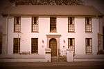 |
| 9/2/069/0083 | 94 Mill Street, Paarl | Current use: Dwelling. The original portion of this house was initially in the Cape Dutch style and dates from the beginning of the nineteenth century. The building was later Victorianised by subsequent owners. | Paarl | Paarl | Provincial Heritage Site | 33°43′39″S 18°57′31″E / 33.727385°S 18.958577°E |
|
| 9/2/069/0084 | 60-62 Mill Street, Paarl | This double-storeyed building is predominantly in the Georgian style, although it also possesses Victorian characteristics. It dates from about 1803 and forms an integral part of the historic facade of Mill Street. | Paarl | Paarl | Provincial Heritage Site | 33°43′49″S 18°57′30″E / 33.730233°S 18.958312°E |
|
| 9/2/069/0085 | Amstelhof, Daljosafat, Paarl District | The house is H-shaped and has a square, pedimented front gable dated 1856, bearing some illegible initials which are probably those of Jacobus Petrus Theron, owner from 1843 to 1890. The house is without doubt older. This can be determined as the back fl This Cape Dutch house in its present form dates from the second half of the 19th century, as is evident inter alia from the date (1856) on the front gable, the plain style of the gable and Victorian influences. In 1694 the 60 morgen farm was granted to Da Type of site: Farmstead. | Paarl | Provincial Heritage Site | 33°44′42″S 19°00′58″E / 33.745132°S 19.016079°E |
| |
| 9/2/069/0086 | Eikenhof, Van der Poels Avenue, Paarl | This late Victorian house was erected in 1900 as a mansion for wagonmaker Stark. | Paarl | Paarl | Provincial Heritage Site | 33°43′35″S 18°57′44″E / 33.726486°S 18.962186°E |
|
| 9/2/069/0087 | 9 De Jongh Avenue, Paarl | This imposing Cape-Dutch dwelling-house with its thatched roof and symmetric facade presumably dates from the 1850s. | Paarl | Paarl | Provincial Heritage Site | 33°44′48″S 18°57′48″E / 33.746744°S 18.963423°E |
|
| 9/2/069/0088 | La Vieille Cure, 43 Hugenot Street, Franschhoek | This property previously formed part of the farm La Cotte, which was originally granted to the French Huguenot Jean Gardiol in 1713. The dwelling-house with its predominantly Cape Dutch features was presumably erected before 1850. | Franschhoek | Paarl | Provincial Heritage Site | 33°54′22″S 19°07′01″E / 33.905977°S 19.116964°E |
|
| 9/2/069/0089 | 4 and 5 Zeederberg Square, Paarl | This double storeyed semi-detached complex, with its Georgian and Victorian features, dates from the years 1890-1900. The property forms and integral part of the historic core of Paarl. | Paarl | Paarl | Provincial Heritage Site | 33°44′41″S 18°57′41″E / 33.744684°S 18.961504°E | 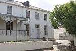 |
| 9/2/069/0090 | Toringkerk and vaults, Main Street, Paarl | This imposing church building with its 57 metre high tower was designed by the architect firm Sherwood, Pitts and Wood and erected during the years 1904 to 1907 by the builders De Villiers, Larson and Co. The cornerstone was laid on 8 April 1905 by Dr. An Type of site: Church, Museum Current use: Church : Dutch Reformed. | Paarl | Paarl | Provincial Heritage Site | 33°43′58″S 18°57′47″E / 33.732817°S 18.963156°E |  |
| 9/2/069/0091 | 127 Main Street, Paarl | An L-shaped house, now under: iron roof, with loft-windows and veranda. Its clipped front gable is dated 1837, and 2 sashes in front date from that time. The front door and outer french windows are late 19th century. This Victorian dwelling-house, of which the front gable bears the date 1837, forms an integral part of the historic and architectural character of Main Street, Paarl. | Paarl | Paarl | Provincial Heritage Site | 33°45′08″S 18°57′44″E / 33.752314°S 18.962306°E | 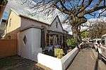 |
| 9/2/069/0092 | Stadtzicht, 19 Victoria Street, Paarl | A single-storeyed late-Victorian villa with a wooden fretwork veranda and entrance porch. The veranda is wrapped round the corner turret, left, and on the right runs dead into a 3-bay 'stoepkamer'. This late-Victorian manor-house was erected at the turn of the nineteenth century. | Paarl | Paarl | Provincial Heritage Site | 33°44′00″S 18°57′30″E / 33.733310°S 18.958367°E |
|
| 9/2/069/0093 | 2 Zeederberg Square, Paarl | A rectangular house, 2 rooms deep, with iron roof, loft-windows and a later veranda. The windows are late 19th century. This dwelling-house, originally erected in the Cape Dutch style, was victorianised in the 1890s. The property forms an integral part of the historical core of Paarl. This dwelling-house, originally erected in the Cape Dutch style, was victorianised in the 1890s. The property forms an integral part of the historical core of Paarl. | Paarl | Paarl | Provincial Heritage Site | 33°44′40″S 18°57′41″E / 33.744493°S 18.961502°E |
|
| 9/2/069/0094 | De Kleine Konstantie, Constantia Street, Paarl | This Cape Dutch house, with its impressive front gable bearing the date 1841, was originally the homestead of the farm 1 Kleine Konstantie, which was granted to Johannes Philippus Minnaar on 1 July 1817 by Lord Charles Somerset. This farm; which was owned. | Paarl | Paarl | Provincial Heritage Site | 33°45′05″S 18°57′33″E / 33.751352°S 18.959197°E | 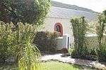 |
| 9/2/069/0095 | Divisional Council Building, 194 Main Street, Paarl | This impressive public building with its neoclassical elements forms an integral part of the architectural character of Main Street, Paarl, where the Cape Dutch, Georgian, Victorian and Edwardian building styles blend harmoniously. | Paarl | Paarl | Provincial Heritage Site | 33°44′30″S 18°57′45″E / 33.741751°S 18.962386°E |
|
| 9/2/069/0096 | 70 Main Street, Paarl | Victorian corner house with splayed corner, veranda, loft-windows and louvred woodwork. These properties form an integral part of the historical and architectural nucleus of Paarl. The houses on these erven, the majority of which date from the nineteenth century are representative of the Cape Dutch, Georgian. Victorian and Edwardian styles o | Paarl | Paarl | Provincial Heritage Site | 33°55′17″S 18°25′19″E / 33.921327°S 18.422047°E |  |
| 9/2/069/0097 | 72 Main Street, Paarl | These properties form an integral part of the historical and architectural nucleus of Paarl. The houses on these erven, the majority of which date from the nineteenth century are representative of the Cape Dutch, Georgian. Victorian and Edwardian styles o | Paarl | Paarl | Provincial Heritage Site | 33°55′17″S 18°25′19″E / 33.921341°S 18.422053°E |  |
| 9/2/069/0098 | 189 & 191 Main Street, Paarl | Paarl | Paarl | National Monument | 33°44′36″S 18°57′44″E / 33.743407°S 18.962303°E |
| |
| 9/2/069/0099 | 92 Main Street, Paarl | These properties form an integral part of the historical and architectural nucleus of Paarl. The houses on these erven, the majority of which date from the nineteenth century are representative of the Cape Dutch, Georgian. Victorian and Edwardian styles o | Paarl | Paarl | Provincial Heritage Site | 33°45′00″S 18°57′41″E / 33.750086°S 18.961433°E |  |
| 9/2/069/0100 | 106 Main Street, Paarl | These properties form an integral part of the historical and architectural nucleus of Paarl. The houses on these erven, the majority of which date from the nineteenth century are representative of the Cape Dutch, Georgian. Victorian and Edwardian styles o | Paarl | Paarl | Provincial Heritage Site | 33°44′56″S 18°57′42″E / 33.748800°S 18.961688°E |
|
| 9/2/069/0101 | 146 and 148 Main Street, Paarl | These properties form an integral part of the historical and architectural nucleus of Paarl. The houses on these erven, the majority of which date from the nineteenth century are representative of the Cape Dutch, Georgian. Victorian and Edwardian styles o | Paarl | Paarl | Provincial Heritage Site | 33°44′44″S 18°57′44″E / 33.745426°S 18.962134°E |  |
| 9/2/069/0102 | Outspan, 150 and 152 Main Street, Paarl | Type of site: Outspan. These properties form an integral part of the historical and architectural nucleus of Paarl. The houses on these erven, the majority of which date from the nineteenth century are representative of the Cape Dutch, Georgian. Victorian and Edwardian styles o | Paarl | Paarl | Provincial Heritage Site | 33°44′42″S 18°57′43″E / 33.745110°S 18.961896°E |  |
| 9/2/069/0103 | 172 and 174 Main Street, Paarl | A double-storeyed house, partly altered, but retaining woodwork dating from c1830, including 2 fine 8-panelled doors with garlanded spoke-fanlights contained within rectangles. These properties form an integral part of the historical and architectural nucleus of Paarl. The houses on these erven, the majority of which date from the nineteenth century, are representative of the Cape Dutch, Georgian, Victorian and Edwardian building | Paarl | Paarl | Provincial Heritage Site | 33°43′01″S 18°57′46″E / 33.716810°S 18.962894°E |  |
| 9/2/069/0104 | Vergenoegd, 186 Main Street, Paarl | These properties form an integral part of the historical and architectural nucleus of Paarl. The houses on these erven, the majority of which date from the nineteenth century, are representative of the Cape Dutch, Georgian, Victorian and Edwardian building | Paarl | Paarl | Provincial Heritage Site | 33°42′52″S 18°57′47″E / 33.714394°S 18.963005°E |
|
| 9/2/069/0105 | De Oude Woning, 214 Main Street, Paarl | The gable is an early florid one, of 1784-, unornamented except for a fan and the date set on a ribbon. The house is H-shaped, with a similar but plainer gable at the back: it contains yellowwood doors which have been very well cared for, and, in the kitc A reminder of the gabled houses which once lined Paarl streets. These properties form an integral part of the historical and architectural nucleus of Paarl. The houses on these erven, the majority of which date from the nineteenth century. are representative of the Georgian and the Victorian building styles. | Paarl | Paarl | Provincial Heritage Site | 33°44′26″S 18°57′44″E / 33.740520°S 18.962334°E | 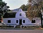 |
| 9/2/069/0106 | 388 and 390 Main Street, Paarl | These properties form an integral part of the historical and architectural nucleus of Paarl. The houses on these erven, the majority of which date from the nineteenth century. are representative of the Georgian and the Victorian building styles. | Paarl | Paarl | Provincial Heritage Site | 33°43′28″S 18°57′47″E / 33.724368°S 18.963127°E |
|
| 9/2/069/0107 | Hillside, 44 Mill Street, Paarl | A single-storeyed late-Victorian house, c1895, its projecting section on the right built up to 2 storeys with a balcony. There is a wooden fretwork veranda. These properties form an integral part of the historical and architectural nucleus of Paarl. The houses on these erven, the majority of which date from the nineteenth century are representative of the Cape Dutch, Georgian. Victorian and Edwardian styles o | Paarl | Paarl | Provincial Heritage Site | 33°43′55″S 18°57′34″E / 33.731873°S 18.959418°E |  |
| 9/2/069/0108 | 27 and 29 Orange Street, Paarl | These properties form an integral part of the historical and architectural nucleus of Paarl. The houses on these erven, the majority of which date from the nineteenth century are representative of the Cape Dutch, Georgian. Victorian and Edwardian styles. | Paarl | Paarl | Provincial Heritage Site | 33°44′09″S 18°57′38″E / 33.735830°S 18.960684°E |
|
| 9/2/069/0109 | 2 Patriot Street, Paarl | This impressive dwelling-house which was erected in 1905 by Wilhelm Bruckner de Villiers in the late-Victorian style, not only forms an essential part of the traditional architectural street scene of Patriot Street, but also an integral part of the history. | Paarl | Paarl | Provincial Heritage Site | 33°44′29″S 18°57′49″E / 33.741443°S 18.963582°E |
|
| 9/2/069/0110 | 91 Main Street, Paarl | These properties form an integral part of the historical and architectural nucleus of Paarl. The houses on these erven, the majority of which date from the nineteenth century are representative of the Cape Dutch, Georgian. Victorian and Edwardian styles | Paarl | Paarl | Provincial Heritage Site | 33°45′22″S 18°57′46″E / 33.756155°S 18.962697°E |  |
| 9/2/069/0111 | 95 Main Street, Paarl | A rectangular, 2-rooms deep house with an iron roof. The end-gables are clipped, but there is a square and pedimented front gable dating from c1850. The facade woodwork is modern. These properties form an integral part of the historical and architectural nucleus of Paarl. The houses on these erven, the majority of which date from the nineteenth century are representative of the Cape Dutch, Georgian. Victorian and Edwardian styles | Paarl | Paarl | Provincial Heritage Site | 33°45′22″S 18°57′46″E / 33.756043°S 18.962818°E |  |
| 9/2/069/0112 | 133 and 135 Main Street, Paarl | Rectangular house, now with iron roof and loft-windows. There front door is 8-panelled and with spoke-fanlight. These three properties with their Victorian buildings are not only typical of the architectural tradition which gives Main Street its character, but are in themselves also an integral component of the historical core of Paarl. | Paarl | Paarl | Provincial Heritage Site | 33°45′06″S 18°57′44″E / 33.751790°S 18.962237°E |  |
| 9/2/069/0113 | Nooitgedacht, 2 Church Square, Paarl | The original portion of this impressive dwelling, which was erected in the Georgian style, dates from 1850. The building was enlarged in 1880 by Dr Josias Hoffman by the addition of a building in the Victorian idiom of approximately the same size as the o Type of site: House. | Paarl | Paarl | Provincial Heritage Site | 33°52′12″S 18°49′35″E / 33.870099°S 18.826479°E |
|
| 9/2/069/0114 | 82 Main Street, Paarl | These properties form an integral part of the historical and architectural nucleus of Paarl. The houses on these erven, the majority of which date from the nineteenth century are representative of the Cape Dutch, Georgian. Victorian and Edwardian styles | Paarl | Paarl | Provincial Heritage Site | 33°45′07″S 18°57′42″E / 33.752075°S 18.961787°E | 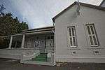 |
| 9/2/069/0115 | 99 Main Street, Paarl | A rectangular house with its narrow side towards the street. This end has a 6-panelled door flanked by louvred sashes, mide 19th century. On the clipped end appears the date 1889, which probably refers to the roof alteration. These properties form an integral part of the historical and architectural nucleus of Paarl. The houses on these erven, the majority of which date from the nineteenth century are representative of the Cape Dutch, Georgian. Victorian and Edwardian styles | Paarl | Paarl | Provincial Heritage Site | 33°46′36″S 18°57′26″E / 33.776762°S 18.957242°E | 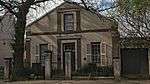 |
| 9/2/069/0116 | 128 and 130 Main Street, Paarl | 128 is a 2-storeyed house of 3 bays, probably originally single-storeyed with deep plan, to judge by the disparity in facade woodwork, the lower being c1830, the upper c1870. 130 is a late double-storeyed house. These properties form an integral part of the historical and architectural nucleus of Paarl. The houses on these erven, the majority of which date from the nineteenth century. are representative of the Georgian and the Victorian building styles. | Paarl | Paarl | Provincial Heritage Site | 33°46′37″S 18°57′26″E / 33.776946°S 18.957155°E |
|
| 9/2/069/0117 | 195-199 Main Street, Paarl | These properties form an integral part of the historical and architectural nucleus of Paarl. The houses on these erven, the majority of which date from the nineteenth century. are representative of the Georgian and the Victorian building styles. | Paarl | Paarl | Provincial Heritage Site | 33°44′34″S 18°57′45″E / 33.742748°S 18.962388°E | 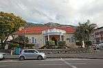 |
| 9/2/069/0118 | Ronwe Homestead, Paarl District | Type of site: Farm Complex. | Paarl | Provincial Heritage Site | 33°45′43″S 19°00′11″E / 33.761998°S 19.002922°E |
| |
| 9/2/069/0119 | 40 Main Street, Paarl | Paarl | Paarl | Provincial Heritage Site | 33°45′39″S 18°57′41″E / 33.760894°S 18.961441°E |  | |
| 9/2/069/0120 | First National Bank, Main Street, Paarl | Type of site: Bank Current use: Bank. | Paarl | Paarl | Provincial Heritage Site | 33°43′52″S 18°57′46″E / 33.730993°S 18.962743°E | 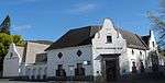 |
| 9/2/069/0121 | Valencia, Daljosafat, Paarl District | Type of site: Farm Complex | Paarl | Provincial Heritage Site | 33°40′18″S 18°54′57″E / 33.671528°S 18.915796°E |
| |
| 9/2/069/0122 | 9 Hugenot Street, Franschhoek | Franschhoek | Paarl | Provincial Heritage Site | 33°54′47″S 19°07′19″E / 33.913041°S 19.121921°E |  | |
| 9/2/069/0123 | 486 Main Street, Paarl | Paarl | Paarl | Provincial Heritage Site | 33°42′50″S 18°57′45″E / 33.713890°S 18.962627°E |  | |
| 9/2/069/0124 | 42 Main Street, Paarl | Paarl | Paarl | Provincial Heritage Site | 33°45′35″S 18°57′41″E / 33.759627°S 18.961368°E | 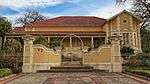 | |
| 9/2/069/0125 | 414 Main Street, Paarl | A T-shaped homestead with woodwork dating from the 1830s. It now has an iron roof, loft-windows. veranda and clipped gables. On the right side there are steps leading to the loft. | Paarl | Paarl | Provincial Heritage Site | 33°43′17″S 18°57′47″E / 33.721267°S 18.962932°E | 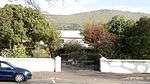 |
| 9/2/069/0126 | De Hoop, Main Street, Paarl | De Hoop was settled as 'De Goede Hoop' in 1688 by Jean Cloudon: his name died with him. The house has been modernized, but retains a main gable, dated 1809, neo-classical, bearing the initial of 'L E. De Villiers, widow of Isaac Minnaar'. This lady's wido Type of site: House Current use: House. | Paarl | Paarl | Provincial Heritage Site | 33°45′28″S 18°57′34″E / 33.757725°S 18.959519°E |  |
| 9/2/069/0127 | 54 and 56 Main Street, Paarl | These properties form an integral part of the historical and architectural nucleus of Paarl. The houses on these erven, the majority of which date from the nineteenth century, are representative of the Cape Dutch, Georgian, Victorian and Edwardian building | Paarl | Paarl | Provincial Heritage Site | 33°45′19″S 18°57′42″E / 33.755241°S 18.961767°E | 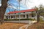 |
| 9/2/069/0128 | 58 Main Street, Paarl | A rectangular house, 10 m deep; with hipped iron roof and good victorian detail louvred french windows, curving veranda, louvred loft-windows. These properties form an integral part of the historical and architectural nucleus of Paarl. The houses on these erven, the majority of which date from the nineteenth century, are representative of the Cape Dutch, Georgian, Victorian and Edwardian building | Paarl | Paarl | Provincial Heritage Site | 33°45′18″S 18°57′42″E / 33.754990°S 18.961693°E |
|
| 9/2/069/0129 | 84 and 86 Main Street, Paarl | These properties form an integral part of the historical and architectural nucleus of Paarl. The houses on these erven, the majority of which date from the nineteenth century are representative of the Cape Dutch, Georgian. Victorian and Edwardian styles | Paarl | Paarl | Provincial Heritage Site | 33°45′07″S 18°57′42″E / 33.751887°S 18.961698°E |  |
| 9/2/069/0130 | 101 Main Street, Paarl | A rectangular house, 2 rooms deep, but with a roof of only 7 m span. The end-gables have been clipped, but the square and pedimented front gable, dated 1854, is an excellent example of its type; the 8-panelled door and the sashes date from the same time. These properties form an integral part of the historical and architectural nucleus of Paarl. The houses on these erven, the majority of which date from the nineteenth century are representative of the Cape Dutch, Georgian. Victorian and Edwardian styles | Paarl | Paarl | Provincial Heritage Site | 33°45′21″S 18°57′45″E / 33.755736°S 18.962492°E | 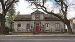 |
| 9/2/069/0131 | 165 Main Street, Paarl | These properties form an integral part of the historical and architectural nucleus of Paarl. The houses on these erven, the majority of which date from the nineteenth century, are representative of the Cape Dutch, Georgian, Victorian and Edwardian building. | Paarl | Paarl | Provincial Heritage Site | 33°44′43″S 18°57′45″E / 33.745307°S 18.962622°E | 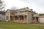 |
| 9/2/069/0133 | Zeedeberg House, 1 Zeederberg Square, Paarl | It has a hipped roof and is built of brick, not plastered but whitewashed. Its facade is 3 bays wide, with fine louvred sashes and a door with plaster surround. At the side there is an equally well-proportioned coach-house with round-headed door and a pr A double-storeyed house, dominating Zeederberg Square - example of early Victorian town-house design. The complex can be dated at about 1850. Type of site: House. | Paarl | Paarl | Provincial Heritage Site | 33°44′42″S 18°57′42″E / 33.744915°S 18.961622°E |  |
| 9/2/069/0134 | Town Hall, 256 Main Street, Paarl | Type of site: Town Hall Current use: Town hall. | Paarl | Paarl | Provincial Heritage Site | 33°43′55″S 18°57′46″E / 33.731886°S 18.962822°E |  |
| 9/2/069/0135 | Joostenberg, Muldersvlei, Paarl District | The road from Stellenbosch to Malmesbury crosses the national road from Cape Town to Paarl by an overhead bridge about 40 kilometres from Cape Town. Not far away, in the northern angle of these two roads, amongst some trees, stands the old Cape Dutch hous Type of site: Farm Complex. A particularly fine Old Cape farmhouse. The front gable bears the date 1756. It is, as far as is known, the oldest Old Cape gable still in existence and probably the only remaining gable of its type. | Paarl | Provincial Heritage Site | 33°48′42″S 18°48′35″E / 33.811737°S 18.809608°E |
| |
| 9/2/069/0136 | Oude Kelder, Bo La Motte, Paarl District | Paarl | Paarl | National Monument |
| ||
| 9/2/069/0137 | Watergat, Simondium, Paarl District | It is a good example of a late house, although the houses of this period have lost the elegance and disciplined proportions of the earlier ones. It has a rectangular plan. 2 rooms deep, and the gable is square and pedimented. It has a greater height than The asymmetrical house was presumably erected in 1863 by C. F. Beyers. The gable depicts the simple lines of the penultimate phase of the Cape Dutch architectural style.
Granted to Henning Villion in 1712, as payment of a debt owed him a certain Willem Type of site: Farm Complex. |
Paarl | Provincial Heritage Site | 33°50′43″S 18°59′05″E / 33.845373°S 18.984670°E |
| |
| 9/2/069/0138 | 4 Zeederberg Street, Paarl | A double-storeyed house with iron roof and windows of 19th century. Its ornate veranda is similar to that of no 3.". | Paarl | Paarl | Provincial Heritage Site | 33°44′42″S 18°57′42″E / 33.745069°S 18.961646°E |  |
| 9/2/069/0139 | Landskroon, Paarl District | Landskroon was settled by Jan Holsmit in 1691: the present house was built by Pieter De Villiers, in whose family it remained for over a century. The main gable is dated 1769, and is an example of the florid type surprisingly elaborate for so early a date Type of site: Farm Complex. | Paarl | Provincial Heritage Site | 33°46′17″S 18°55′27″E / 33.771375°S 18.924090°E |
| |
| 9/2/069/0140 | Taalmonument, Paarlberg, Paarl | Paarl | Paarl | National Monument | 33°45′58″S 18°56′36″E / 33.766126°S 18.943261°E | 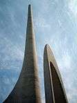 | |
| 9/2/069/0141 | Schoongezicht, 52 Main Street, Paarl | It is an L-shaped house, with door, windows and gable (with pediment but without pilasters) all dating from c1840. It has stepped end-gables. N of the house and now on a different property, there is what must have been a wine-cellar: it dates from roughly This house stands on land granted to Pieter Canzius van Blommestein in 1819; it was a trifle over 8 morgen in extent. In the same year he built a house, now demolished, on the upper part of the farm (see Elliott, 881). The farm was transferred in 1821 to. | Paarl | Paarl | Provincial Heritage Site | 33°45′48″S 18°57′40″E / 33.763449°S 18.961219°E |  |
| 9/2/069/0142 | Jewish cemetery, Paarl | Paarl | Paarl | National Monument |
| ||
| 9/2/069/0143 | La Garomme Beacon, Paarl District | Paarl | Paarl |
| |||
| 9/2/069/0144 | Zondernaam, Groot Drakenstein, Paarl District | Paarl | Paarl |
| |||
| 9/2/069/0145 | Dutch Reformed Church Cemetery, Dirkie Uys Street, Franschhoek | Type of site: Graveyard. | Franschhoek | Paarl | Provincial Heritage Site | 33°54′28″S 19°07′09″E / 33.907897°S 19.119076°E |  |
| 9/2/069/0146 | Eendracht, La Rochelle Girls' School, Faure Street, Paarl | Paarl | Paarl | National Monument | 33°44′15″S 18°57′55″E / 33.737430°S 18.965397°E |
| |
| 9/2/069/0147 | La Brie, Paarl District | Paarl | Paarl | Pending Declaration |
| ||
| 9/2/069/0148 | Hof Street Cemetery, Berg River Boulevard, Paarl | Paarl | Paarl |
| |||
| 9/2/069/0149 | 271 Main Street, Paarl | Paarl | Paarl | 33°44′10″S 18°57′47″E / 33.736137°S 18.963006°E |
| ||
| 9/2/069/0150 | Nantes Vue, 56 Mill Street, Paarl | Paarl | Paarl | Provincial Heritage Site | 33°43′50″S 18°57′30″E / 33.730497°S 18.958298°E |  | |
| 9/2/069/0151 | 64 and 66 Mill Street, Paarl | Paarl | Paarl | Provincial Heritage Site | 33°43′48″S 18°57′30″E / 33.729973°S 18.958303°E |  | |
| 9/2/069/0152 | 39 Dirkie Uys Street, Franschhoek | Franschhoek | Paarl | National Monument | 33°54′18″S 19°07′04″E / 33.904941°S 19.117712°E |
| |
| 9/2/069/0153 | 42 Dirkie Uys Street, Franschhoek | Franschhoek | Paarl | 33°54′21″S 19°07′04″E / 33.905709°S 19.117706°E |
| ||
| 9/2/069/0155 | 48 Mill Street, Paarl | Franschhoek | Paarl | 33°43′53″S 18°57′32″E / 33.731521°S 18.958956°E |
| ||
| 9/2/069/0156 | La Chaumiere, 49 Dirkie Uys Street, Franschhoek | Franschhoek | Paarl | 33°54′12″S 19°07′00″E / 33.903296°S 19.116744°E |
| ||
| 9/2/069/0157 | 42A Main Street, Paarl | These properties form an integral part of the historical and architectural nucleus of Paarl. The houses on these erven, the majority of which date from the nineteenth century, are representative of the Cape Dutch, Georgian, Victorian and Edwardian building | Paarl | Paarl | Provincial Heritage Site | 33°45′35″S 18°57′41″E / 33.759625°S 18.961367°E |  |
| 9/2/069/0158 | PAARL MAGISTERIAL DISTRICT, GENERAL | Paarl | Paarl |
| |||
| 9/2/069/0159 | L'Orleans, Dal Josafat, Paarl | Paarl | Paarl |
| |||
| 9/2/069/0160 | Langvlei Farm, Suider Paarl, Paarl District | Paarl | Paarl |
| |||
| 9/2/069/0161 | 5 Malan Street, Paarl | This is a mid- to late 19th-century residential building, which is in fairly good condition. It retains some of its joinery and much of its architectural character. The building is situated within the historic precinct of Paarl and is of contextual impor | Paarl | Paarl | Register | 33°43′24″S 18°57′44″E / 33.723200°S 18.962103°E |
|
| 9/2/069/0162 | 451 Main Street, Paarl | Paarl | Paarl | 33°43′18″S 18°57′49″E / 33.721552°S 18.963547°E |
| ||
| 9/2/069/0163 | 1 Church Square, 157-161 Main Street, Paarl | Paarl | Paarl | Pending Register | 33°44′52″S 18°57′44″E / 33.747721°S 18.962175°E |
| |
| 9/2/069/0164 | St Stephen's Church, Erf 4856, Main Street, Paarl | Paarl | Paarl | Pending Register |
| ||
| 9/2/069/0165 | Lanquedoc, Groot Drakenstein, Paarl | Paarl | Paarl | 33°43′10″S 19°00′47″E / 33.719522°S 19.013068°E |
| ||
| 9/2/069/0166 | Victor Verster prison "Madiba House", farm Watervleit | SIGNIFICANCE
Nelson Rolihlahla Mandela was one of South Africa's leaders. It was at Drakenstein Correctional Services, formally known as Victor Verster Prison that th |
Paarl | Paarl | National Heritage Site | 33°49′56″S 18°59′05″E / 33.832340°S 18.984751°E |
|
| 9/2/069/0167 | De Poort, Main Street, Paarl | Paarl | Paarl |
|
References
- ↑ "Western Cape Provincial Heritage Sites (previously National Monuments)" (PDF). 19 September 2002. Retrieved 2013-01-28.
| Wikimedia Commons has media related to Cultural heritage monuments in Paarl. |
Lists of South African Heritage Resources | ||||||||||||||||||||||||||||||||||||
|---|---|---|---|---|---|---|---|---|---|---|---|---|---|---|---|---|---|---|---|---|---|---|---|---|---|---|---|---|---|---|---|---|---|---|---|---|
| SAHRA Heritage sites |
| |||||||||||||||||||||||||||||||||||
| World heritage sites | ||||||||||||||||||||||||||||||||||||